Skip to content

Or try searching by Category and/or Location

Nature

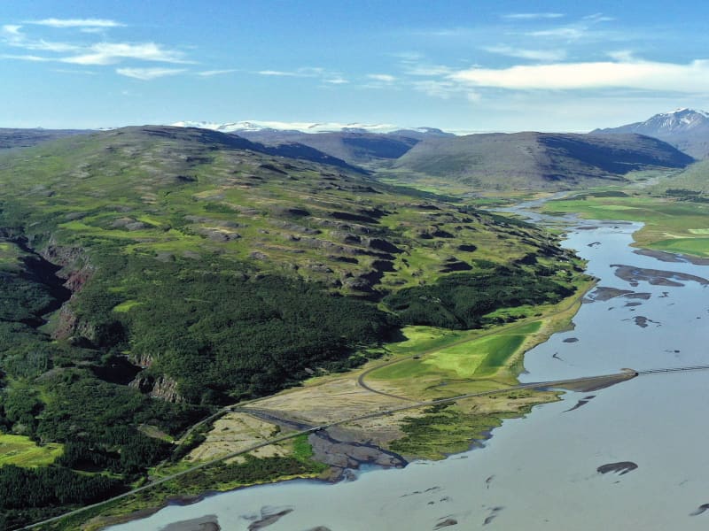
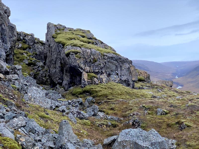
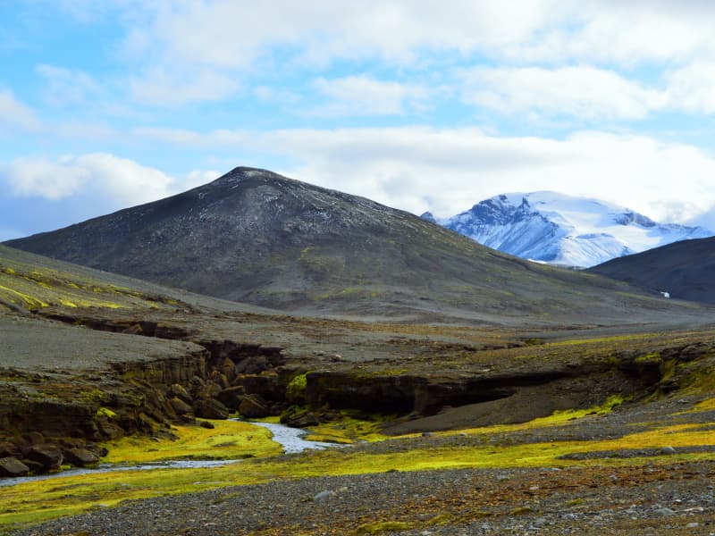
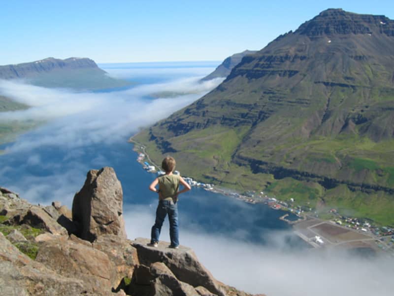
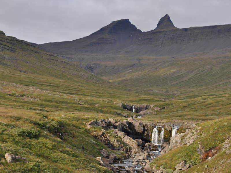
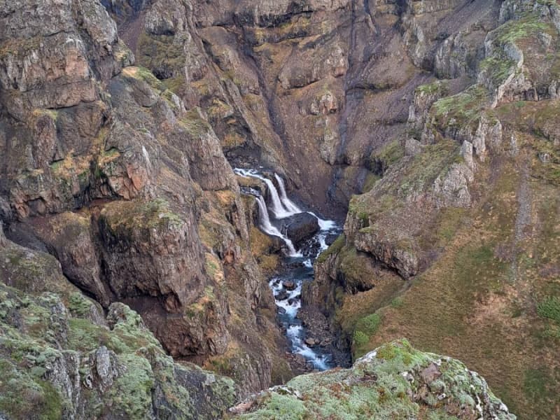
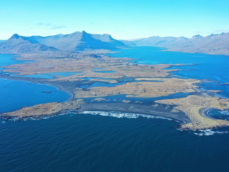
Geographicly, Austurland is an incredibly diverse area. It offers spectacular coastlines, impressive mountains and waterwalls, magnificent higlands and either narrow or vast fjords. Most of Austurland is within the Eastern Basalt Area, where great mountain ranges make an impression on the landscape, while the northwest area of Austurland is in a Palagonite Area, where the land is young; valleys narrow and shallow, and few mountains except for volcanos.

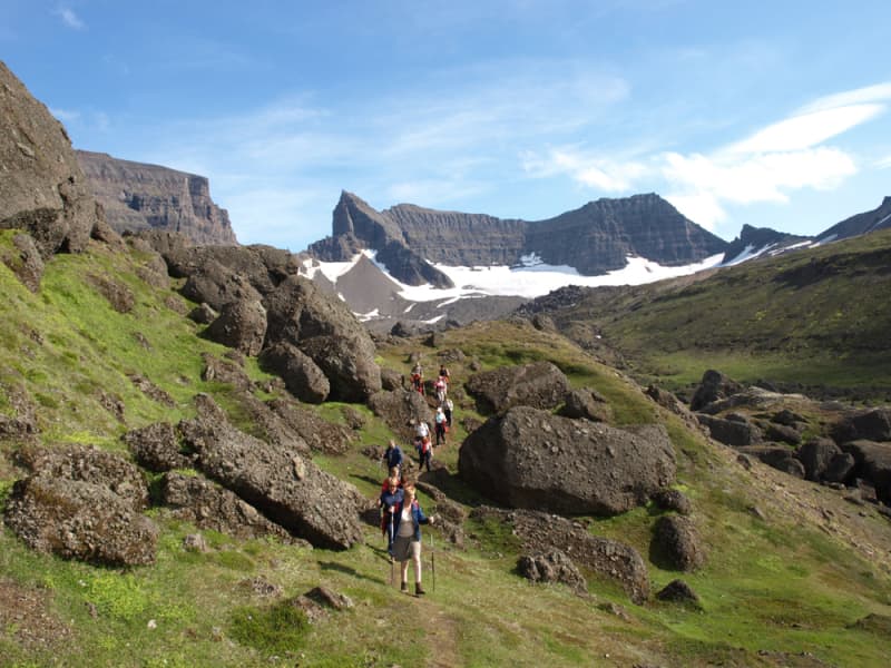
There are plenty of good hiking trails and outdoor recreational areas in Austurland, making it easy to enjoy the nature of Austurland to the fullest.

Húsey
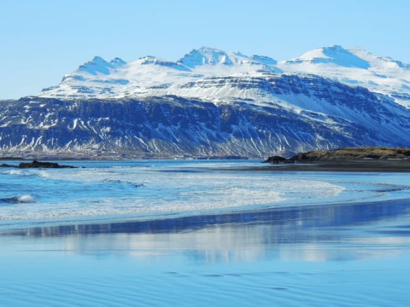
Húsey farm is renowned for its picturesque nature, abundant wildlife and hiking opportunities. A marked hiking route will take you towards river Jökulsá where seals and seal pups hang out in the river mouth and out to Héraðssandur black sand beach. Húsey is a bird watchers' paradise and with nesting grounds of red-throated divers, parasitic jaegers and great skuas, to name a few.  GPS : N65°38.775-W14°14.670   Powered by Wikiloc
Vöðlavík Hiking Trails
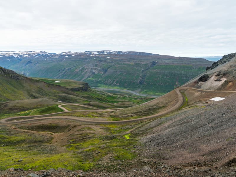
Vöðlavík, which is sometimes called Vaðlavík, is a deserted cove south of Gerpir, where there used to be several farms. A road leads to Vöðlavík from Eskifjörður, which is only open in the summer for four-wheel drive cars. There are two marked hiking trails to Vöðlavík from Eskifjörður / Reyðarfjörður, one over Karlsskálastaður and on the other by Krossanes. From Vöðlavík there is a hiking trail to Sandvík. It is about a five-hour walk around Gerpisskarð, peaking at about 700 m.y.s. From the cove and the heath, Vöðlavíkurheiði, two mountain peaks are the most prominent: Snæfugl and Hestshaus. Disastrous maritime accidents have occurred at Vöðlavík in the past. For example, the ship Bergvík SU ran aground in Vöðlavík in December 1993. Many people still remember that in an attempt to get the ship afloat, the rescue ship Goðinn ran aground in the bay on January 10, 1994. One died at the wreck, but the Defense Forces' helicopter squadron at Keflavík Airport rescued other crew members. These events are discussed in the documentary Háski in Vöðlvík.
Austdalur – Skálanes
An enjoyable, easy lowland hike from the parking area by Austdalsá river to Skálanes. Walking further brings one to the natural treasures of Skálanesbjarg bird cliffs. The areas teeming bird life includes nesting eiders, so please show consideration and stay on marked paths. Duration: 1,5 hours / Distance: 4,5 km
Rjúkandi
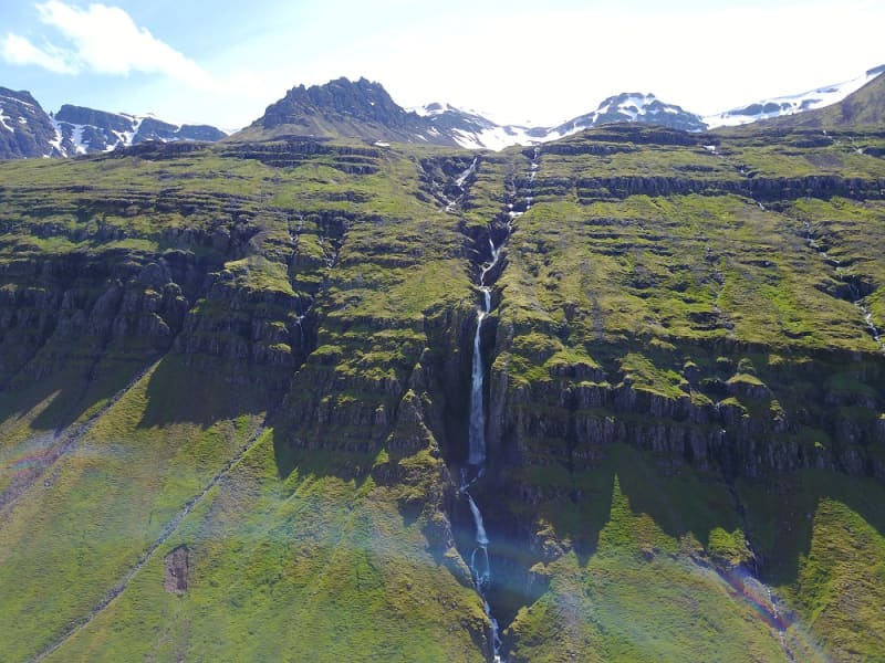
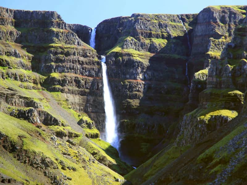
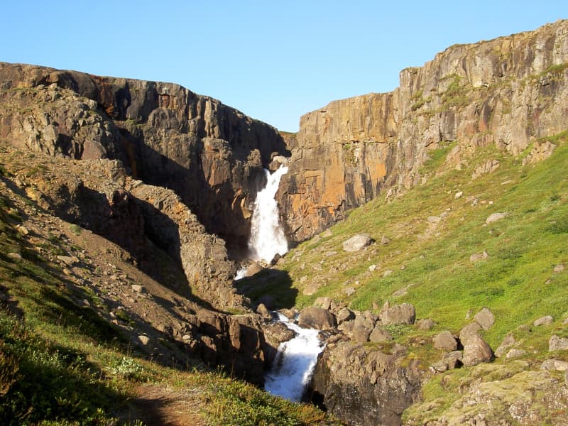
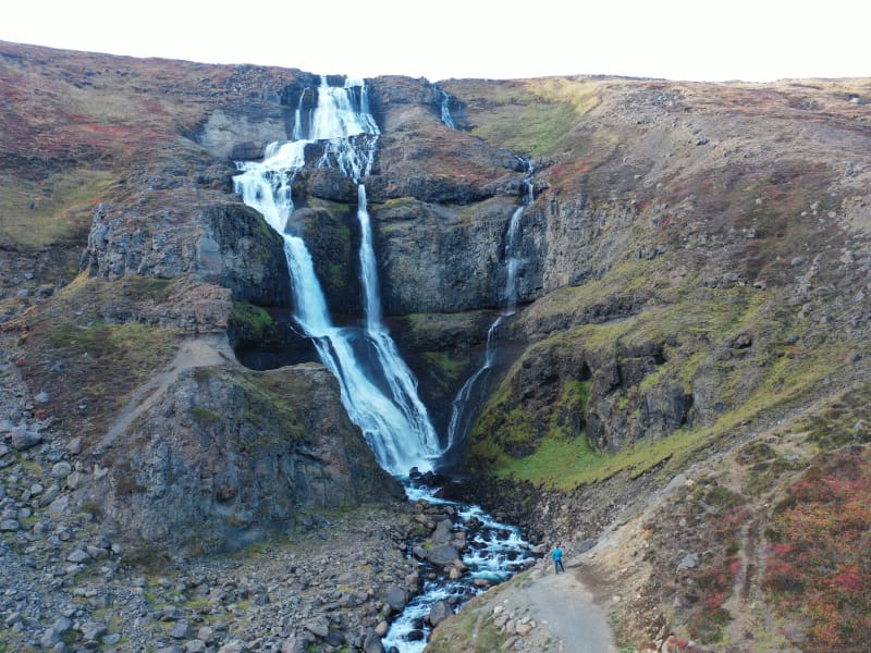
Rjúkandi waterfall is a beautiful waterfall that gracefully descends a few cliffs, from the mountains and almost down to highway 1. Access to the waterfall is very good; it is only a short walk from the car park by the main road.
Búlandstindur
Búlandstindur is a 1069-meter-high basalt mountain in Djúpivogur district and is believed to be about 8 million years old. Búlandstindur is generally considered to be one of the most beautiful mountains in Iceland. At a height of about 700 m east of Búlandstindur runs a mountain ridge, Goðaborg, and it is said that people went up there with their deities immediately after the conversion to Christianity in order to throw them out of the mountain cliff. Other sources say that Goðaborg is a cliff high up in Búlandstindur, said to be wide and flat. It is steep and hard to get up there. Some say that there is water nearby, that was used to wash the bowels of animals that were sacrificed to the gods. Many people make their way to the summit every year. It is best to follow a road that runs along Búlandsá to the south and all the way to a dam that is in the heart of the valley. From there you walk straight up the grassy green slopes and landslides inside Stóruskriðugil in the direction of a pass inside Búlandstindur. After that, the route runs itself until the top peak is reached. You can view an aerial photo of a marked path up to the summit on Teigarhorn's website. The peak is a narrow and steep cliff and there is a great view. It is very important to be careful not to walk too far to the east if something is visually or if it is slippery, because the eastern slope of the mountain is steep and rocky. There is a good mobile connection on the summit.
Streitishvarf
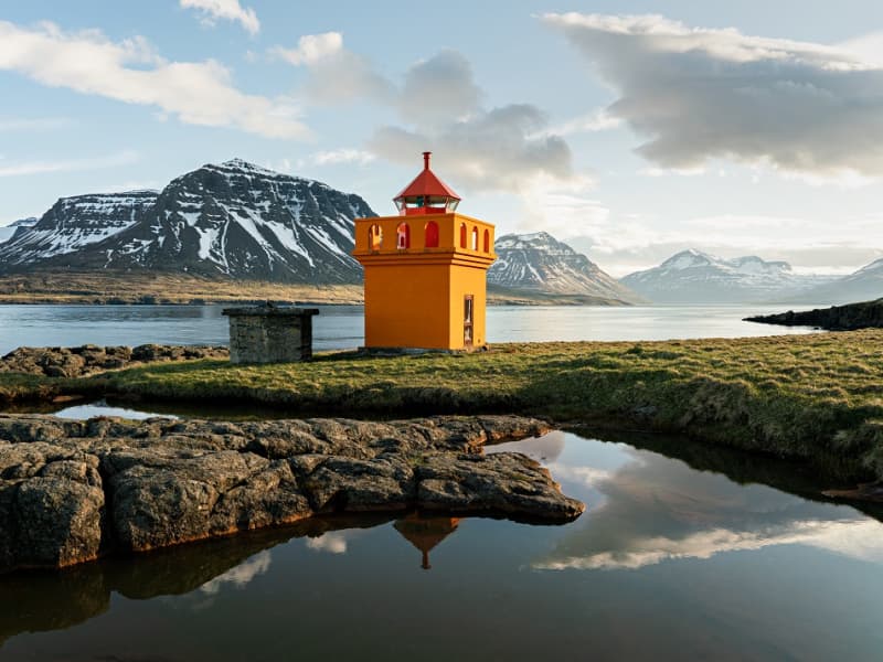
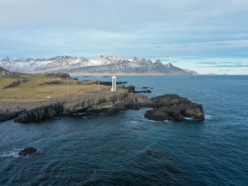
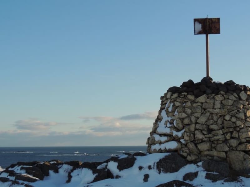
Streitishvarf is a great outdoor area, suitable for the whole family. A beautiful, short hiking trail offers a brilliant insight to the geological history of Austurland, especially the dikes that are characteristic for the area. Although the hiking trail is short, it is a great place to stop for a few hours; to play and enjoy the nature. A lighthouse was first built at Streitishvarf in 1922 and it operated until 1958, when it was removed due to the building of a new lighthouse in Breiðdalsvík. the Streitisviti lighthouse operating today was built in 1984.
Hallormur bike trail in Hallormsstaðaskógur
A simple mountain bike path in Hallormsstaður forest. The start of the path is at Hotel Hallormsstaður and it is a circle around the lower part of the forest. The bike path is 10 km long and the elevation is under 200 meters.
Grænafell
The haven of Mt. Grænafell by Reyðarfjörður has served as the prime location for local outdoor activities for a number of years. At the top of the mountain, a beautiful lake awaits the visitor and a spectacular gorge carves the landscape beside the fell. A paradise of fine bushes at the foot of the mount completes the icing on the cake. The tiny forest is adorned by planted trees,  brooklets and extensive rocks fragments from the cliff, reminiscent of dwellings from the land of fairy tales. The area has been made easily accessible by marked hiking trails.
Hrafnafell
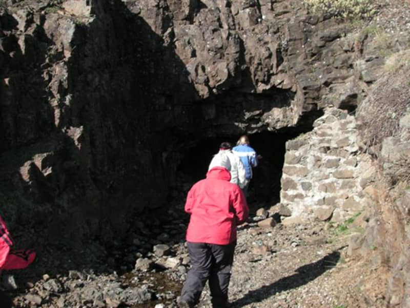
Drive the gravel road up to Fjallssel farm and to the highest spot south-west of Hafrafell. Walk from the sign by the road towards the antennas on Hrafnafell where you can find the cylinder with the visitors’ log and stamp. Do walk on to Hafrafellsrétt livestock pen (N65°18.02-W14°29.23) which is man-made of rocks and stones, between cliffs slightly to the east of the trail. It is also very nice to descend east of Hrafnafell and see Kvíahellir cave (N65°18,359-W14°29,063). If you take the circle the walk is 5.8 km long and a red trail. Part of Hiking Treasures in Egilsstaðir Region GPS : N65°18,304-W14°29,098 Powered by Wikiloc
Hvannargil
Walk from the sign by road F905. A circular trail from Kjólsstaðaskora then Vatnsstæði, inside the lowest Hvannárgil creek through all three creeks to the end of the highest. The highest creek is spectacular and ends in a waterfall. The cylinder with the visitors´log and the stamp is in the highest creek. Walk back down Slórdalur. GPS: N65°16.868-W15°47.418 Powered by Wikiloc
Skessugarður
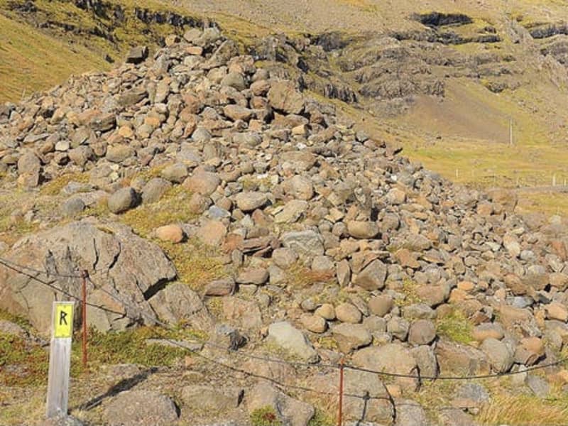
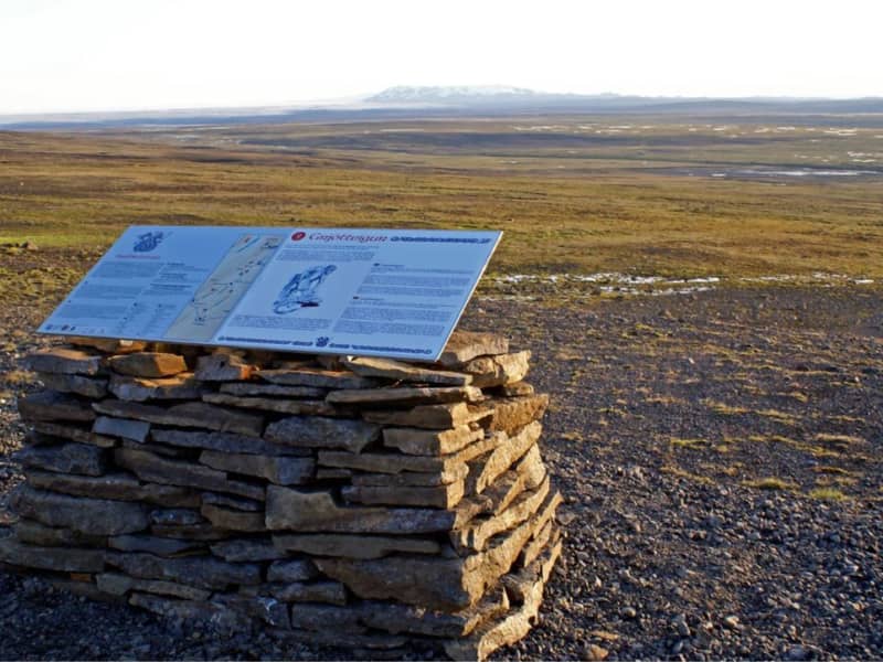
Skessugarður - the Rampart of the Giantess is a natural phenomenon in East Iceland, which has been called one of the most amazing natural formations in the country. It was formed by an ice-age glacier, Brúarjökull. It is a large arch-shaped moraine and consists of massive boulders (porphyritic basalt) making up to a ca 300 meters long and ca 7 meters high natural wall. It lies from west to east. It marks the stagnation level of Brúarjökull at the end of the last glacial period. After the stagnation of the glacier, a flood followed which washed this area clean of smaller rock leaving behind the big ones which makes this moraine unique as it lacks all smaller, finer sand particles and stones, or the glacial flour. Skessugarður is located by the lake Grjótgarðsvatn was of Sænautasel turf house, on the other side of Mt. Snæfell. Turn left onto the old ring road (number 907, a gravel road) after you leave Sænautasel and drive for a couple of km. Then turn left onto a dirt road, which turns into a track until you reach Skessugarður after 2 km.
Stapavík by Héraðsflói
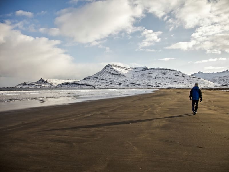
Stapavík is an inlet that lies in a magnificent setting of steep cliffs and the open sea. From 1930-1945 Stapavík was a used as an unloading port for ships and is closely related to the commercial history of Borgarfjörður Eystri and Hérað. Remains of the facilities are very picturesque and the view from the inlet is beautiful on a sunny day.  A marked trail leads from the farmstead Unaós, following Selfljót river downstream to the rivermouth. Héraðssandur black sand beach opens to the North of the river with a view over Hellisheiði Eystri rhyolite mountain ridge. This is a about a two hour long (back and forth) family friendly hike. Travellers could also challenge themselves to a longer hike by crossing Gönguskarð mountain pass over to Njarðvík which adds a about two hours to the hike. Powered by Wikiloc
Gufufoss
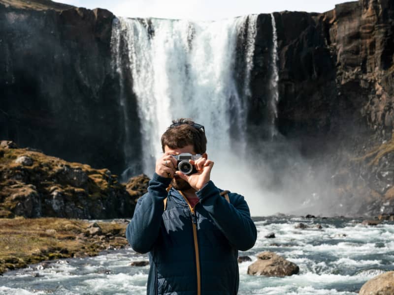
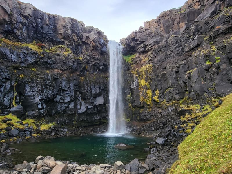
Gufufoss waterfall is a beautiful waterfall in Seyðisfjörður. The name is due to the steam emitted by the waterfall and envelops it in a certain mystery. The road over Fjarðaheiði lies next to the waterfall, and the access to it is very good.
Gilsárfoss
A pleasant hiking trail leads from Vattarnesvegur, on the east side of the urban area on Fáskrúðsfjörður, up along Gilsá. There are numerous beautiful waterfalls on the way and you can walk behind one of them. That waterfall is called Gilsárfoss.  It takes about 15 minutes to walk to the waterfall from the road. Powered by Wikiloc
Breiðavík
Landsendi
Walk from the sign by the road no 917 towards Ker (before crossing the mountain road Hellisheiði) (N65°42.52- W14°24.41), and from there to Landsendahorn cliff. There one can enjoy a magnificent view of Móvíkur. Above them are 200–300 meters high cliffs and hanging rocky slopes called Móvíkurflug. The rock consists mostly of rhyolite of many colors but mostly yellowish, light brown or greenish grey. The cylinder with the visitors’ log and a stamp is on the banks above Ker. Part of Hiking Treasures in Egilsstaðir Region GPS : N65° 43.352-W14°23.300 Powered by Wikiloc
Reindalsheiði
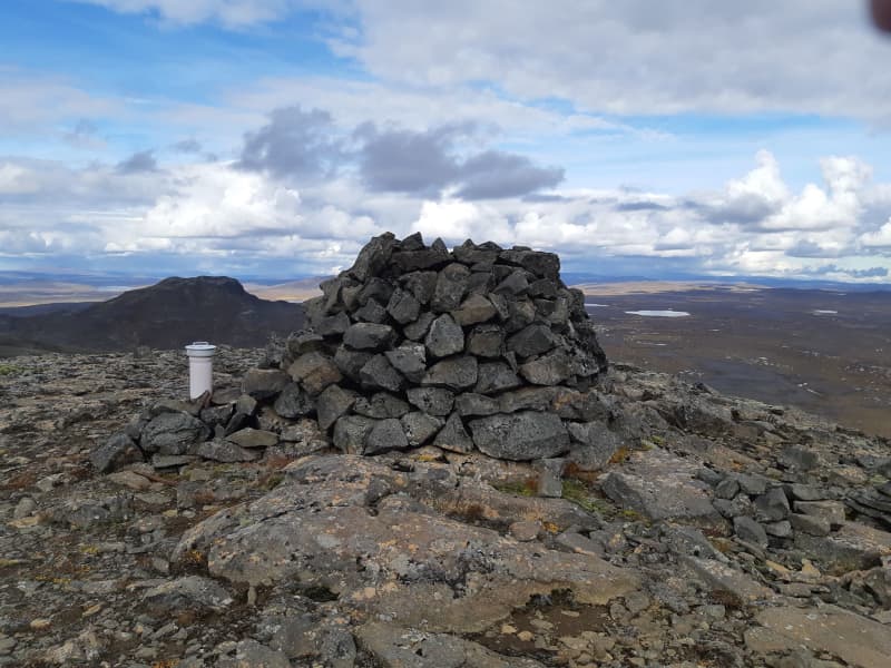
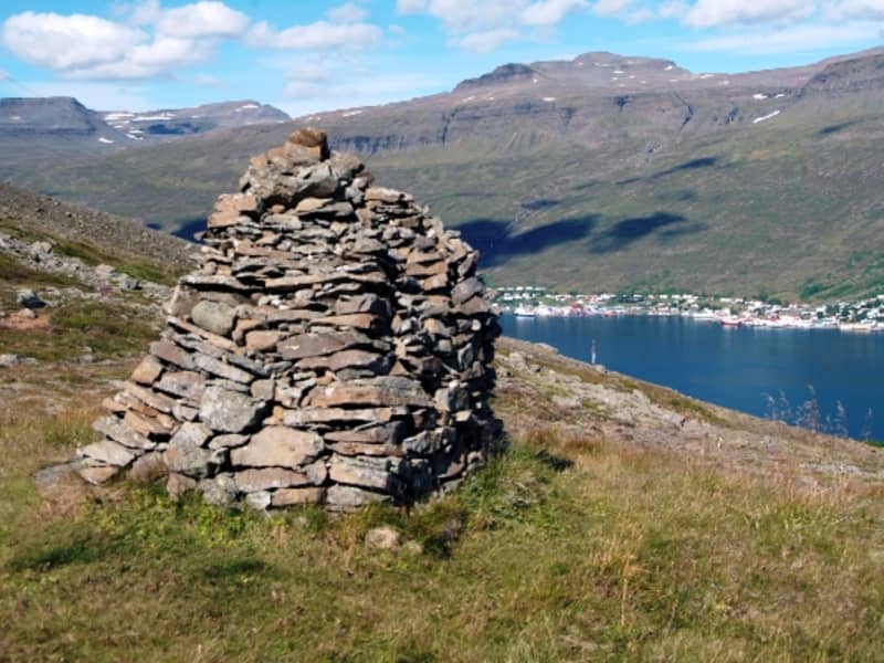
Reindaldsheiði is an old marked route between Breiðdalur and Fáskrúðsfjörður. The mail was brought this way in times gone by and therefore the old cairns still mark the trail. The tour, which is verily a feast for the eye, takes 7-10 hours.   Powered by Wikiloc
Ranaskógur - Mountain biking
A new mountain biking track through the ancient birchforest, Ranaskógur. The track starts at the entrance of Víðivallaskógur foreset, following the electrical masts that lead up the mountain. The main head of the trail then starts from there leading down the mountain. For more information about the trail please visit the Hel-Fjallahjólaleiðir í Fljótsdal Facebook site.
Skjólfjörur black sand beach
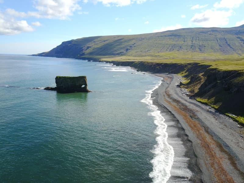
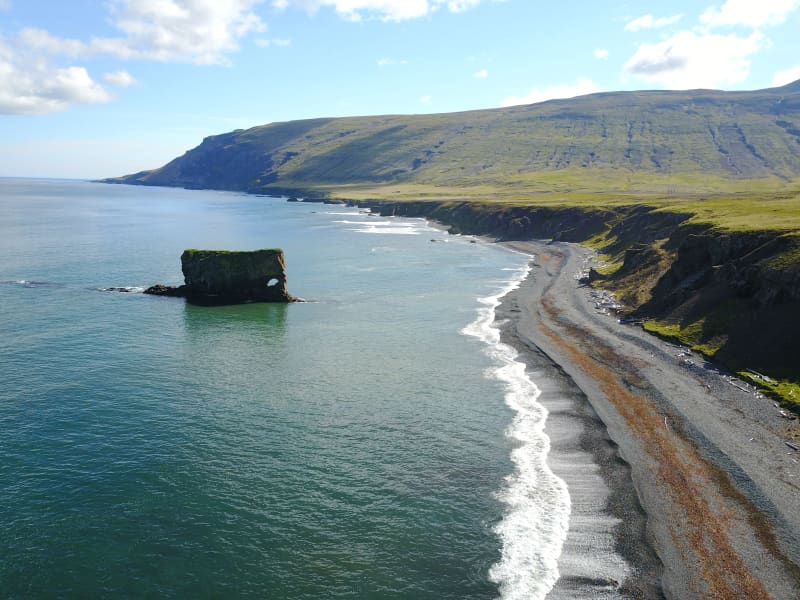
Be sure to visit Skjólfjörur beach when driving through Vopnafjörður! The beach is only a short walk from the road and offers a magnificent view of the open Atlantic sea. If you’re lucky, you might even spot a whale. The beach has a rocky shore with colorful stones that capture the eye. Driftwood brought to land by the waves is a testament to the incredible force the sea possesses. Please respect the fact that it is forbidden to remove stones from the beach.  One characteristic of Vopnafjörður is the incredible rock pillars and cliffs that take on various forms, often resembling different creatures. Ljósastapi rock pillar stands out in the sea just off Skjólfjörur. It is often called Fíllinn or the Elephant by locals, as its form resembles an elephant. To the right of Ljósastapi, the mountain Búrið stands out from the mountain range. Búrið is a part of the Fagradalur mountains, an ancient volcanic area. In the Fagradalur mountains, you can see colorful rhyolite rocks that certainly make their mark on the surrounding environment. A marked walking path takes you down to Múlahöfn harbour and to Þerribjörg cliffs, east of Hellisheiði eystri, where the rhyoli te is at its most beautiful.
Húsavík
Einbúi
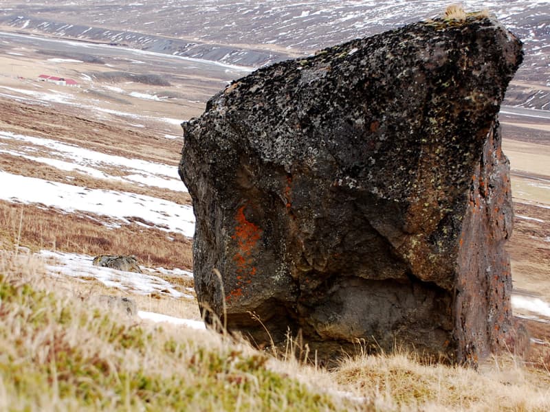
Jafnadalur is a valley in Stöðvarfjördur facing northward. At the core of the vale, there is Einbúinn - "The Hermit"- , a voluminous and solitary rock in otherwise flat surroundings. The Jafnadalur also boasts a 6 m. stonearch, located to the east of Mt. Álftafell. A walking trail connects Jafnadalur and fjord Fáskrúðsfjörður. These are agreeable surroundings and well-suited for short or extensive hikes.   Powered by Wikiloc
Hellisheiði eystri
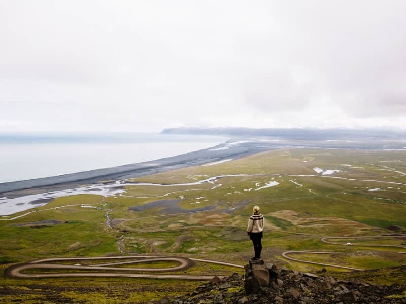
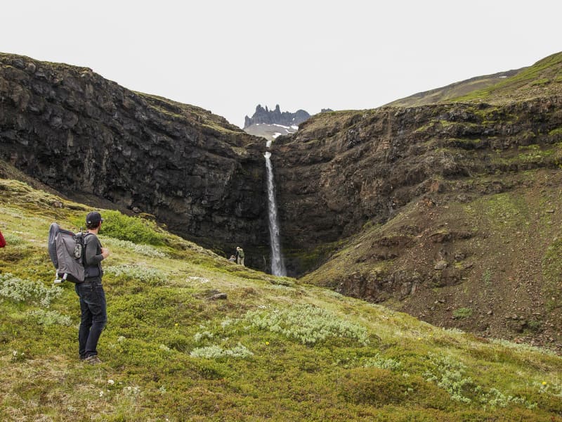
Hellisheiði eystri lies between Vopnafjörður and Fljótsdalshérað. When coming from Vopnafjörður, the route follows Hlíðarvegur (Road No. 917) around the bottom of the fjord and then along the southern coast of Vopnafjörður into Böðvarsdalur, a journey of about 20 km. From there, the road climbs steep slopes up to Hellisheiði, which spans about 14 km. When approaching from Fljótsdalshérað, you take a turn from Route 1 just north of the bridge over Jökulsá á Dal onto Road No. 917 and continue for about 33 km along Jökulsárhlíð until you reach Héraðsflói. Theroad then ascends the heath following Hellisá, forming part of the route On the Edge.   Crossing Hellisheiði is an adventure; the road is one of the steepest and highest mountain roads in Iceland, reaching up to about 665 meters. It is accessible to all vehicles in summer but is closed and not maintained during winter. Due to its high elevation, winter sets in early in autumn and spring arrives late. The vegetation on the heath reflects this, with plants like glacier buttercup and other alpine species, and the spring flowers often appear well into summer. Traffic on the heath is generally light, allowing travellers to enjoy the peace, natural beauty, and views at their leisure. On the Vopnafjörður side, just before reaching the Fagridalur slope, there is a hill called Fönn, where the snow rarely melts completely in summer. It is said that if the snow does fully melt, it predicts a very harsh winter.    On a clear day, the view from the eastern edge of the heath is spectacular, stretching from the vast ocean to the extensive lowlands and mountains of Fljótsdalshérað. By the coast is Héraðssandur, a black sand beach often lined with surf between the mountains. Inland from there is a wide, flat, and lush lowland. Beyond the flatlands, a majestic mountain range separates Hérað from the fjords, with the impressive Dyrfjöll mountains particularly notable. Further inland, you can see the valleys of Fljótsdalshérað and the highlands. The rivers Jökulsá á Dal and Lagarfljót have shaped the flatlands with glacial deposits and sands, constantly changing their courses and creating islands, as reflected in the many place names.    Kattárdalur and Fagridalur are significant valleys extending into the northern part of the cape between Vopnafjörður and Héraðsflói. Between them lies Dýjafjall, a bright green mountain covered in moss, easily visible from the road across the heath. Towards the tip of the cape is the centre of an ancient central volcano known as Fagradalseldstöð, which was active around 14.5 million years ago and is the oldest known central volcano in East Iceland. Only part of the volcano is visible above sea level, with the rest having been eroded and shaped by glaciers. The volcanic products are seen in various rock formations in the surrounding area, such as colourful rocks like light-coloured rhyolite. The road across Hellisheiði lies within the influence zone of this volcano, although the signs are more evident further out on the cape.    Fagridalur was long inhabited and considered a good resourceful farm with seals, driftwood, eider duck nesting, and fishing opportunities.A school also operated there. Fagridalur was abandoned in 1964.   Before motor roads, Hellisheiði was one of the routes between Fljótsdalshérað and Vopnafjörður. It was the trading route for residents of Jökulsárhlíð, who went to Vopnafjörður for commerce. There was also a postal route over Hellisheiði. In 1959, a trail was cleared over the heath. The route via Hellisheiði is about 40 km shorter than traveling via the main road through the Ring road (route 1) and route 85.   From Hellisheiði, there is a route to Þerribjarg and Múlahöfn. From the road over Hellisheiði a track leads northeast over Dýjafjall to Kattárdalur. This track is followed until a parking area and information sign in the Kattárdalur area. The hiking trail to Múlahöfn and Þerribjarg begins here. The trail is steep and quite challenging and should ideally only be attempted in good visibility. The trail is marked from the sign to the edge above Múlahöfn. From there, a sheep trail descends over a scree ridge to Múlahöfn. The harbor is a natural formation, surrounded by cliffs and stacks on two sides. Múlahöfn is a natural harbor, but it was difficult to transport goods from there to the settlements. From Múlahöfn, the trail continues along the shore northward to the outer point, where Þerribjarg is visible. Þerribjarg and its surroundings are a masterpiece of natural formations in the heart of the ancient Fagradalur volcano. Yellow, yellow-pink, and black cliffs with diverse formations, peaks, stacks, and scree extend from the heath's edge down to the shore above the green-blue sea. The view over Héraðsflói and out to the open sea is magnificent.   There are many interesting stopping points accessible right off Road No. 917 on either side of Hellisheiði, which are worth taking the time to explore. On the eastern side, there is a hiking trail leading to Landsendi (Lands End) just before the road turns up to Hellisheiði. On the Vopnafjörður side, there are Skjólfjörur and Ljósastapi just inside Böðvarsdalur, and further inland are Virkisvík, Gljúfursárfoss, and Drangsnes.   
Mulakollur
Þingmúli divides Skriðdalur into Norðurdalur and Suðurdalur. The Round Road nr.1 lies through Suðurdalur to Breiðdalur. The homestead at Þingmúli was a place of gathering for the Thing in Eastern Iceland for centuries. The northernmost part of the mountain is called Múlakollur. Walk the ridge from the sign straight up to 400 m. When you reach Múlakollur’s top it is pleasant to walk onwards and along the top and descend on the east side a bit south of Múlastekkur. One can also ascend by walking up from Múlastekkur. Part of Hiking Treasures in Egilsstaðir Region GPS : N65°01.624-W14°38.049 Powered by Wikiloc
Hamarsfjörður
Hamarsfjörður, a sea reservoir that lies between Berufjörður and Álftafjörður, is a particularly beautiful area with many reasons for outdoor activities. Melrakkanes separates Álftafjörður and Hamarfjörður and out of that is Melrakkanesós which is a narrow channel between Stapaey in Starmýrarfjörður and Þvottáreyjar which are in the mouth of Hamarsfjörður, but the fjords fall into the sea through the estuary. Another narrow channel, Holusund, is on the east side of Þvottáreyjar and lies next to Búlandsnes. On the north side of Hamarfjörður is Hálsfjall, but up from the fjord to the west is Hamarsdalur and its top draft is at the foot of Þrándarjökull. Grassy places can be found in the valley. Hamarsá falls through the valley, which has its main source up on Hraun and Hamarsdalsdrögur. Glacial water from Þrándarjökull mixes with it and it can often be very watery. The river flows from many cliffs on its way down the valley and forms beautiful waterfalls. When you reach the bottom of the valley, the river flows through your ears, until it flows into the sea at the bottom of Hamarsfjörður. Off Hamarsfjörður and Búlandsnes on Papagrunn is the largest island in the Eastfjords, Papey, about 2 square kilometers in size. In Búlandsnes, south of Berufjörður, is the town of Djúpivogur. It is recommended to take a good time travelling through Hamarsfjörður and Álftafjörður to enjoy the natural beauty the area has to offer.
Kambanes
Between Breiðdalur valley and Stöðvarfjörður there are three steep lines emanating from the mountain Súlur. Peninsula Kambanes is an ideal area for outdoor activities of any kind.
Stuðlagil
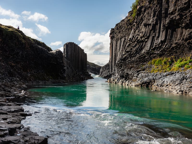
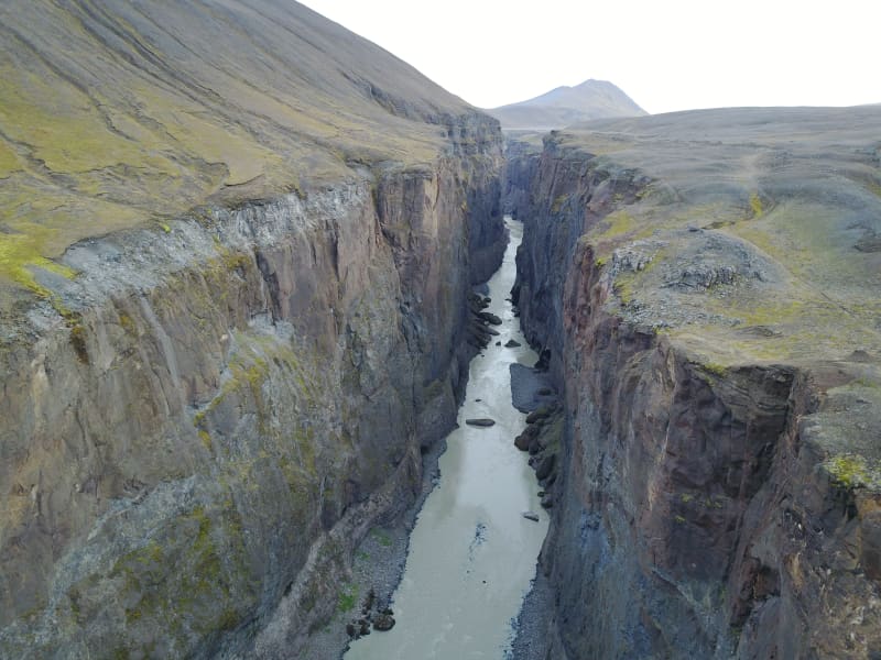
Stuðlagil is a unique basalt canyon located in Efri-Jökuldalur in Fljótsdalshérað, which in recent years has established itself as one of the most exciting destinations in East Iceland. For the longest time, Stuðlagil canyon was mostly hidden by a powerful glacial river called Jökulsá á Dal (referred to as Jökla by locals). It wasn’t properly discovered until after the Káranhjúkar hydro-dam was put in use and the Hálslón reservoir started to fill, making Jökla’s water levels drop and revealing the stunning basalt columns of Stuðlagil canyon. Jökla is one of the longest glacial rivers in Iceland, spanning a total of 150 kms from Vatnajökull glacier to Héraðssandar beach. Entering Jökla, or other glacial rivers, is extremely dangerous and forbidden as they are very powerful, and their currents are not always visible on the surface. Stuðlagil canyon boasts one of the country’s largest and most beautiful basalt formations and is exceptionally graphic, especially when Jökla’s glacial water is clear. The bluish-green colour of the water, which contrasts beautifully with the colourful basalt columns, really is a sight to behold. As is with glacial rivers, its colour and water flow change depending on the season. Come spring and snow start to thaw, and the Hálslón reservoir is overflowing, the river takes on a grey-brown colour. Overflow is most common from the beginning of August until October – but can occur at other times too. You can monitor the water level of the reservoir at any time. Stuðlagil canyon is a fantastic destination no matter the season, and no one should leave Austurland without visiting, even if only for a short time! Stuðlagil canyon is located roughly 52 kilometres (about an hour’s drive) from Egilsstaðir. If you’re visiting from the North, it will take around an hour and a half to drive from lake Mývatn. When leaving Route one (the Ringroad) towards Stuðlagil canyon, you’ll be driving on a gravel road (923). Although gravel, the road is accessible to all cars and is open all year round. Keep in mind if visiting during wintertime that, weather and road conditions can change in a matter of minutes. You can access Stuðlagil canyon via two routes: Stuðlagil observation platform Driving north on Highway 1 from Egilsstaðir, leading you through Jökuldalur, take the exit down route 923, just beyond Skjöldólfsstaðir. From there, it is about a 19 km drive on a gravel road to the farm Grund which stands on the northern side of Stuðlagil canyon. There you’ll find parking, toilets and safe access to an observation platform located at the top of the canyon – only a few minutes by foot from the parking lot. If you wish to enter the canyon, this is not the route for you Note that you cannot get down into the canyon from this side.  Stuðlagil hike Driving north on Highway 1 from Egilsstaðir, leading you through Jökuldalur, take the exit down route 923, just beyond Skjöldólfsstaðir. Turn towards the Klaustursel farm after driving roughly 15 kms. By Klaustursel, you’ll find two parking lots, one by the bridge over Jökla (around 10 km hike to Stuðlagil canyon back and forth) and the other by Stuðlafoss waterfall (about 5 km hike to and from Stuðlagil canyon). Stuðlafoss is a majestic waterfall surrounded by towering basalt columns. It truly is a sight, and you won’t find many like it in the world. Standing at the bottom of Stuðlagil canyon is another unique experience to check off your bucket list. Keep in mind when entering the canyon that the rocks might be wet and very slippery.  The nature surrounding Stuðlagil canyon is stunning but delicate. Visitors are encouraged to show respect for the area, wildlife and nature and leave it as they found it. From May 1st to June 10th, numerous pink-footed geese nest in the area and, therefore, crucial that guests stay within the marked trails so as not to upset the birds. The area surrounding Stuðlagil canyon is agricultural, so it’s common to see farmers bringing their sheep down from the highlands right before winter hits, which can be an enjoyable experience. In summertime, you can continue your drive through route 923 into the East Iceland Highlands (F-roads are generally only open from around mid-June for a few months, see more here). T here you can get on to The Highland Circle travel route, which will lead you to exciting places such as Kárahnjúkar dam, Laugarfell and down into Fljótsdalur. Note that parts of the way are only accessible for well-prepared 4x4 vehicles. For further information, visit the official Stuðlagil website. 
Bjargselsbotnar - hike
Hiking trail starts by a sign near Hallormsstaðarskóli schoolhouse in Hallormsstaður woodland following a light green marked trail that passes through an area where half the mountain slid forward some 10.000 years ago. You’ll ascend up to Bjargselsbotnar, onwards to Bjarg and Þverbjarg to Illaskriða landslide. From there you follow the trail to the Leirtjarnarhryggur ridge.  Part of Hiking Treasures in Egilsstaðir Region GPS : N65°05.465-W14°43.031  
Skálanes
Skálanes nature and heritage centre is situated in a beautifully restored Icelandic farmhouse set in its own nature reserve at the mouth of Seyðisfjörður East- Iceland. Dramatic snow-capped mountains, vast sea cliffs, secluded shoreline and coves, and a vibrant bird colony make Skálanes a place for relaxation, research, contemplation, and a different pace of life.     
Völvuleiði
At the top of Hólmaháls, just above the road, is the grave mound of a Völva (prophetess) that has protected Reyðarfjörður and Eskifjörður from attacks from sea for centuries. Legend has it that Völva lived in Sómastaðir in the 17th century, and before she died, she asked to be buried where the best view of Reyðarfjörður was. She said that the fjords, Eskifjörður and Reyðarfjörður, would never be attacked from sea as long as her bones remained intact. Later, when the Turks came to the East Fjords, they intended to sail into Reyðarfjörður and plunder, but when they sailed to the mouth of the fjord, such a thick fog came towards them that they had to turn away.  The legend also says that as long as stones are regularly added to the grave, nothing terrible will happen in the fjords. 
Prestagil
Prestagil is a small gorge innermost in Mjóifjörður, on the south side. A small but beautiful waterfall flows through the gorge, which derives its name from a legend about a giantess that lured two priests into the canyon. This is a gorgeous outdoor area.
Hrakstrandarkofi
Hrakstrandarkofi is a newly renovated pedestrian hut on the hiking trail between Norður and Suðurdalur. You can walk intoNorðurdalur past Glúmstaðarsel and into Hrakströnd, and then the next day across to Þorgerðstaðardalur and on to Suðurdalur. Bookins for the hut are made at The Wilderness Centre .  
Stafdalur
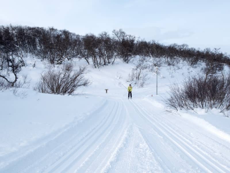
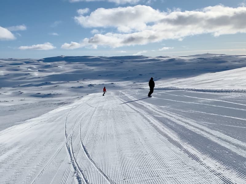
Stafdalur ski resort in Seyðisfjörður is located near road nr 93 between Egilsstaðir and Seyðisfjörður. In the area are 3 skilifts and hills for all kind of skiers. Beginner’s lift is a rope lift 100 meters long and only open on weekends and holidays. Lift nr 1 is a tow lift 900 meters long and has 190 meters vertical drop. Lift nr 2 is a tow lift 700 meters long and has 160 meters vertical drop. Stafdalur has a nordic ski track which is about 5 km long. Ski and snowboard rental is on the area and a hut for all guests.
Gönguskarð
Stórakerald and Tyrkjaurð
Historical mountain sites. Steðji is the name of the mountain that stands tall behind Stöðvarfjörður town. On the side of this characteristic mountain is Stórakerald, which is an unusually large ravine. Besides being an old route landmark, there are old tales of the residents in Stöðvarfjörður seeking refuge in Stórakerald and defending themselves by throwing stones at Turkish pirates, who made a foray in Iceland in the early 1700s. This tactic paid off, running the Turks out of Stöðvarfjörður and giving the rocky area in front of the ravine the symbolic name of Tyrkjaurð, or the Turkish scree.
Tangasporður
Vopnafjörður town is located on Kolbeinstangi peninsula. The outmost part of Kolbeinstangi is called Tangasporður and is not inhabited. The landscape is characterised by unusual rock formations and white sand beaches. There are three small mountains on Tangasporður: Fagrafjall, Miðfell and Tafla. Enjoy a walk to Tangasporður, preferably by following a track that starts by the crossroads (rd. 85 and 917) above the town. This leads through a small grove and out to the tip of the peninsula. The birdlife is rich in this area, especially on the east side. Seals relaxing in the tidemark are a common sight on the beach at the tip of Tangasporður. It is also possible to start the walk by turning left off the road to the lighthouse on Kolbeinstangi. 
Sveinsstekksfoss
Sveinsstekksfoss, Fossárfoss eða Nykurhylsfoss Sveinsstekksfoss waterfall, also known as Fossárfoss waterfall, is a 50-foot waterfall on the Fossá River, the last fall before it empties into the Atlantic Ocean. It is located on Route 1, Northwest of Djúpivogur. You can climb above the waterfall to see more of the Fossá River cascades. Nykurhylsfoss waterfall is the lowermost waterfall in the Fossá River. The river plunges 15 m into a narrow gully, churning, and racing in pools and rapids until it reaches the 9 m deep Nykurhylur pool. The river Fossá has numerous waterfalls in its course. There used to be a magical water horse living in the lowest pool, just under the bottommost waterfall. All attempts to drive the water horse away remained unsuccessful, but it finally disappeared when baptismal water was poured into the river after the baptism of a child up the valley.
Drangsnes
A hiking trail leads from the parking lot by Gljúfursárfoss through Drangsnes, to Krummsholt. At Krummsholt you can see ancient ruins dating back to Viking age. In fact, a Viking named Þorsteinn Uxafótur is said to have lived there. Looking at such ancient habitats leaves one wondering about the lives lived here centuries ago, wishing the earth could talk and tell us the stories of our ancestors. Walking along the precipitous cliffs is a great experience and leaves few visitors unmoved.  
Dyrfjöll
The magnificent 1136 high mountain range Dyrfjöll near Borgarfjörður Eystri draws its name from the iconic "door" in the middle of the range. Its shape is very different from many other mountains in Iceland with steep vertical valls and the big door-like gap (856 m high) in the middle. Dyrfjöll is an old volcano formed during or before the last Ice age.  The hiking trail up the ridge is very diverse with untouched mossy areas, clear pools and glacier landscapes but only suitable for experienced hikers under guidance. The view from the top is breathtaking.  
Sandfell
Sandfell is a distinctive 743m. high rhyolite mountain between Stöðvarfjörður and Fáskrúðsfjörður. The best approach is from the south side of Fáskrúðsfjörður. The trail leaves the coastal road between Víkurgerði and Vík farms and proceeds along the Víkurgerðisá River before cutting west for the peak. The scenery is excellent en route, with views of Fáskrúðsfjörður, Andey and Skrúður islands. Powered by Wikiloc
Sandvík Bay
Once the easternmost settlement in Iceland. Though this inlet of the Gerpir cliffs is now abandoned, it once sheltered Iceland´s easternmost settlement, and is still home to the famous ghost Glæsir. He used to precede people who were from here wherever the went, and greeted everybody by taking off his head in a friendly manner. A marked path goes from Stuðlar til Sandvík Bay, through the Sandvíkursakð mountain pass. It´s an app. three hrs. route, going 500m above sea level. The view from the mountain pass is nothing less than stunning.
Hafnarhús
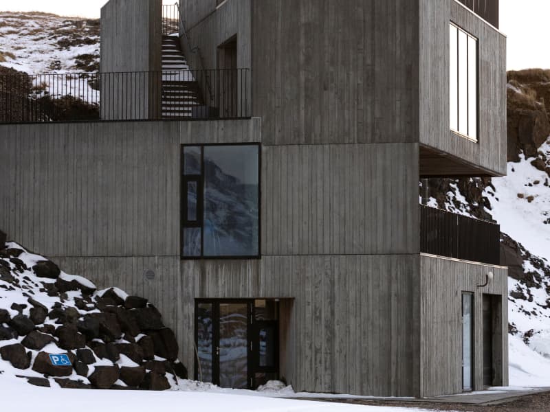
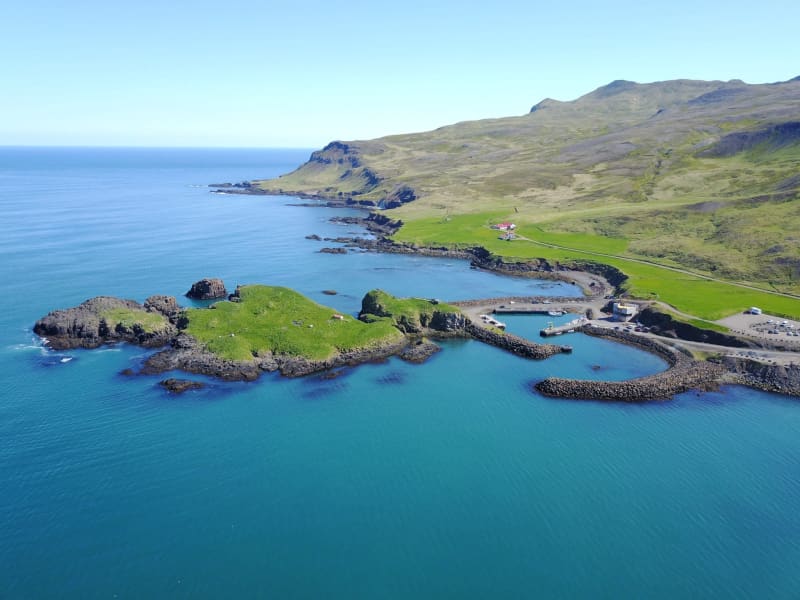
At Hafnarhólmi in Borgarfjörður eystri a new, magnificent building was unveiled in 2020. Not only had there been a lack of facilities for fishermen and other dock workers of Borgarfjörður harbor - but also for the enormous number of tourists who make their way to the puffin nesting ground in Hafnarhólmi each year. The municipality, therefore, decided to host a design competition in collaboration with the Association of Icelandic Architects for the construction of a new facility in the area. The winning submission came from Anderson & Sigurdsson architects. The house is plain and fits well in with the surroundings, but still is an attraction in itself and catches the eye of everyone who visits the area.
Lagarfljót and Lögurinn
Lagarfljót is one of Iceland´s deepest lakes, covering about 140 km from its source in Eyjabakkafjökull glacier to Héraðsflói Bay. The innermost section forms the lake Lögurinn, with a surface of 53 square kilometers and an average depth of 51 m, reaching 112 m where it is deepest. Its deep, mysterious glacial waters are home to Iceland´s ancient and much older equivalent of the Loch Ness Monster: The terrifying sea-worm-like Wyrm or Lagarfljótsormur. The oldest recorded sighting dates back to 1345. It was considered a bad omen if the curved forms of the monster were spotted above the water´s edge. In recent years the Wyrm has mostly kept to itself but pay close attention as you never know when it may reveal itself again!
Gjárhjalli
The trail to Gjárhjalli runs from Glúmsstaðasel in Norðurdalur, Fljótsdalur and up the western slope of Múlan. Gjárhjallin is a special natural phenomenon with cracks and chasms, up to 20 m deep. The cracks are believed to have been formed by gradual rock creep over millennia. Distance: 2 km Steep and beware of ground cracks.
Hengifoss í Seldal
Norðfjörður's highest waterfall Hengifoss, is in the river Hengifossá, which flows from Oddsdalur valley into the valley Seldalur. The canyon is exceptionally pretty and lush.  
Snæfell
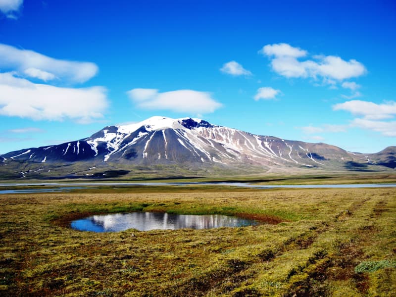
Mt Snæfell towering to 1,833 m, is the highest mountain in Iceland, outside the glacier regions. Even so, and despite the omnipresent snow, (Snæfell = "The Snow Mountain), it is fairly accessible from Snæfellsskáli hut. While Snæfell boasts a splendor of its own, it offers a fabulous view, partly overlooking the oasis of Eyjabakkar. Eyjabakkar is the choice habitat for geese.  Reindeer can frequently be spotted west of Snæfell, towards Hálsalón reservoir, in addition to other territories in the East Iceland highlands.
Dalatangi
The way out to Dalatangi lies along a narrow road that winds out of Mjóifjörður. Drive along with landslides and cliffs, past waterfalls and gorges. When Dalatangi appears, it is as if you are on an island inland. It is not possible to drive further east in Iceland. At Dalatangaviti, there is an excellent view to the north, all the way to Glettingur and into Loðmundarfjörður and Seyðisfjörður. The two lighthouses on Dalatangi have a remarkable history. The older one was built on the initiative of the Norwegian fishing operator and entrepreneur Otto Wathne in 1895. It is made of basalt stone with stone glue in between. The younger lighthouse, which is now in use, was built in 1908. At Dalatangi, there is a beautiful farm. By the farm, there is an ornamental garden and a greenhouse.
Urðarhólar
A delightful short walk from Afrétt in the innermost part of Borgarfjörður Eystri takes the wanderer to Urðarhólar; idyllic scenery with hilly terrain and small ponds, rich birdlife, and colorful view of the mountaintops.  The marked trail is 3 km. But should you wish to extend it, there is much to see!  
Heiðavatn
A beautiful road takes you along the beautiful Breiðdalur valley, ascending towards the heath with the same name. Once upon the rolling flatland, you´ll discover the idyllic little lake Heiðavatn - often a peaceful haven to herds of reindeers. A stroll around the lake with a subsequent halt for a light meal or a moment of relaxation is recommended.
Tröllkonustígur hiking trail
Tröllkonustígur is the name of a hiking trail between Skriðuklaustur and Végarður in Fljótsdalur, which runs, among otherthings, after a rock passage in Valþjófsstaðafjall. Folklore says that the street in the mountain was created due to the travels of a troll in the olden days. The trail is marked and goes through the forest above Snæfellsstofa and out to the Bessastaðarárgljúfur. Distance: 5 km.  
Gljúfursárfoss
The Gljúfursárfoss waterfall, situated on the southern side of Vopnafjörður, runs down a colorful ravine just below the parking lot. The waterfall is about 45 meters high and very beautiful.   The river Gljúfursá used to be a major obstacle to travellers heading east over the mountain pass Hellisheiði eystri. Many accidents occurred when people tried to cross the river by foot or on horseback.   You can also walk along the river to the old bridge over Gljúfursá, built around 1900 and was a great improvement at the time. The story goes that construction began on the bridge after a man on horseback died while attempting to cross the river during winter.    A marked hiking path leads from the parking lot along the river Gljúfursá, and around Drangsnes.   
Selskógur
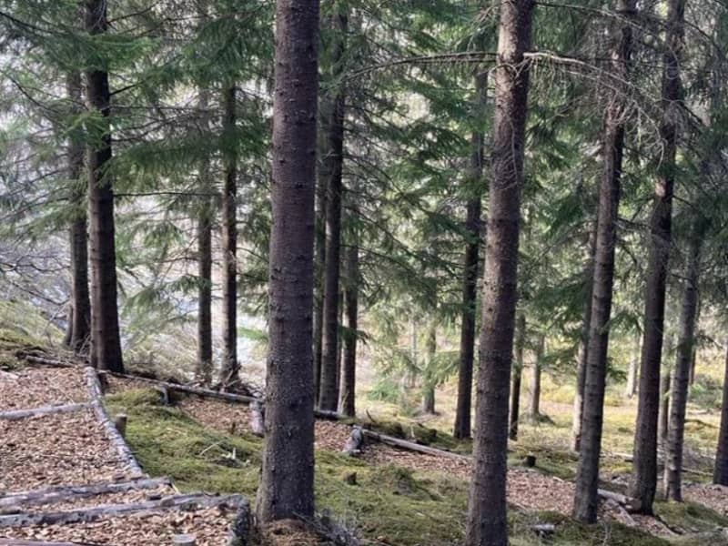
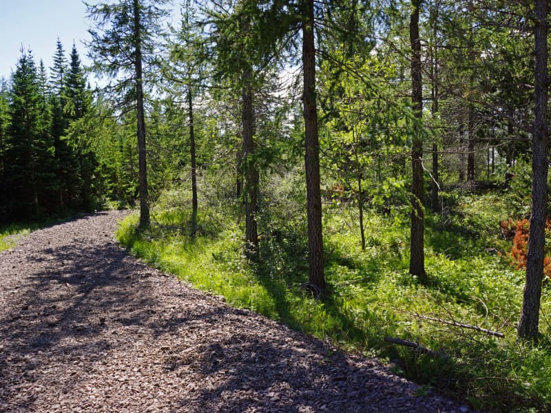
Selskógur the small forest on the eastern outskirts of Egilsstaðir, mainly consists of birch but also numerous rowans. Inviting woodchip trails of various lengths lure the wanderer to stroll through the peaceful surroundings.  A football field and a playground are among other recreational options in the area.
Búðará
Búðará flows right through Reyðarfjörður town. In the center of the town, you will find the start of a beautiful hiking trail that runs along the river through the forested riverbank of Búðará. When you come to the War Museum, you can choose whether to walk along with a wooded lookout point along the ridge east of the War Museum or up to Búðarárfoss waterfall.
Þverárgil canyon
A hiking path running along Þverá river in Þverá canyon in Vopnafjörður. The canyon is exceptionally beautiful as one can see colorful rock formations from an old volcano, contrasting the otherwise dark rocks of the Smjörfjöll mountains. There is rich birdlife in this area, especially Icelandic moorland birds. The views are magnificent over the Hofsá valley and out to sea. The hiking path is of medium difficulty, about two hours long and is a little bit upward.  The starting point of the walk is above the Þverá river on rd. 919.
Stuttidalur
Walk from the sign by road nr. 1 close by Haugaá river. Go through a gate and then walk by the fence approx 600 m. Keep on walking the staked trail. Stuttidalur lies east between Hallbjarnarstaðatindur and Haugafjall. The cylinder with visitors’ log and a stamp is by the pond a short distance by Sjónarhraun. If you prefer a different route back the one way is crossing the river and passing through Haugahólar hills on the way to your starting point. Haugahólar hills were formed by a huge landslide, one of the largest ever from Haugafjall, and lie between Stuttidalur and Vatnsdalur. Part of Hiking Treasures in Egilsstaðir Region. GPS : N64°59.173-W14°35.217 Powered by Wikiloc
Eiðar
Eiðar (approx. 15 km drive from Egilsstaðir) is a church site with longstanding and important cultural and educational background. One of the first agricultural schools in Iceland was founded in Eiðar in 1883 which later converted into a general educational center for Austurland. Its function as a school was discontinued in 1995 and since then many ideas have been launched as to its future role. Tourism and services to travellers has grown in recent years with a guesthouse, camping site and recreational area. A great location for travellers who want to stay in a peaceful and picturesque area on the banks of beautiful Lake Lagarfljót in the center of Austurland. 
Gerpir
Gerpir is the easternmost cape of Iceland, steep and rugged, 661 meters high. It is believed that the oldest cliffs in Iceland, about 12 million years old, are found in Gerpir.  Gerpissvæðið is a true paradise for hikers. Ferðafélag Fjarðamanna has issued a hiking map of the area, which is available in information centers and shops in Fjarðabyggð.  Anyone interested in outdoor activities should visit the Gerpir area.  Powered by Wikiloc
Álfkonusteinn Hiking Trail
Above the farm Bustarfell in Vopnafjörður stands a large rock called Álfkonusteinn (Elf Stone). It is relatively easy to walk from Bustarfell to the rock, and an interesting legend related to the stone. It claims that a district magistrate’s wife at Bustarfell was once led in her dreams by an elf into the stone. There she came to the aid of an elf-woman in childbirth, who paid for the assistance with a beautiful gold-plated cloth. The cloth is neatly made, exotic and unique in this country, and is now owned by the National Museum of Iceland.
Eiríksstaðahneflar - hike
Hike starts by að sign on the bank of river Þverá south of Eiríksstaðir farm and continues on to Fremri Hnefill – mountain top (947 m). From there one can cross over to the top of Ytri Hnefill (922m) and down to Eiríksstaðir farm again. Travellers could challenge themselves to a longer hike by walking over to the ruins of the abandoned Hneflasel farm and then traverse back between the two mountains to Jökuldalur valley. Part of Hiking Treasures in Egilsstaðir Region GPS : N65°08.617-W15°28.195
Hólmanes
Between Reyðarfjörður and Eskifjörður you can visit the Nature reserve Hólmanes. This is an ideal place to enjoy a good walk either down to the sea or up the hills. Birds and remarkable rock formations can be enjoyed in Hólmanes. With luck, you could stumble upon a herd of reindeers. Powered by Wikiloc
Skrúður
Skrúður is an island in Fáskrúðsfjörður. It is surrounded by high cliffs and is accessible only to the bold and brave. There is a sizable cave on the island, which sailors occasionally used as a shelter when making their way southwards. Legends say three giant brothers were living in Austurland. One made his home in Skrúður, the second in Streitishvarf, and the third on Papey. The Skrúður dweller abducted his wife from the on-shore vicarage of Kolfreyjustaður; she was the local priest´s young daughter. Legends relating to their insular existence lived among the sailors who visited the island.  
Saxa
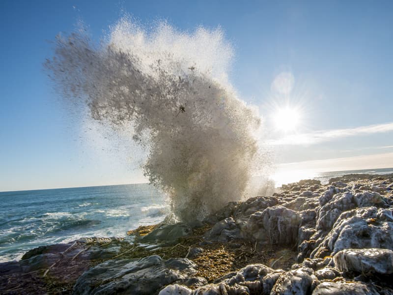
Just off the coast of farm Lönd in Stöðvarfjörður, there´s a singular rock formation called Saxa ("The Grinder). This is an impressive perforated cliff, penetrated ceaselessly by the swelling waves of the Atlantic, resulting in spectacular eruptive splashes which fling seaweed and algae, minced by the force of the ocean, high into the air.
Rauðubjörg
These brightly colorful rhyolite cliffs rise over the seashore of Barðsnes peninsula, across the bay from Neskaupstaður. Residents of the fjord have long said that if the sun shines on them in the evening, there will be good weather the next day.
Mjóeyri
Mjóeyri is a beautiful place outside the village in Eskifjörður. There is a lighthouse and a beach where it is fun to play.  Mjóeyri was the last execution site in Austurland, and there is an information board on the grave of the last man who was executed at Mjóeyri.  Today, Mjóeyri is a thriving tourism place where, among other things, you can get guidance around the area.
Þerribjarg and Múlahöfn
Drive the main road up Hellisheiði mountain and when you’ve reached where you are about the highest part, take an off-road trail to the right from there until you’ve reached Kattárdalsdrög. The trail leads to Kattárdal valley. There is a sign where you can park your car and start walking. The trail is staked to the edge of the cliffs above Múlahöfn harbor. From there (65°45.144 - W14°21.964) lies a trail below the edge, down a rocky slope down to Múlahöfn, one of the natures’ masterpieces surrounded by cliffs and huge pillars of rock on two sides. This harbor was declared an official trading harbor in 1890 but was only used once as such because of the complications when bringing the shipment further on land. From the harbor, walk north to the outer point. From there one can see Þerribjarg cliffs and Langisandur shore. The cylinder with the visitors’ log and a stamp is by the trail leading down to the beach. Hikers are encouraged to go down and walk along the sand under Þerribjarg before turning back. Part of Hiking Treasures in Egilsstaðir Region Powered by Wikiloc
Hengifoss Waterfall
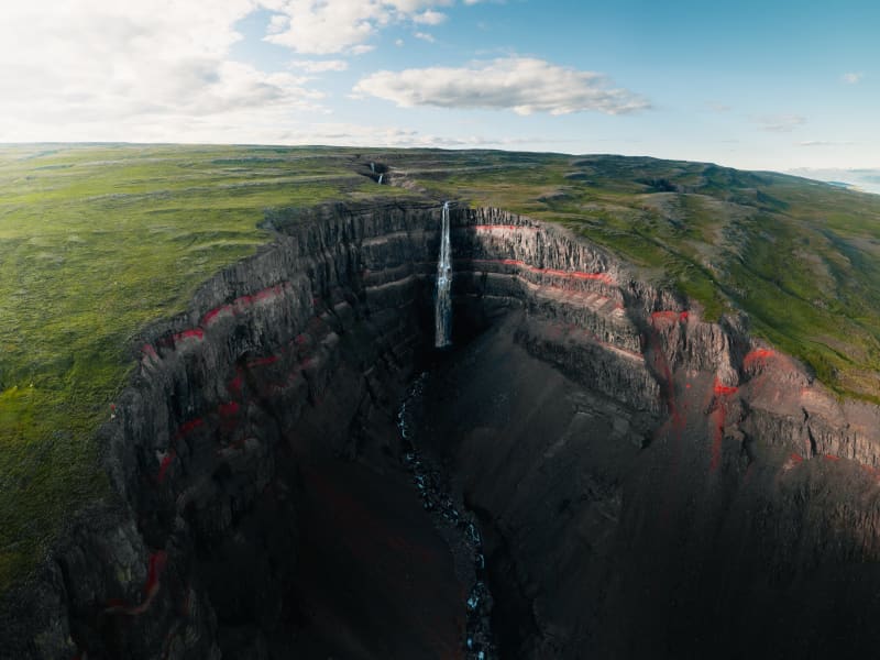
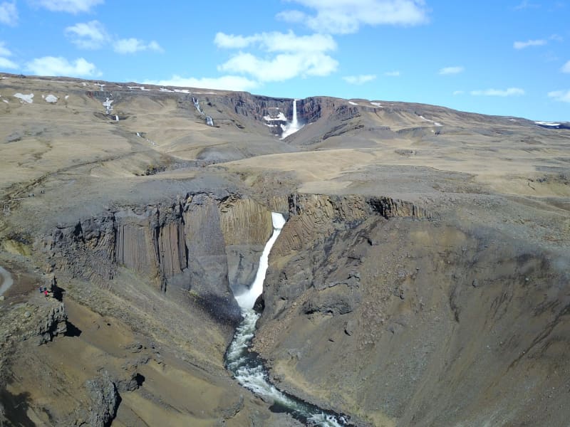
Hengifoss Waterfall is one of the most popular destinations in East Iceland, known for being one of the tallest waterfalls in Iceland at 128 meters high. It is particularly picturesque. A good hiking trail leads you to the waterfall from a service center by the parking lot. Excellent accommodations, restaurants, and activities can be found in the surrounding area.The Hengifoss waterfall plunges from the plateau into a magnificent gorge. The layers between the numerous Tertiary lava strata yield a reddish color, particularly striking in the cliffs around Hengifoss. On the way to Hengifoss, you can also see Litlanesfoss, which features impressive basalt columns on both sides of the gorge.How to Get ThereFrom Egilsstaðir, the major town of East Iceland located by Highway 1, there are two routes to Hengifoss. You can drive on either the west side or the east side of Lake Lagarfljót. The distance is the same, around 35 km.West Side: You will find the junction with Highway 1 on the hill by the timber bridge close to Egilsstaðir airport. It is marked as Route 931 with signs pointing to Fljótsdalur and Skriðuklaustur.East Side: Follow Route 95 first and then Route 931 towards Hallormsstaður, continuing until you reach the end of Lake Lagarfljót. There you should see the waterfall and the parking lot by the main road.From the parking lot, it takes 40-60 minutes to walk to the waterfall on either side of the river. Start by going through a gate by the service center and climbing up a flight of stairs. Then follow a good gravel trail for the next 2 km, which is moderately steep but not very difficult. About halfway up, around 1.2 km from the parking lot, you will see Litlanesfoss with its beautiful basalt columns. There are trails down into the canyon below the waterfall, but they are steep and covered in loose gravel, so be cautious if you decide to enter the canyon. Keep in mind that getting very close to the canyon edge is risky due to the danger of falling. This is especially important if you are accompanied by children.There are two bridges for hikers to connect the trails on each side of the river: one at the upper end just before you enter the great gorge, and the other by the parking lot.By the parking lot is a new service center where you can get information from rangers about the area and the surroundings. We recommend taking your time to visit Hengifoss as there is much more to explore in the area than just the waterfall. You can learn more on this website and use it to help plan your trip.Hiking in SummerDuring the high season (July), Hengifoss can be crowded, mainly with cars at the parking lot. If you can't find a parking space, continue further into the valley and check the visitor's center for Vatnajökull National Park at Skriðuklaustur (5 km away), then return to see if a space has opened up.The waterfall and the gorge face southeast, so for the best lighting, visit in the morning. In June and July, there is usually plenty of water in the river, making Hengifoss magnificent. However, in August, if the summer is really dry, the falls may not be as broad, but they are still enormously high.Late May and early June can be risky due to melting snow in the highlands, causing high water levels in creeks and rivers. Expect muddy trails and slippery paths on your way to the waterfall, and the need to wade through some small streams. By autumn, rain can make the trails muddy as well, but you usually won’t have to wade through any streams unless you want to enter the gorge and get close to the base of the great waterfall.Hiking in WinterMore people are visiting Hengifoss in winter, but caution is necessary. The trails and paths can become icy and very slippery, so stay away from the edge of the canyon and be aware of the dangers. It is not safe to enter the gorge by the big falls in winter due to the risk of falling ice from the cliffs. 
Beljandi
In Breiðdalsá, close to the farm Brekkuborg in Breiðdalur valley, is the Beljandi waterfall. In fact, there are two waterfalls; Ytri Beljandi and Innri Beljandi, and eponymous pools. The waterfalls are not very high, but they are beutiful and well worth the short hike from the road through Breiðdalsvík. The whole area is extremely beautiful and suitable for outdoor activities.
Stapi in Stapavík
In Stapavík, south of Djúpivogur an close to Höfn, there is a majestic cliff rising about 20 meters out of the sea. It is landlocked and is a little way from the mainland cliff. Popular with locals and tourists alike, the cliff the beach south of Álftafjörður are considered unique natural gems and therefore essential stops when visiting the area.
Mountain biking in Hallormsstaður
A fun and diverse mountain bike trach, length about 5 km long. The track starts at Hallormsstaðaskóli and it takes you up to Bjargselsbotnar where the downhill track startsm which is about 2 km. As the decent is finished the path leads back into the forest and to the school. Path description  Powered by Wikiloc
Kolfreyjustaður
The vicarage Kolfreyjustaður in Fáskrúðsfjörður dates back to the year 1878 many old and beautiful artifacts are there to be seen. The place swarms with stories and legends.  The troll Kolfreyja lends her name to the site and her fellow troll lived on the island of Skrúður.  
The waterfall trail
The glacial river of the Fljótsdalur valley has many waterfalls of different sizes and shapes, stretching from farms by the edge of the highlands up to the Ramsar protected wetlands of Eyjabakkar. It takes you about 6 hours to walk this 20 km route by the river which in many places runs through a deep canyon. The Wilderness Center is a good starting point and on the way is a natural birch forest, an ideal resting place. You can expect to see reindeer or maybe an arctic fox. When you reach the plateau it is ideal to drop by the highland hostel at Laugarfell and relax in the natural hot springs. You can also start at Laugarfell and work your way downhill towards the Wilderness Center. The choice is yours. Both Laugarfell and Wilderness Center offer you a drive from one place to the other, before or after the hike.
Búðará Canyon and Waterfall
A beautiful walking path from the center of Reyðarfjörður. Búðarárfoss can be found above Reyðarfjörður. The waterfall is full of water and falls down Búðarklettar. The river flows down through the center of the urban area of Reyðarfjörður. A pleasant footpath up the Búðarárgil, from the city center up the Búðará river. The route leads i.a. past the Icelandic Wartime Museum. The camp cliffs are very majestic as they are maintained, rock pigeons (Colombia livia) have their abode there, there is also a common raven (Corvus corax) and down in the moor there are quite a lot of stilts (Oenanathe oenanthe), mouse shrike (Troglodytes troglodytes) and snow tit (Plectrophenaxnivalis). Soon after, you come to Búarðarfoss and above it is the Reyðarfjörður Electricity Dam.  The Electricity supply was established with the joint effort of the towns people in 1930. Even higher is Svínadalur.
Atlavík
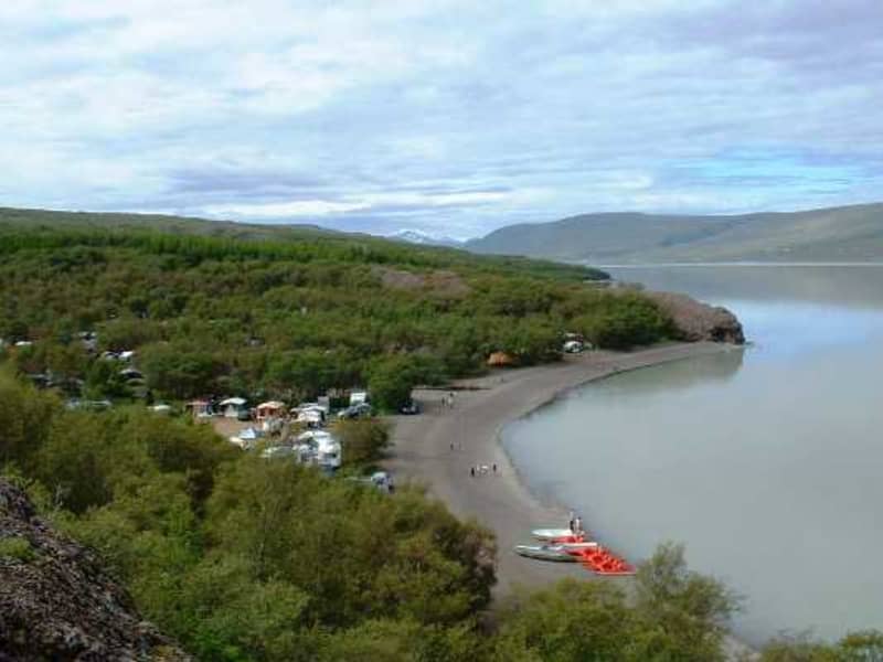
The inlet of Atlavík camp site in Hallormsstaðaskógur woodland is beautifully situated on the shores of Lake Lagarfljót. In the eighties Icelanders would flock to the legendary Atlavík Festival where no other than Ringo Starr performed in 1984! Like other areas in Hallormsstaðaskógur, the inlet provides the shelter of trees, as well as a comparatively continental climate at the south end of the lake, far away from oceanic conditions. The forest is considered to be Iceland’s largest one. It covers an area of 740 hectares, most of which is native birch. The birchwood remnants at Hallormsstaður were declared protected in 1905. Hallormsstaðaskógur is a popular outdoor recreational area for both locals and travellers, with its diverse landscapes and over 40 kms of versatile hiking routes and marked trails, open spaces and playgrounds. The Hallormsstaður Arboretum is unique in Iceland, comprising a collection of around 80 tree species from all over the world.   
Hallormsstaður
Hallormsstaður is a village situated in the middle of Iceland's oldest national forest. The forest is a popular recreational area featuring camping sites, marked hiking and biking trails, an arboretum, and a frisbee golf course.Hallormsstaður also hosts a large hotel with two restaurants and a spa. In the summer, an ice-cream shop with groceries operates by the gas station. Great accommodations, restaurants, and activities can be found in the surrounding area. You will find all the information you need on this website, along with links to social media.From Egilsstaðir, the major town of East Iceland located by Route 1, there are two routes to Hallormsstaður. The shortest route, on the east side of Lake Lagarfljót, is 27 km long. For this route, take Road 95 from Egilsstaðir and continue on Road 931 by the Grímsá river. If you choose the west side of the lake, which is 40 km long, you will find the junction with Route 1 on the hill north of the timber bridge near the Egilsstaðir airport. This route is marked as Road 931 with signs pointing to Fljótsdalur and Skriðuklaustur. When you reach the end of the lake, turn left just before reaching Hengifoss waterfall, towards a long bridge, and continue to the forest. 
Víðivallaskógur
Víðivallaskógur is in the land of Víðivellir Ytri I and II. There is a fun gathering area that is suitable for various events. Moreinformation can be obtained from the residents of Víðivellir, Bjarki Jónsson – phone +354 698 6237 or Krístín Gunnarsdóttir – phone +354 690 1276.  
Brúnavík
Brúnavík is a deserted inlet just south of Borgarfjörður Eystri, renowned for its serene surroundings. A hike back and forth from the parking lot at Hafnarhólmi marina across Brúnavíkurskarð pass (360 m) down to the ruins of the farm is approx. 12 km. Crossing at the mouth of the river is an absolute must to appreciate the colorful beach. The way back crosses the Brotagil ravine across the bridge to pass Hofstrandarskarð (320 m). The hike takes about 5-6 hours on a marked trail.
Hottur
Höttur (Hátúnahöttur) is a beautiful mountain which lies in the mountain range between Vellir and Fagridalur and is favored by many who live in Egilsstaðir. Walk from the sign by road nr 1 east of Gilsá river (N65°08,172-W14°31.133), towards Grjótá river by Víðihjalli and up along the river. Onwards and up to Hattarhólar, turn inland and ascend to the top of Höttur (1106 m). Part of Hiking Treasures in Egilsstaðir Region. GPS : N65°07.63-W14°27.25 Powered by Wikiloc
Breiðdalseldstöð
Breiðdalur central volcano is an ancient volanic area above Breiðdalur valley and Berufjörður. It was the object of extensive research carried out by the English geologist George D.L. Walker who made East-Iceland teritary volocanologic phenomenons the main object of his professional work. The Breiðdalur area of volcanism is set with rhyolithic-inserts producing the mainstay of majestic mountain range searating Breiðdalur and Berufjörður, e.g. Mt. Flögutindur, Mt. Smátindar, Mt. Röndólfur, Mt. Slöttur and Mt. Stöng. The southern side of the volanic formation is highly colorful and the instrusions assume an irregular aspect, set with tephra-layers. The site of the central volcano extends between Mt. Fossárfjall, south of Berufjörður to Mt. Bæjartindur, which towers above farm Þorgrímsstaðir in Breiðdalur. The western slope runs along Mt. Ófærunafir towards the west, whereas the eastern side - although highly eroded - extends east of Mt. Kerlingartindur, S-Breiðdalur. The southern region of Breiðdalur - the very centre of area - forms a basin where the excruciating heat has transformed the rock to such an extent that the basalt and the andestite have turned pale-green, making it problematic to tell them apart from the rhyolite. This can be clearly detected at river Innri-Ljósá Blágil ravine. The beforementioned chain of mountains was formed at a later date as the rhyolite wielded its way to the surface through the basalt layers, forming insertions on top of the massive tephra layers along the edges of the crater. Their remnants are visible in rhyolithic-rocks throughout the Breiðdalur region. This central volcano is considered to be of later date than its Álfta- and Reyðarfjörður counterparts. The Reyðarfjörður ignimbrite, a pyroclastic flow made as a burning hot mixture of about 430 km2 with a diameter of about 6 m. thickness. This layer is linked the Mt. Skessa south of Reyðarfjörður, best known as the Skessulag. The immense volcanism of the area has resulted in a great variety of rare minerals and semi-precious stones on display at Petra´s wonderful stone collection in Stöðvarfjörður and the Breiðdalur miniral museum in Breiðdalsvík.
Ranaskógur woods
Often considered one of the country´s most beautiful birch woods, Ranaskógur has numerous birches with white bark and tall, straight trunks. Moreover, the forest floor is unusually smooth, in comparison to most Icelandic wooded areas. In the Icelandic name, skógur means "woods" and rana refers to the lower end of the long ridge west of the Gilsá river gorge. Ranaskógur extends along the west side of the gorge, which is the traditional border between two counties in East Iceland. The Icelandic birch species is Betula pubescens. Besides the abundant wood crane´s bill, Geranium sylvaticum, and stone bramble berry plants, Rubus saxatilis, in the undergrowth, Ranaskógur has an unusual number of tall rowan trees, Sorbus aucuparia; in fact, no other Icelandic site presents such a concentration of large rowans.  At the Kiðuhóll rise in the middle of Ranaskógur, Metúsalem J. Kjerúlf, farmer at the nearby Hrafnkelsstaðir, started a plot of coniferous trees between 1955 and 1961, in remembrance of his brother Páll. Not only did Metúsalem plant 23 different species, but 21 are still represented, with the talles trees nearing a height of 20 m. The Ranaskógur woods have existed ever since Iceland´s settlement and are mentioned in documents from the 15th century. hey are part of the woods which figured in the well-known Saga of Hrafnkell, which states that the saga´s hero cut down stands of trees here when he moved to this valley and built up the farm that has since been named after him, Hrafnkelsstaðir. Nineteenth-century quarrels between the Hrafnkelsstaðir and Víðivellir farmers over the use of forest resources resulted in most of the lower part of the woods being cut down. While the woods had previously extended south below Kirkjuhamar cliff, now only a very few of those trees remain, at a place called Skógarbali.  The traditional use of Ranaskógur for firewood continued until nearly the middle of the 20th century, and in 1951 Eirkíkur M. Kjerúlf bought the woods to make them part of a new farm, Vallholt.
Kóreksstaðavígi
Kóreksstaðavígi is a beautiful rock of basalt columns. There the Viking Kórekur is said to have fought his enemies to the death and been buried at the site. One drives past Hjaltalundur and takes the road towards the farm Kóreksstaðir. Park your car in an area close to the sign by the gate leading to the farm. Walk on towards the Kóreksstaðavígi where you will find a cylinder with the visitors’ log and stamp. Standing on its top is an enjoyable experience. Part of Hiking Treasures in Egilsstaðir Region GPS : N65°32.782-W14°10.591 Powered by Wikiloc
Sanddalur
Sanddalur is a beautiful valley that lies south of Snæfell. The valley is barren and breathtaking with green moss plains and peculiar rock formations that envelop the valley with a fairytale glow. To go to Sanddalur you need a four-wheel-drive car, but you can also walk there from road number 910 to Kárahnjúkar.
Víknaslóðir
Víknaslóðir trails, sometimes also referred to as Trails of the Inlets is a vast net of well-marked and versatile hiking routes reaching from the village in Borgarfjörður Eystri to Loðmundarfjörður. Locals have through the years marked out and maintained numerous trails, making the area a rightfully called hiker's Paradise. They also publish a high-quality hiking map and operate comfortable hiking lodges with facilities in Breiðavík, Húsavík and Loðmundarfjörður, deserted inlets and fjord, south of Borgarfjörður Eystri. The mountains come in all shapes and sizes and the variety of colors is stunning; everything from the black sand beaches to the pinkish orange hues of the mountain ridges. The trails wind themselves between isolated coves and fjords over colorful hills and through green valleys all the way down to the coast. Abandoned houses and ruins of ancient farms leave their mark on the surroundings. Travellers can easily spend a few days in the area exploring and taking in the breathtaking views. Tourism companies in Borgarfjörður Eystri offer hikers all kinds of services related to their journey, whether it be tour planning, guidance or transport.
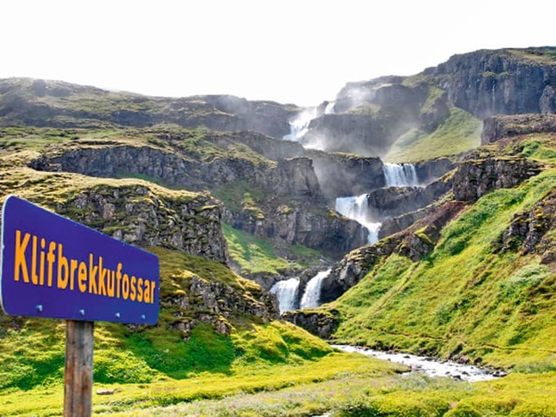
Klifbrekkufossar
Klifbrekkufossar is a magnificent tier of waterfalls in Mjóifjörður. While descending the main road from Egilsstaðir the waterfalls can be spotted on the right-hand side.
Eyjabakkar
In the vicinity of majestic Mt. Snæfell and the imposing Vatnajökull glacier you´ll find the rolling flatland Eyjabakkar; a green oasis in the otherwise scarcely vegetated highland.  This is a resting niche for some 14 000 geeses before setting off for their long flight southward bound. This area is suitable for all kinds of outdoor leisure. The Fljótsdalshérad Touring Club has a chalet at Mt. Geldingafell beyond the river Blöndukvísl.  
Hraunlína
An observation area offering nice views over the lagoons - Skógarlón and Nýpslón near Vopnafjörður. Lón is a nature reserve because of the great variety of animal and bird life. The lagoons are inhabited by over 40 microorganisms in addition to fish species and birds. The walk walk along the beaches of the Lón is beautiful, enjoying the the bird life in all its variety. At the observation point, just off Búðaröxl road, is an information sign for Vopnafjörður.
Sandfell Skriddalur
Sandfell is an impressive looking rhyolite mountain in the shape of a ridge and reminds one of a tent because of its even slopes which are mostly free of cliffs and by it’s two darker peaks. The path starts by the main road (no 1). A little distance from the Gilsá river you will find the sign where you start. Walk the trail towards a fence then turn and walk up along it, then upwards by the trail on the northern ridge straight to the top which reaches 1157 m. Part of Hiking Treasures in Egilsstaðir Region GPS : N65°05.637-W14°30.298 Powered by Wikiloc
Vestdalsvatn
A great trail for hiking which involves crossing Vestdalsheiði mountain range, from Hérað to Seyðisfjörður. Vestdalsheiði heath used to be a frequently traveled road. People walked along Gilsá river, across the heath, and into Vestdalur valley. Walk from the sign in Fjarðarheiði (N65°15.577-W14°13.524) and head towards the western part of the mountain Bjólfur. You will see the Lake when you get near the mountain. This is a nice walk in rolling hills. When you get to Vesdalsvatn you can choose between three routes if you don´t want to take the same route back. Down Vestdalur by a staked trail to Seyðisfjörður; down Gilsárdalur valley down towards Gilsárteigur farm (east of Eiðar in Fljótsdalshérað) or go west of Bjólfur mountain down to Stafdalur valley. The cylinder with the visitors’ logbook and a stamp is where Gilsá river runs out from the lake. You will need to cross the river if you choose to walk from Fjarðarheiði. Part of Hiking Treasures in Egilsstaðir Region GPS : N65°17.102-W14°17.887 Powered by Wikiloc
Tvísöngur Sound Sculpure
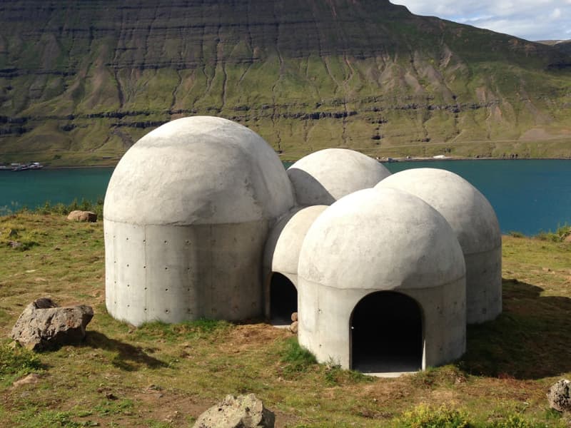
Tvísöngur sculpture, by artist Lukas Kühne, mixes concrete, nature, and sound to create an interactive tribute to Iceland’s unique tradition of five-tone harmony.  The installation piece looks like a grouping of interconnected cement bubbles from afar. Up close the five segments are quite large, ranging from roughly 6 to 12 feet tall and can be entered via rounded arches built into the walls. Once inside the stark industrial domes, visitors will find that they have each been designed to resonate at different harmonies as the wind blowing in off the cliff rushes through the openings. The collective effect is almost as though the wind itself is playing a giant instrument. The five chambers of the piece are meant to recall the Icelandic musical tradition of quintal harmony, with each dome reflecting a tone in the tradition. Juxtaposed with the serene and stark surroundings, it seems as though Iceland itself is creating the music. Tvísöngur is a permanent work and is meant to keep the country’s musical traditions alive, which is not an easy thing to do simply with concrete.
Virkisvík
Virkisvík cove is a beautiful place with colourful sediments, basalt formations and a waterfall that cascades over precipitous cliffs into the sea.  The oldest known rock formations, above the sea, in Iceland are in Austurland and Westfjords. They are about 15-16 million years old, from the Miocene Tertiary era.  The layers from that epoch are formed of lava flows with occasional sediment layers in between. Such layers, in thicker form, have long been research subjects, since they often include plant or animal remains which hold information about the climate when the layers formed. Two thick sediment layers can be found in Vopnafjörður. One in Virkisvík and the other at Bustarfell mountain. 
Hnjúksvatn
Hnjúksvatn is a lake on the heath across from Merki farm. Walk from the sign by road no. 923 along Hnjúksá river to Binnubúð hut by Hnjúksvatn. By the hut, you will find the cylinder with the visitors’ log and stamp. An old lady and midwife, Brynhildur Stefánsdóttir built this hut for those who wished to visit and enjoy the highlands. Part of Hiking Treasures in Egilsstaðir Region GPS : N65°14.333-W15°15.887   Powered by Wikiloc
Bleiksárfoss waterfall
Bleiksá and its waterfalls are the first thing that catches your eye when you turn off the main road into Eskifjörður. The highest waterfall in the series of Bleiksár waterfalls is called Bleiksárfoss. Floodlights have been directed up to Bleiksárfoss, and it is quite a spectacle to see it on dark winter evenings, whether it slides down the slope or is covered in ice.
Fjallkonustígur hiking trail
A walk to the Vestdalur Nature Reserve in Seyðisfjörður, up to the Vestdalur lake and the cave of "The Mountain Maid". The route once served as the principal communication link between Seyðisfjörður and other regions in East Iceland. Relics of this 19th - 20th c. pillar of transport can still be detected through meticulous road constructions, stone walls, and Cairns. Having passed several tiers of glorious waterfalls, the wanderer reaches a small lake, Vestdalsvatn, which remains frozen most of the year. With majestic Mt. Bjólfur to the left., a tiny cave awaits to the right, the site of one the most important archaeologic discoveries of later times. In 2004 a group of workers unearthed some human bones, later defined as those of lady, around thirtyish - along with more than 400 pearls and some pins dating back to the era of settlement.  The remains are believed to date from the era around 940. These are now conserved at the National Museum. Vestdalseyri / Vestdalur valleyDuration: 3,5 hours / 6 km Period: June - September 
Búðarárfoss
A nice and pleasant hike up to Búðarárfoss waterfall. The hike is easy and gives a great view over the town. Due to a massive landslide in December 2020, the path up to Búðarárfoss waterfall was partially destroyed. Please treat with caution.
Laugarfell
Laugarfell is located in the eastern part of the Icelandic Highlands, a bit north from Mount Snæfell. There are only two km from the road that leads to Kárahnjúkar to the hostel and it is the only part of the road that is not paved. In the summer there is good access to Laugarfell in all kinds of vehicles. Laugarfell offers accommodation for 28 people. Two natural pools are located in Laugarfell and according to old folk tales the water is known for its healing powers. There are many interesting tracking paths around Laugarfell and a number of beautiful waterfalls. Additionally, one can expect to see reindeers wandering around the area of Laugarfell. Laugarfell is open from the 1st of June to 30th of September.
Spanarhóll
Spanarhóll is in the north end of Fjórðungsháls, 591 m high. You drive to the south up Fell to the farm Refsmýri. Walk from the sign by Þorleifará river and up along the river, about 0,5 km. Then you turn from the river and walk towards Hlíðarsel and onwards up the canyon above the ruins upon Fjórðungur on the Fell heath. From there the way to Spanarhóll is easily hiked. There are four hills and people should walk towards all of them. One can also hike to Spanarhóll hill by going up by the Ormarsstaðir river or from Fjallssel up to the edge, and then inland. The cylinder is on top of the biggest hill. At the hill, lore has it that there is a presence of elves or hidden people. Part of Hiking Treasures in Egilsstaðir Region GPS : N65°15.588-W14°41.446 Powered by Wikiloc
Vatnsskarð eystra
Fardagafoss Hiking Trail
Fardagafoss waterfall is close to Egilsstaðir, at the roots of Fjarðarheiði. It is one of three waterfalls in the Miðhúsaá river; the others are called Gufufoss and Folaldafoss. There is a marked hiking trail to the waterfall, and it is easy except for the last part, which is a bit difficult to cross. The hiking trail starts at a car park by road 93, close to Áningarsteinn rock.  Behind the waterfall is a cave. The story goes that an awful giantess one lived in the cave. It is believed that a tunnel runs through Fjarðarheiði to Gufufoss in Fjarðará in Seyðisfjörður. The giantess in Fardagafoss was famous for having a cauldron full of gold. When the giantess had become so old that she knew her death was imminent, she slid the kettle with the gold down into a deep pothole in the middle of Gufufoss, further down the Miðhúsaá river. The handle of the cauldron is said to be visable when there is little water in the river. Powered by Wikiloc
Þjófadalur (Thief valley)
Þjófadalur is a beautiful valley that lies south of Snæfell. To get there you have to walk, the best is to walk along the Þjófadalsá river through Þjófadalur between Snæfell and Þjófahnjúkar. The valley is beautiful and accessibility is only good as summer passes. If you walk east into the valley, there is a very good view of Eyjabakki and Þóriseyjar.
Kárahnjúkavirkjun
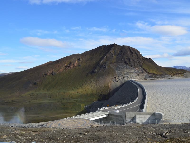
A large power plant has been built at Kárahnjúkar, to supply the aluminum plant in Reyðarfjörður with energy. The Kárahnjúkar power plant is the largest construction project in Icelandic history and, at the same time, the most significant electricity production in the country. A trip to Kárahnjúkar is an ideal road trip for the family. A paved road runs from Fljótsdalur to the Kárahnjúkar dam. The Kárahnjúkar area is ideal for outdoor activities. It is fun to see the Kárahnjúkar Dam itself and the Hálslón Reservoir. When Hálslón fills up and overflows, the Hverfandi waterfall appears at the western end of the dam, where the water plunges about 100 meters into Hafrahvammagljúfur. The waterfall is mighty and can become more powerful than Dettifoss waterfall. There are also fun hiking trails in the area; for example, there is a great hiking trail along Hafrahvammagljúfur and to Magnahellir, but to get to the starting point of the marked hiking trail, you need a four-wheel-drive car. 
Helgustaðanáma Hiking Trail
The Iceland spar mine in Helgustaðaland can be found on the way from Eskifjörður to Vöðlavík, and a footpath leads to it. Helgustaðanáma is an old Iceland spar mine in the land of Helgustaðir in Eskifjörður, which was protected as a natural monument in 1975. Helgustaðanáma is one of the most famous spar mines in the world, where spar was excavated from the ground from the 17th century until the first half of the 20th century. Most of the Iceland spar in museums around the world comes from the mine at Helgustaðir, but some of the largest and purest specimens of spar in the world were found in Helgustaðanáma. Iceland spar is a particularly clear crystal of the rock calcite, but the rock played a vital role in developing various studies on the properties of light. Today the Iceland spar is protected, and it is strictly forbidden to remove it from Helgustaðanáma.
Þvottaá
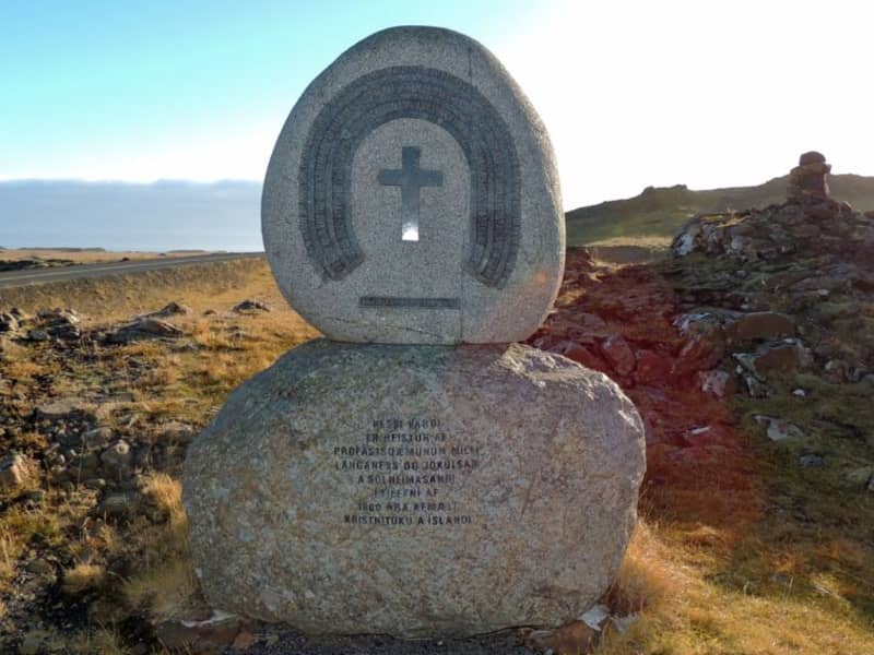
The farm Þvottá is the southernmost farm in Álftafjörður. Around the year 1000 the renowned Saga personality Hallur Þorsteinsson, or Síðu-Hallur, lived there. He received the priest and missionary Þangbrandur, who spent the winter with him. Síðu-Hallur and his whole household were baptized in the river by the farm and since then it was named River Þvottá (The Wash River). The farm gets its freshwater supplies from the so-called Þangbrandur Well, where the missionary probably held services at St. Michael’s Mass with the people of Þvottá attending the day before they were baptized. A ruin by the well was declared inviolate. Þvottá was a church site until 1754 and a parsonage for a long time. The old cemetery is still visible. Mt Mælifell (487m) is closer to the sea and north of it are Sellönd (Summer Pastures). The whole area is rather colourful because of the rhyolite intrusions and quite a few basaltic dykes decorate the landscape. These formations were created by the ancient and extinct central volcano, which has now mostly disappeared under the Álftafjörður Bay. Traces of several minerals were discovered in the area, gold, platinum etc. By Þvottaá, there is a monument to the adoption of Christianity and the area is vell suited for outdoor activities. 
Hengifossárgil Gorge
Hengifossárgil Gorge features distinct rock layers and formations. Along the trail, you'll encounter two stunning waterfalls: Stuðlabergsfoss (also known as Litlanesfoss), framed by captivating rock formations, and Hengifoss, one ofIceland's tallest waterfalls standing at 128.5 meters. While the hike up the gorge is steep, expect a two-hour round trip with an elevation gain of approximately 300 meters. You can ascend to Hengifoss and descend on the opposite side. You have to be very careful when crossing the river because there an be high tides.   You can get information from Snæfellsstofa about hiking trails within Vatnajökull National Park. The Wilderness center offers a variety of outdoor activities and recreation.  
Tjarnargarðurinn Park
Tjarnargarðurinn is a lush park in the heart of Egilsstaðir, with beautiful woodland. Its name is derived from the pond that it surrounds. It is a nice place to relax, enjoy the weather, play, or have a picnic. The Frisbee golf court is found in this recreation area. Frisbees can be found at the camping site in Egilsstaðir.
Oddsskarð
It was not until 1949 that Norðfjörður first came into road contact with the neighboring settlements. The route was through Oddsskarð, one of the highest mountain roads in the country, which was usually difficult to navigate due to heavy snow. A tunnel was built under Oddsskarð in the years 1974-1977. The tunnel is 626 m long at 632 m above sea level. Close to the pass, you´ll find one of the best ski resorts in Iceland. In the wintertime, these delightful and versatile hills call out to skiers to come and enjoy. There are hills to fit the needs of all ages and different capacities. Here can you find more info: Oddsskarð 
Stekkjarvík
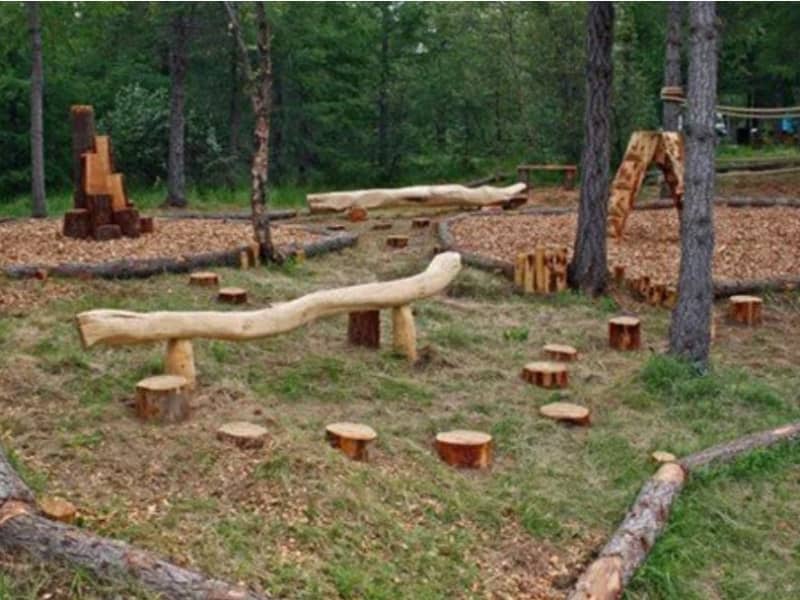
Stekkjarvík is an outdoor area for the family about 4 km away from the urban area of ​​Hallormsstaður, close to Hafursá. There are playground equipment made from local wood, charcoal grills and tables in beautiful clearings.
Valtyshellir
Walk from the sign by road no 1 road east of Gilsá river (N65°08,172-W14°31.133), pass the ruins of Hátún which used to be a large farm in the early ages. It is said to have had 18 doors on iron hinges and latches. Remains of old rock fences are visible. In the 19th century, an ancient sword was discovered there but it was promptly melted down and the metal cast for horseshoes and other necessities. Walk on further and along a flat grassy pasture named Kálfavellir. Valtýshellir is a small cavity further on behind some rubble north of Hjálpleysuvatn lake. The walk is about 8,4 km. The visitors’ log and a stamp are by the cave. GPS : N65°06.410-W14°28.517 Powered by Wikiloc
Hafrahvammagljufur
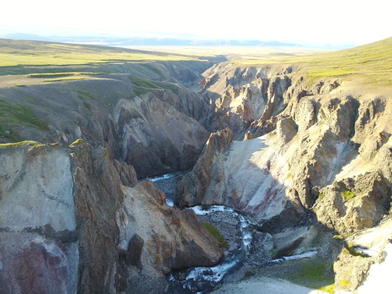
Hafrahvammagljúfur in Austurland is one of the largest and most magnificent gorges in Iceland. The gorge is about 200 meters from the bottom to the edge (where it is highest), and the canyon is about 8 kilometers long. There is a marked hiking trail along the gorge and down to Magnahellir. You need a four-wheel-drive car to drive to the trail's starting point, but you can see part of the gorge from Kárahjúkar dam, and you can get there by an average car. 
Seven summit´s
Period: summer By climbing seven of the peaks surrounding the fjord of Seyðisfjörður, one earns the prestigious title of "a Seyðisfjörður Mountain Viking". Mostly exceeding an altitude of 1.000 m, these mountains are as follows:  Sandhólatindur, Bjólfur, Nóntindur, Hádegistindur, Strandartindur, Snjófjall, and Bægsli. You´ll find guestbooks and ink stamps waiting at each peak. The cards for summit stamps and further details are available at the information centre in the ferry terminal, tel. +354 472 1551 and at www.seydisfjordur.is
Laugavalladalur
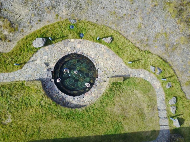
Laugavalladalur is a green oasis west of river Jökulsá á Dal, some 20 km. north of dam Káraghnjúkar. Close to the site of an abandoned farm, there is a geothermal stream, ideal for taking a bath and a shower in the warm waterfall where the stream runs into the valley's main river. Please be wary of the temperature as it sometimes rises well above suitable limits!
Rangarhnjukur
Walk from the sign by the gate to Fjallasel farm, where you take an old road up above the farm. When you arrive up to turn off the road to the right and walk onto Rangárhnúkur where you will find the cylinder with the visitors’ log and stamp. On the way back it is a good idea to walk down to Egilssel farm and walk on towards Fjallssel farm. Then you will pass Dansgjá which is a peculiar creek or ravine through tall cliffs west of Staffellsbjörg cliffs right off the road and marks the borders of the farms. Part of Hiking Treasures in Egilsstaðir Region GPS : N65°19.410-W14°35.498 Powered by Wikiloc
Ljósastapi
Be sure to visit Skjólfjörur beach when driving through Vopnafjordur! The beach is only a short walk from the road and offers a magnificent view of the open Atlantic sea. If you’re lucky you might even see a whale. The beach has a rocky shore, with colorful stones that capture the eye. Driftwood which the waves have brought to land is a testament to the incredible force the sea possesses. Please respect that it is forbidden to remove stones from the beach.  One characteristics of Vopnafjordur is the incredible rock pillars and cliffs that take on various forms, often resembling different creatures. Ljósastapi rock pillar stands out in the sea just off Skjólfjörur. It is often called “Fíllinn” (the Elephant by locals), as its form resembles an elephant. It is a vera photogenic place! To the right of Ljósastapi, the mountain Búrið stands out from the mountain range. Búrið is a part of the Fagradalur mountains, an ancient volcanic area. In the Fagradalur mountains, you can see colorful rhyolite rocks that certainly make their mark on the surrounding environment. A marked walking path takes you down to Múlahöfn harbour and to Þerribjarg cliffs, east of Hellisheiði Eystri, where the rhyolite is at its most beautiful.
Sænautasel highland farm
Sænautasel on Jökuldalsheiði is a unique location by the tranquil mountain lake, Sænautavatn. Sænautasel is an old highland farmstead that was rebuilt in 1992 and has been welcoming visitors during the summer since then. At Sænautasel, you can learn about the conditions and struggles of those who lived in the highlands. Guided tours are offered around the farm, sharing stories about the people and farming practices at the highland farmsteads that were inhabited well into the 20th century. Light refreshments are available in a traditional style. It is open every day in June-August.   To reach Sænautasel, you can drive from Highway 1 north of Skjöldólfsstaðir onto Möðrudalsvegur (Road 901) and then, after a short drive, turn onto Brúarvegur (Road 907). Alternatively, you can drive from Brú on Jökuldalur via Brúarvegur (Road 907) north to Sænautasel. From Sænautasel, it is a short distance to the magnificent natural rock formations Skessugarður slightly west on Jökuldalsheiði, and also close to Stuðlagil on Jökuldalur.   Settlement in Jökuldalsheiði began in the mid-19th century. The settlements in the highlands were partly built on the ruins of ancient farms and sheepfolds. The highlands are exceptionally beautiful in summer, making it hard to imagine how it was to live there year-round, including the harsh winters. The first farmstead built in the highlands during this period was Háreksstaðir in 1841. Over the next two decades, a total of 16 farmsteads were established in Jökuldalsheiði, the last one in 1862. The quality of the highland farms varied, and their periods of occupancy ranged from a single year at some to nearly a whole century at Sænautasel. The reasons for establishing these highland farms included overcrowding in the lowlands where all farms were occupied, and the development of urban areas and employment opportunities by the sea was still minimal. Therefore, people had few alternatives other than being laborers or tenants.   The farming conditions in the highlands were not entirely bad, although most places had heavy snow, as most farms were over 500 meters above sea level. Resources such as trout fishing in lakes, hunting for ptarmigan, geese, ducks, and swans, and grass harvesting were significant supplements. Some areas had excellent hayfields, at least in good years. Reindeer roamed the area, though their population was at a historical low around the turn of the 20th century. About 120 people lived in the highlands simultaneously at its peak. The eruption of Askja in 1875 greatly affected the highland settlements, causing a temporary abandonment of all farms except the northernmost ones. Many who left eventually emigrated to America. A few years later, some farms were reoccupied, and the settlement continued into the early decades of the 20th century. The last farm was abandoned in 1946.   Sænautasel was first established in 1843 and was inhabited until 1943, except for five years after the Askja eruption. It was the longest-inhabited farm in the highlands, occupied for a total of 95 years. Farming in the highlands under difficult conditions and great isolation has inspired Icelandic writers. Many fans of Halldór Kiljan Laxness know the story of Bjartur of Summerhouses in the novel *Independent People*. It describes the struggle of an independent crofter in a remote highland area. Many believe the story's inspiration came from Sænautasel, as Halldór stayed there in the 1920s. Highland farming was also a subject for writers Gunnar Gunnarsson and Jón Trausti.     Old legends said that sea cattle had been seen in Sænautavatn and even suggested that there were underwater tunnels from the lake to the sea that the sea cattle used.  
Sandvík in Vopnafjörður
Sandvík is a long, black sandy beach at the innermost part of the fjord. This is a family paradise created by nature. Visitors may find seashells, take a walk, watch the birds, build a sand castle - or follow their own imagination. Along this coast a supply ship ran aground on 2nd October 1981. All the crew were rescued. At low tide one can still see a glimpse of the wreckage. Access to Sandvík is by a track down to the bay from near the golf course.  Visitors are reminded to be careful along the beach. The river Hofsá may overrun its banks in the spring, and as a result quicksand can form along the beach.
Hrafnkels saga trail
Hrafnkell's Saga Freysgoði takes place in East Iceland and recounts the conflicts between chieftains in the 10th century. Hrafnkell's farm in Fljótsdal is named so because Hrafnkell lived there for a time. Not far from the town, there is a historical sign that is part of a historical trail that can be followed over Fljótsdalsheiði and down to Hrafnkelsdal.
Hallormsstaður National Forest
The birchwood remnants at Hallormsstaður farm were protected in 1905, making it Iceland’s first national forest. Today, birch forest and woodland cover about 350 hectares within the original fenced area, and a variety of tree species have been planted on another 200 hectares. Large areas to the north and south have been annexed to the forest more recently and either planted with trees or allowed to naturally regenerate with birch. A total of 85 tree species from over 600 locations worldwide can be found in the forest, covering around 740 hectares.Lands managed by the Land and Forest Service are designated as National Forests. These areas are open to everyone year-round and are located throughout Iceland. Many, like Hallormsstaður Forest, are easily accessible and offer a variety of facilities for outdoor recreation. Others require a 4WD vehicle or hiking up steep hillsides to enjoy.Hallormsstaður Forest is ideal for hiking, strolling, or biking. There are well-marked trails, in different colors, throughout much of the surrounding woodland. These trails are shown on a clear map published by the Forestry Service, which you can find in boxes at the entrance of many trails and nearby services. The maps can also be downloaded here.There are two camping sites in the forest: one in Atlavík and the other in Höfðavík. Both sites have small and large flat areas among the trees and are close to Lake Lagarfljót. Foresters will collect the payment for camping. More information can be found on our Facebook page.Rest places and picnic areas are scattered throughout the forest. For example, in Stekkjarvík, there is a barbecue area and a playground. The arboretum in Hallormsstaður is unique in the Arctic region. 
Teigarhorn
Teigarhorn, close to Djúpivogur, is known for remarkable geological formations and interesting history of industry and culture. Teigarhorn is a nature reserve, and part of it is a natural monument. There is year-round ranger at Teigarhorn, and development work in the area is being done in harmony with nature. Teigarhorn is one of the most significant mining sites of zeolites in the world. Among the types of zeolite stones found at Teigarhorn are schoolite, stilbite, epistilbite, mordenite, laumontite and heulandite. There are also other minerals, such as seladonite, opal, chalcedony, rock crystal, calcite and Iceland spar. Zeolites from Teigarhorn have been used in various geological studies for more than 200 years. These include descriptions of crystal forms, chemical composition, internal structure of crystals and optics, some of which are among the first descriptions of the rocks in question. Samples from Teigarhorn were sold to museums around the world in the second half of the 18th century, but since 1976 the main mining places have been protected as natural monuments. Weywadthús, at Teigarhorn, was built by Níels P.E. Weywadt in the years 1880-1882. He was a store manager in the Örum and Wulff store in Djúpivogur. Weywadthús has been part of the National Museum of Iceland since 1992. Níels' daughter, Nicoline Weywadt, was the first Icelandic woman to study photography and operated a photography studio in Teigarhorn. Nicoline is also believed to have owned the first sewing machine in East Iceland.
Fuglabjarganes cliffs
Fuglabjarganes is on the north side of Vopnafjörður’s coast line.  It is on Iceland’s nature conservatory list for its beautiful and diverse coast and great bird life. Walk along the beach to the headland where high bluffs reach down to the sea. From there you can see rock pillars that rise from the sea and enjoy the view across the open ocean. Please be careful when walking along the cliffs and do not go too close to the edge. 
Eyvindará river
Among the precious gems of the township, Egilsstaðir is the river Eyvindará. A farm on the river banks,k with the same name, traces its roots prior to  A.D. 1000. The burial mound of saga legend Helgi Droplaugarson, and ruins - commonly believed to be the ruins of his historic abode- are still to be seen on the Eyvindará grounds.  The area is highly popular among the local youths for all kinds of outdoor activities.
Brimnes
Brimnes is an abandoned farm located on the northern side of Seyðisfjörður. It stands beneath Brimnesfjall, which acts as a protective barrier against the north wind. The highest point above the Brimnes farm is Ytra Rjúpnafell, which reaches 771 meters. The upper part of the mountain is characterized by steep and high cliffs, while the lower slopes are green, covered with shrubs and heather. Further out on the peninsula, the land is steep with difficult scree valleys.The coastal vegetation gives the land a distinct appearance. A hike to Brimnes in good weather is unforgettable. The nature is magnificent, and the view to the sea and over the fjord is beautiful. It is also an ideal place to reflect on the history of settlement in this remote location. The best starting point for the hike is Selstaðir, accessible by road No. 951 from Seyðisfjörður. A road was cleared to Brimnes before it was abandoned, but it is no longer driven. The sea route was the main supply route for the residents for most of the time.   Brimnes was a large farm in earlier times. The land was considered excellent for farming, and fishing was practiced. Several small farms were also in the vicinity of Brimnes, including Brimberg near the current lighthouse and Borgarhóll about one kilometer inland from Brimnes. The farm was inhabited until 1961 when the residential house burned down. Significant fishing was conducted in the late 19th century and early 20th century, forming a small community (Brimnessettlement). The Brimnes farm itself was located above Brimnestangi, and just outside it, above Útvogur, an icehouse was built in 1894, one of the first two icehouses in the country. The Brimnes lighthouse was built in 1906 and stands a short distance from the Brimnes farm. The residents of Brimnes engaged in fishing, and numerous visiting boats also fished there in the summer, providing the farmers with income from services. Several buildings related to fishing were constructed during these years, but most were only used in the summer. At the end of the 19th century, up to 40 rowboats operated from the Brimnes settlement in the summer, many from the Faroe Islands. This fishing activity ceased when motorboats became common, as proximity to fishing grounds was no longer as crucial. Remnants of old buildings can still be seen in the area. Near the farm is the place name Klausturskemmutangi, indicating that Brimneswas once owned by Skriðuklaustur monastery in Fljótsdalur.   Brimnes is not only beautiful, peaceful, and prosperous but also a place where nature and the struggle for survival could be harsh. In 1732, an avalanche struck Brimnes farm, killing nine people, while another nine survived. Some sources mention that nine days later, a four-year-old girl was found alive in the ruins. This winter was likely heavy with snow and was subsequently called Brimnes winter. In 1740, a boat carrying, among others, a county governor, was wrecked on a skerry later named Sýslumannsnaggur, located about one km outside Brimnes lighthouse at Sléttanesvogur. Then, on the morning of May 1, 1922, in calm and foggy conditions, the coastal ship Sterling ran aground on the same skerry. All on board, about 50 passengers and 30 crew members, were rescued. They reached land in lifeboats, and the ship's steward served refreshments on a place called Ostabalar nearby. The passengers were allowed to retrieve their belongings from the ship before the Danish coast guard transported them to the harbour at Seyðisfjörður. Goods and various ship items were salvaged from the ship, which was destroyed at the stranding site. There are well-documented records of this stranding, including a list of passengers and crew and an inventory of items salvaged from the ship and sold at auction. This event drew considerable attention since maritime transport was vital for the settlements at that time, with coastal ships transporting people, mail, and goods around the country. Sterling was among the first ships owned by the Icelandic state and was the only coastal ship at that time.   
Djáknadys
According to legend the mound marks the spot where the pastor of Háls and the deacon of Hamar fought to the death. Both were buried at the site, and that is the origin of the name Djáknadys (Deacon’s Burial Mound). Tradition requires every traveller, on first passing by Djáknadys, must throw a pebble or stone onto the mound: one for him/herself, and one for every horse or dog accompanying them. If they fail to do so they will lose their way. Another version of the tradition is that travellers must place three stones on the mound. An old verse on the subject says: To quickly dismount and fling a stone over the aged deacon brings good fortune along the road. Please treat this protected heritage site with respect and care. Do not remove stones from the mound and do not dispose of refuse under stones. 
The Mountains of Stöðvarfjörður
A natural treasure. The mountains in Stöðvarfjörður are ideal for all lovers of mountaineering. Súlur, the emblem of Stöðvarfjörður, is the perfect choice for experienced climbers looking for new challenges. Mt. Kumlafell should also be recommended as a challenge. At the top, there is a hole going through the mountain top, with a view to the neighboring fjord of Fáskrúðsfjörður. For lovers of hiking, Stöðvarfjörður is also the perfect place, with ample opportunities for long and nourishing walks in beautiful surroundings.
Kúahjalli og Hrafnatindur
Numerous marked trails surround the village at Borgarfjörður Eystri. One of them leads to the mountainous terrain of Kúahjalli and Hrafnatindur. The trail follows the banks of Bakkaá river up to Hrafnatindur mountain offering a remarkable view over the fjord. Thereupon the trail continues to Kúahjalli and down again to Geitavík where a monument dedicated to the reowned Icelandic painter Jóhannes S. Kjarval stands. The hike should take about 3 hours with 350 m elevation.
Angling in Kelduá, Fljótsdal
Kelduá in Fljótsdal flows through Suðurdalur and then into Jökulsá. The river has both local trout and char. Fishing licenses are sold at Hengifoss guesthouse. Gilsá falls into the Lagarfljót, not far within Hallormsstaðarskógur. The Forest Service allows angling in the estuary free of charge. Jökulsá in Fljótsdalur is clear for a large part of the year after the power plant at Kárahnjúkar. It contains local char. Fishing licenses are sold at Óbyggðasetur and you can also rent rods there.
Vallanes
Vallanes is a farm and a vicarage, known for the habitation of many leading scholars and literates of centuries past. Today the farmers of Vallanes are renowned for organic farming and pioneer products, i.a. vegetables and barley. They also produce food and cosmetics under the brand name of  "Móðir Jörð" - "Mother Earth".  In the last century, the locals of the surrounding district erected their community centre, Iðavellir, on the outskirts of Vallanes, and there the East Iceland Equestrian Association has its main hub on the grounds for races and shows.  
Skumhottur
Skúmhöttur the second tallest mountain in the range between Fljótsdalshérað and Reyðarfjörður. It consists mostly of rhyolite but the peak itself is of a darker rock formation. Drive the main road (no 1) until you pass Litla Sandfell farm. Make a left turn and go through the gate and continue until you come to an old bridge by Þórisá river. There is a parking area. Walk from the sign by Þórisá river and along the ridge until you are on the top, 1229 m. A good walk and an interesting mountain. Part of Hiking Treasures in Egilsstaðir Region GPS : N65°05.637-W14°30.298 Powered by Wikiloc
Jórvíkurskógur
Jórvíkurskógur is an attractive Icelandic woodland. It has all that the local people disire: Green growth and plants with berries and mushrooms. The trees are tall enough to form a wind-shelter, there ar enice hiking trails and lovely brooklets with pure water flowing briskly, old farmhouse, and green lawns. This is an ideal spot for resting peacefully and enjoy life.
Heidarendi
Take the driveway up to and above Heiðarsel farm and turn to the left before you come to the farm Nátthagi. Walk from a sign by the old road above Nátthagi. Walk up to the top and further on to the right where you get to the cylinder with the visitors’ log and stamp. It is pleasant to walk on from Heiðarendi descend and walk back by the old gravel road. Part of Hiking Treasures in Egilsstaðir Region GPS : N65°23.085-W14°33.819
Waterfall Circle
The Waterfall Circle is an 8 kilometers long hiking circle that starts and ends in Laugarfell. On the hike, you can see five waterfalls and one canyon. Some of these waterfalls are among the most powerful in East Iceland. Most famous of the waterfalls are Kirkjufoss and Faxi. This beautiful hike is getting more and more popular among hikers. After the hike then it is a good idea to take a bath in the hot springs in Laugarfell.
Arboretum in Hallormsstaðar Forest
The Hallormsstaður Arboretum is unique in Iceland, comprising a collection of around 80 tree species originating from various parts of the world. In addition to trees, there are also various species of shrubs. Begin your walk through the arboretum from the car park by the main road and follow the paths. Allow yourself plenty of time, about 2-3 hours, to explore the arboretum, enjoy the surroundings, and breathe in the fresh air. Walk down to Lake Lagarfljót, enjoy a picnic, and listen to the birds singing.Forestry in Hallormsstaður began in 1903 by fencing off 12 hectares for a tree nursery called Mörk. Half a hectare was prepared as nursery beds, marking the beginning of the nursery. In 1905, 50 Engelmann spruces were planted on the upper half of Mörk. Now, only five of these trees remain, and they are the oldest spruces in the forest, standing close to the parking lot.Over the years, single trees and groups of various species have been planted in Mörk. This arboretum is already the most impressive in the country, offering visitors a good opportunity to see both common and rare species. 
Hafnarhólmi
Hafnarhólmi islet at the harbour in Borgarfjörður Eystri is perfect for birdwatching. Hafnarhólmi is easily the most accessible Atlantic Puffin colony in Iceland where they nest every year from middle of April to beginning of August. Kittiwakes, Fulmar and Common Eider also nest in Hafnarhólmi along with many other bird species. Locals have taken care of Hafnarhólmi and its birds for decades and built it up to be easily accessible for visitors to enjoy the area in harmony with the wildlife there. At the newly built Hafnarhús - Harbour House you can enjoy art exhibitions and excellent view over the harbour and Hafnarhólmi while tasting some Icelandic delicacies. 
Geithúsaárgil ravine
Geithúsárgil is a ravine that runs down from the mouth of Sléttudalur under the roots of Grænafell in Reyðarfjörður. The river that flows down the gorge is called Geithúsaá and joins Norðurá when it comes down to the fjord. The gorge is magnificent and spectacular with criss-crossing hammer walls on each side and has been shaped by the Geithúsaá river over the centuries. The river has thus shaped the gorge and still is, but gorges are said to be the characteristics of "young waterfalls".  
Bóndavarðan - The farmers cairn
Bóndavarðan - The farmers ´cairn stands high on the ridge just seawards of the village. The view from Bóndavarðan cairn is great! it may have been first erected by farmers keeping watch towards the sea after a severe raid by North African pirates in 1627. There is a view indicator up the cairn.
Vatnajökull National Park
Vatnajökull national park established 7. June 2008, covers an area of 14,141 km2 (13,7% of Iceland). The eastern covers 2.384km2. There are many places to visit, and experience, the contrasts in the unique nature are magnificent. The battle between ice and fire still rages within the National Park's boundaries. Few other places in the world exhibit the effects of such a wide range of natural phenomena.Among highlights of the east are Kverkfjöll, the home of Ice and fire, the oasis Hvannalindir, Snæfell the ancient volcano, where the reindeer roam and Eyjabakkar the celebrated home of the Pink-footed Goose.
Álftafjörður
Álftafjörður is a lagoon that Starmýrarfjörður, which is no wider than a large surf crosses them, separates the lagoon from the sea. The fjord is quite large, but relatively shallow and large areas of it dry up when the tides are low. There are several islands in Álftafjörður, Brimilsnes being the largest. To the south of the fjord rises Krossanesfjall, just over 700 m high straight up from the sea, but to the north are Mælifell and Sellönd. When this is released, we receive four valleys that rise from Álftafjörður, to the west. Their southernmost is Starmýrardalur. The mouth of the valley is narrow, but when it enters it opens slightly but high mountains, Flötufjöll and Miðfell to the south and Selfjall to the north, rise rapidly. Selá lies around the valley and has its source at the top of Starmýrardalur. At the mouth of the valley, the river flows through Sjónarhraun and from there in a bend to the northwest over Stekkjartún where it joins Starmýrará, which originates in Hæðir. From there, Selá falls into Krossavík south of Álftafjörður. North of Selfjall lies Flugustaðadalur, about 14 km. long. Like Starmýrardalur, it is narrow and the lowlands are small. To the east of the valley, the Suðurá / Flugustaðaá river, which originates in Bláskriðir at the bottom of the valley, falls under Tungutindar and Flugustaðatindir. Under Tungutindur by Tungusporð, the river Hofsá merges, which comes down from Hofsvötn east of Hofsjökull and together they flow east through Hofshólmur to the west of Álftafjörður. The mouth of Flugustaðadalur is to the south of the rivers and the mouth of Hofsdalur to the north, the division remains so until Tungutindur takes over and separates the valleys, so that Flugustaðadalur stretches further west and Hofsdalur bends to the northwest. Both valleys are fairly well-vegetated and there is considerable birch scrub. When you reach the valley, you face Jökulsgilsgrindur, Grísatungur and Hofsjökull (1280 m). At the northern side of Hofsdalur, steep mountain slopes take over and Selfjall (950 m) is the highest peak and beyond the mountain range is Geithelladalur, about 18 km long. High mountains are bends due to the valley all the way west of Þrándarjökull (1248 m) on the south side, but when you reach the bottom of the valley, land rises rapidly and the plateau northeast of Vatnajökull, so-called Hraun, is exposed. The valley is grassy and there is a lot of forest there. The Geithellaá river flows through the valley, which is a considerable waterfall and has its main source in large water into lava. It falls through Geithelladalur in waterfalls and gorges until it reaches the lowlands. From there it flows through gravel ears and falls into branches to the west of Álftafjörður. It is recommended to take a good time travelling through Álftafjörður and Hamarsfjörður to enjoy the natural beauty the area has to offer.
Flögufoss
Flögufoss is the highest waterfall in Breiðdalur valley, around 60 meters high. The waterfall is in the river Flöguá that runs through the Flöguskarð mountain pass. Just above Flögufoss is another small waterfall that falls to a ledge, from where the river runs under a small rock arch.  The hiking path leading to the waterfall is easy and short.
Meleyri
Meleyri is a charming shoreline near Breiðdalsvík. This is an outdoor area, a colorful birdlife arena and popular among locals and tourists alike. The locals use this area a lot, especially during winter because snow des not stick to the sand. 
Loðmundarfjörður
Loðmundarfjörður is a beautiful deserted fjord north of Seyðisfjörður. It was probably inhabited since settlement started in Iceland. It is known that 143 people lived there in 1860, but their number decreased after that. Loðmundarfjörður was deserted in 1973. You can still see quite a few traces of settlements in the area, and there is still a tiny church by Klyppstaður. Today, Loðmundarfjörður is a popular destination for hikers, as the fjord is part of the hiking trail system Víknaslóðir. It is possible to drive to Loðmundarfjörður in the second half of the summer, but it is necessary to have a four-wheel-drive car.
Stórurð
Stórurð boulders is one of Icelands most spectacular sights and has gained more popularity amongst hikers in recent years. The expansive surroundings offer plenty to see and experience; blue-green ponds contrast with flat, vegetated meadows surrounded by sheer-sloped and jagged tuff Dyrfjöll mountain peaks. As the name suggests, the area is strewn with many enormous boulders, likely abandoned by retreating glaciers. Five marked trails lead to and from Stórurð. Two from Vatnsskarð pass, one from Njarðvík and two from Borgarfjörður Eystri. Since Stórurð is located over 400 m above sea level, snow often lingers far into summer so best time for exploring this magnificent area is from mid-July to first appreciable snows of autumn. The hike back and forth takes about 4-5 hours so consider this a day tour.  
Grjotgardur við Hjardarhaga
A walk of about two and a half hours, fairly short but quite steep. Park your cars at the crossroads to Hnefilsdalur. Walk from the sign, located by the main road (no 1), a marked path up along the river Sauðá up to the edge of the slope to the stone wall or fence. Follow the fence until you’ve reached the cylinder with the visitors’ log and stamp. Keep on towards Teigará to the cairn and then walk back for a bit down a staked horse riding trail through Hestagil creek. The purpose of the stone wall is unknown but thought to have been a fence for farm animals. Part of Hiking Treasures in Egilsstaðir Region GPS : N65°21.391-W15°00.061 Powered by Wikiloc
Hellisfjörður
A charming, richly vegetated fjord, deserted and hidden behind the mountainous peninsula across the bay from Neskaupstaður. The ruins of a whaling station that operated early in the 20th century can still be seen here. Powered by Wikiloc
Bessastaðaárgil Gorge
Bessastaðarárgil is withing Bessastaðir and Eyrarland. You can walk from Melarétt along the main road and over the bridge. From there, you go up the ravine to the outside. The largest waterfall in the gorge is called Jónsfoss at a height of about 30 m near the middle of the gorge, but further down are Tófufoss and Litlifoss. Beneath it is Sunnevuhylur, and you can see it from the road. There are colorful sedimentary layers in the gorge from the Teritary period and evidence of a sour fire with ancient vegetation remains, such as in the Hengifoss river gorge. The gorge can also be viewed from the highlandroad that leads to Snæfell, but at one point, the road goes all the way to the edge of the gorge. If you go up the river on the inside, you will come to a small waterfall below Tófufoss.  
Hólmatindur Hiking Trail
Hólmatindur, 985 meters high, is the pride of the people of Eskfjörður, and the beautiful peak stands on the east side of the fjord, facing the village. A challenging hiking trail leads to the mountain top, but hikers can sign a guest book at the top. Hólmatindur is one of the "Five Mountains in Fjarðabyggð " which is a project that school children invented and Ferðafélag Fjarðamanna implemented.    . Powered by Wikiloc
Viðfjörður
The beutiful wilderness at bay Norðfjarðarflói. Of the three fjords or main arms in Norðfjarðarflói bay, Viðfjörður is the most southern. The remaining two are Norðfjörður, the home to Neskaupstaður town, and Hellisfjörður. The Viðfjörður area is widely known for a beutiful walking trails, one lying along the shore from Viðfjörður to Stuðlar and Barðsnes (app. 3hrs walk). This path follows, for the most part, an old track. A bridge lies over the river Viðfjarðará. Viðfjörður was known in the 19th century as a ghostly place. Strange incidents were reported to happen, enkindling eerie stories on the viðfjörður phenomenons. A popular 20th-century Icelandic author, Þórbergur Þórðarson, described some of the ghostly goings-on at Viðfjörður decades ago in one of his books.
Valþjófsstaður
Valþjófsstaður is an estate deep in Fljótsdalur. It is an ancient manor, and there has been a church since the thirteenth century. Valþjófsstaður was one of the mainstays of Svínfellingar, but several members of that family were prominent in the conflicts of Sturlungaaldur. The church that now stands in Valþjófsstaður was sanctified in 1966. The door in the inner doorway of the church is a replica of the famous Valþjófsstaður door that Halldór Sigurðsson in Miðhús carved out in the 13th century. The old door was initially used in a manor but was later used as an interior door in an old church that stood in Valþjófsstaður for many centuries. The original door is now in the custody of the National Museum of Iceland.
Neskaupstaður Nature Reserve
Iceland´s first nature reserve. The reserve, stretching from Stórilækur toward the ocean, became formally protected on November 29th, 1972, making Neskaupstaður Nature Reserve the first of its sort in Iceland. In fact, only a few towns in Iceland have access to such an ideal area for preservation at their very doorstep. The scenery and view are magnificent, while flora, fauna, and geology are varied, creating a haven for recreation, observation, and instruction in the Icelandic countryside. East of the peak Nípukollur (819m), the ridge slopes NE down to 609m. Lying along the entire eastern slope of Nípa, the protected area includes the shore and shallows into the sea. By the steep slope at the coastline, caves or hollows have been carved out by the ocean waves, of which Páskahellir cae is the largest one. Plant diversity is abundant, with characteristic plants of East Iceland blooming along with rarer species. The cliffs are inhabited by Raven and Thrush, and in the coastal cliffs various sea birds nest, including Fulmars and Puffins. Eider Ducks live at the shore. And puddles left on the rocky coastline, as well as the wave-beaten seaside cliffs, are ideal for inspecting small marine creatures, such as crustaceans, snails and barnacles. Statutory protection has two main aims. Firstly, to preserve the land and bio diversity as uninfluenced by man as possible, and secondly, to grant the public access to the rich and unspoiled Icelandic nature. To achieve these aims, visitors are kindly asked not to disturb in any way the vegetation or animal life of preserve. More information about the Neskaupstaður Nature Reserve 
Vestdalur
A walk to Vestdalur Nature Reserve, Vestdalur lake and the Mountain Lady cave. The route was used to transport mail and trade in the old days between Seyðisfjörður and other towns in East Iceland. In 1880 – 1910 this was one of East Iceland’s most frequently used trails and still presents several pretty, piled-rock constructions, including cairns. After several tiers of glorious waterfalls, you will arrive at a small lake, Vestdalsvatn, which remains frozen most of the year. There you will see Mt Bjólfur to your left. To the right you’ll find the tiny cave where the remains of the Mountain Lady were found in 2004. Around the Mountain Lady cave a group of workers found bones of a 30 year old lady, more than 400 pearls and brooches from the Viking era which have been identified as remains from the year 940.
The Stone Arch in Jafnadalur
Naturally carved into the stone  In the slope of mt. Álfafell, there is an exceptionally beautiful rock arch. A real charmer for any walker. Taking the walk from Stöðvarfjörður town, Einbúi, the hermit rock formation is on the way to the arch.  Álftafell is at the end of Jafnadalur valley.   
Asknes Hiking Trail
Asknes in fjord Mjóifjörður houses the remains of a old whaling-station, which the Norwegians erected around year 1900. The factory was the largest of its kind in the world at that time. In its hayday there were 200 employees but today there are only around 40 people living in the entire Mjóifjörður region. No road lies to Asknes, but it is accessible by foot from the road innermost in the fjord.
Héraðssandur
Héraðssandur
Innra Hvannagil
The gorge Innra-Hvannagil is located in Njarðvík near Borgarfjörður Eystri and is accessible on foot from a parking by the road. After about 100 meters you find yourself at the mouth of this marvelous rhyolite canyon, where numerous dark basalt dikes crisscross the bright slopes.
Hálsaskógur
Hálsaskógur is in Búlandsnes, a short distance west of Djúpivogur. The forest area is very nice and there are signs providing information about the forest, such as the tree species, as well as tables and benches. There are footpaths going through the planted forest which makes it particularly suitable for those who prefer light walks.
Disc golf in Hallormsstaður
A 9 course track in Guttormslundur, close to the camping site in Atlavík. There are two tees at each basket which gives players at every experience level a run for their money. Here you can find a map of the course.
Vattarnes
The Vattarnes peninsula is part of a beautiful coastline between Reyðarfjörður and Fáskrúðsfjörður. Vattarnesviti lighthouse is located on Vattarnes. It used to be part of the official way between those two towns, which are now connected by a tunnel. On a good day, choosing the longer way is well worth it.
Blábjörg in Berufjörður
By the sea, on the north side of Berufjordur there is an interesting natural phenomenon. A short distance east of the farm Fagrihvammur, a peculiar cliff hammer rises and it is unlike any other rock in the area, both in colour and texture. The rock hammer is called Blábjörg (Blue Cliffs), and it's got a blue tinge. This rock is made of ignimbrite, approximately 9 million years old. The rock hammer is a testament to a spectacular event in Iceland's geological history; iignimbrite is formed by a spike in heavy explosive eruptions. When the eruption becomes heavier than the atmosphere, it collapses, so there will be a spike in volcanic eruptions, as the fiery spike whips at an alarming rate down the slopes of volcanoes. Is the speed such that there is no man's chance to get away from such a thing.
Raudshaugur
Rauðshaugur is a rock or a hill protruding from the farm Höfði and can be seen widely from Hérað. According to legend it is the burial heap of farmer Rauður or Ásrauður in the sagas and from there two similar heaps can be located, the burial heap Bessahaugur in Fljótsdalur and the heap Ormarshaugur in Fell. Legend Rauður was buried with all his riches. People are said to have tried digging into the pile of rocks but always had to give up because of a burning vision of the homestead in Ketilsstadir. Walk from the sign by Fagridalur road (N65°14.590 -W14°21.156) along the trail on Egilsstaðaháls towards Rauðshaugur. Part of Hiking Treasures in Egilsstaðir Region GPS : N65°12.77-W14°23.01 Powered by Wikiloc
Hallormsstaður hiking circle
A fun trail for the whole family. The route is unmarked but leads to three marked hiking trails. We walk from Hallormsstaðskóli (Húsó), down to Kliftjörn, from there through Höfðavík campsite and then down to Trjásafn. From the Trjásafn you walk up into the forest and come down at Hotel Hallormsstaðar and the circle closes at Hallormsstaðskóli. You can walk the path in both directions. Distance: 5.4 km Family-friendly forest walk
Strútsfoss
Start from the sign near Sturluflöt which is the innermost farm in Suðurdalur, east of Kelduá river. Walk along the banks of Fellsá river on the east side of Villingadalur valley. The waterfall can’t be seen until one is quite far into the valley once there one can walk along Strútsgil creek. The cylinder with visitors’ log and a stamp is to be found up by Strútsgil creek. You can not get to the waterfall except by going into the creek and crossing the river a few times which can be treacherous. Strútsfoss waterfall is on the list of nature reserves. Part of Hiking Treasures in Egilsstaðir Region GPS : N64°54.194-W15°02.314
Magnahellir
Drive north of Kárahnjúkastífla reservoir along a road (fit for SUV) on Lambafell to crossroads by Laugavellir. Drive down to a parking area by Dimmugljúfur canyons. There you will find a sign containing information and the trail running through Hafrahvammar canyon and Magnahellir cave where you will find the cylinder with the visitors’ log and stamp. The farmers in Eiríksstaðir used to keep their sheep in the slopes by Jökulsá river close to the cave called Magna cave which derives its name from the farmer named Magni who was the first one to keep his sheep there in winter. Part of Hiking Treasures in Egilsstaðir Region GPS : N64°99.252-W15°71.683   Powered by Wikiloc
Smjörfjöll
The mountain range between Vopnafjörður and Fljótsdalshérað is called Smjörfjöll (litterally stands for "Butter Mountains"), consisting of high and steep mountains, the highest ones around 1.250 meters high. North of Smjörfjöll is Hellisheiði eystri, where the old road from Vopnafjörður to Hérað lies. The road is amongst the highest mountain roads in Iceland, reaching 655 meters at its highest point.  Due to the elevation it has not been possible to keep the road open once snow firmly settled and now it is only open during the summer. The road may be steep and windy but it offers magnificent views over Vopnafjörður to the north and Héraðsflói to the East.
Aldamótaskógur at Tinna
In the summer 2000, a project was started in Iceland to celebrate the turn of the century and the 70th anniversary of Iceland Forestry Society. Five Millennium Forests (Aldamótaskógur) were planted in Iceland; one tree for each living Icelander.  The plants, representing the inhabitants of Austurland, where planted by Tinnudalsá river (Tinna), at Eydalir. A few decades before, some trees had been planted in that same area turning it into a great outdoor recreational area. A beautiful marked hiking trail runs through the forest, along Tinna. 
Möðrudalur
Möðrudalur is the highest settled farm in Iceland, 469 meters ( 1.539 feet) above sea-level. It has been inhabited since early settlement in Iceland and Möðrudalur has served as a presbytery for centuries. The builder of the church in Möðrudalur was Jón A. Stefánsson (1880 – 1971). He was a great farmer and a multitask-artist and the altarpiece is made by himself. His son was Stefan ,,Stórval“ Jónsson ( 1908 – 1994), one of a kind character and a painter. The panorama view from the farm is interesting in many ways – judge for yourself.  Several hiking trails are available in the area, and you can get maps at the information center. There you can also see a film that shows the eruption in Holuhraun 2014. Möðrudalur is close to many incomparable natural gems such as Herðubreiðarlindir, Askja, Kverkfjöll, Hvannalindir, Jökuldalsheiði Stuðlagil and Stórurður.  Campsites open from June until mid-September.
Bjólfur and the Snow Avalanche Barriers.
A trail leading to the uppermost mountain slopes (>600 m.) offers a breathtaking view of Seyðisfjörður and the Snow Avalanche Barriers. This 5 km. trail is an F-road and presents a rare opportunity for high-altitude sights for those generally averse to mountain climbing. Furthermore, the spot is ideal for paragliders. The ascent takes about 15-20 minutes from the Fjarðarheiði heath road up to the Snow Avalanche barriers. The trail is open from June - September.
Turf Houses by Hjarðarhagi
The old sheep houses by Hjarðarhagi are the remains of a six-house cluster, but the other houses were removed around 1970 due to proximity to the ring road. Today, these remaining houses have been renovated in their original form. The houses were in use until 1980 and are called Efstahús and Miðhús.
Black Sand Beach in Djúpivogur
The area on Búlandsnes, just outside Djúpivogur, is ideal for hiking, experiencing beauty and adventure, playing, learning, and enjoying a break from the hustle and bustle of everyday life in the spirit of the slow movement, Cittaslow. It features exceptionally beautiful and diverse landscapes, with the colours of black sand, vegetated islets, and mirror-like ponds, rich birdlife, and abundant history. There is also a very scenic view of the mountains and the sea.    You can start the hike by walking east from Djúpivogur, stopping at Bóndavarða (Farmers’ Cairn). From there, you have a fantastic view in all directions, with a viewing disc showing the main place names. Inland, there are many prominent peaks and mountains, with Búlandstindur being one of the most beautiful and famous—a tall and steep pyramid on thesouthern side of Berufjörður. Towards the sea, you see islands and skerries like pearls on a string, with Papey being the largest and most well-known. The surroundings of Djúpivogur are marked by distinctive ridges or high, thin rock formations, standing parallel and giving an enchanting look to the area. These are dikes, ancient solidified lava that filled cracks during volcanic eruptions millions of years ago. Because the rock in these dikes is hard, the Ice Age glacier couldn't level these ridges to the ground.   From Bóndavarða, you can continue northeast along Langatangi cape or head directly east down to the shore and then south to Grunnasund and across it to the sand. Grunnasund may need to be waded or you can take a detour along its end. You can also walk straight out to the sand southward on the road that leads to the airstrip, a route also suitable for driving. The environment on Búlandsnes has changed significantly from earlier times when the islets on the sand were real islands with boat-accessible channels between them.     South of Grunnasund, the route continues into Úlfsey. In the past, when there was a channel between it and the mainland, boats rowed through it. Gradually, the channel shallowed, and sources say it was full of sand over 100 years ago, sometime after 1880. On Úlfsey, there is said to be an ancient burial mound, probably named after a person named Úlfur. "No man shall set foot on land there without singing a verse by the mound, making a prayer, or placing a stone on the mound," according to the folk tales of Jón Árnason. The mound believed to be Úlfshaugur is a half-grown pile of stones in the northeast of Úlfsey.   From Úlfsey, you can walk southeast to Hvaley where you can see, in the southernmost cliffs, a cave, considered a natural formation but filled with sand. It was partially excavated a few years ago but has since filled with sand again. It is believed that people who used the island for egg collecting or as a sheepfold, stayed in the cave.   Continue the hike with a stop at Kálki, where there are ruins of houses, and then out to Sandey. It is possible to scramble down to the shore in Sandey if the tide is low and explore a cave there. To close the loop, you can walk along the airfield to the ponds Fýluvogur and Breiðavogur, but first, you might take a detour west across the sand to Hrísey and Kiðhólmi. According to sources, there were settlements in Hrísey in earlier times, and ruins are visible there. According to records, there was a trading harbor in Fýluvogur, then a navigable cove in the 1500s. German merchants from Bremen traded at Fýluvogur, while Hamburg merchants traded at Djúpivogur. With the establishment of the Danish trade monopoly in 1602, German trade ceased.    At Fýluvogur, there are now birdwatching houses to make it easier for people to observe the diverse and bustling birdlife there. Wetlands, ponds, and shores are ideal for birdwatching, especially in spring when migratory birds arrive and during the breeding season, but there is also a passage of migratory birds through the area in autumn. There are many waders and very diverse duck breeding, such as the gadwall and shoveler. The great crested grebe has also nested by the ponds. Besides the many breeding birds, many waders and ducks pass through the area in spring and autumn, including interesting vagrant birds. In addition to the wetland birds, which are prominent on Búlandsnes, you can see seabirds along the coast, moorland birds on the hills and heaths, and if you go up into Hálsaskógur, a forested area near Djúpivogur, you might encounter the goldcrest, the smallest bird in Europe, and other woodland birds. Hálsar is also an ideal area for hiking and nature observation, featuring diverse and unusual landscapes with distinctive dikes.