Hengifoss Waterfall


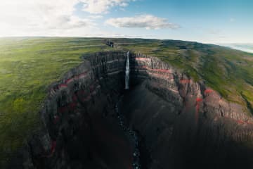
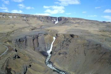
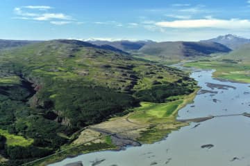
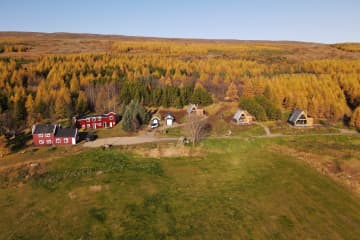
Hengifoss Waterfall is one of the most popular destinations in East Iceland, known for being one of the tallest waterfalls in Iceland at 128 meters high. It is particularly picturesque. A good hiking trail leads you to the waterfall from a service center by the parking lot. Excellent accommodations, restaurants, and activities can be found in the surrounding area.
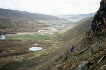
The Hengifoss waterfall plunges from the plateau into a magnificent gorge. The layers between the numerous Tertiary lava strata yield a reddish color, particularly striking in the cliffs around Hengifoss. On the way to Hengifoss, you can also see Litlanesfoss, which features impressive basalt columns on both sides of the gorge.
How to Get There
From Egilsstaðir, the major town of East Iceland located by Highway 1, there are two routes to Hengifoss. You can drive on either the west side or the east side of Lake Lagarfljót. The distance is the same, around 35 km.
West Side: You will find the junction with Highway 1 on the hill by the timber bridge close to Egilsstaðir airport. It is marked as Route 931 with signs pointing to Fljótsdalur and Skriðuklaustur.
East Side: Follow Route 95 first and then Route 931 towards Hallormsstaður, continuing until you reach the end of Lake Lagarfljót. There you should see the waterfall and the parking lot by the main road.
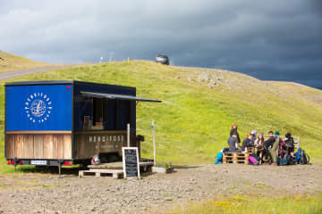
From the parking lot, it takes 40-60 minutes to walk to the waterfall on either side of the river. Start by going through a gate by the service center and climbing up a flight of stairs. Then follow a good gravel trail for the next 2 km, which is moderately steep but not very difficult. About halfway up, around 1.2 km from the parking lot, you will see Litlanesfoss with its beautiful basalt columns. There are trails down into the canyon below the waterfall, but they are steep and covered in loose gravel, so be cautious if you decide to enter the canyon. Keep in mind that getting very close to the canyon edge is risky due to the danger of falling. This is especially important if you are accompanied by children.
There are two bridges for hikers to connect the trails on each side of the river: one at the upper end just before you enter the great gorge, and the other by the parking lot.
By the parking lot is a new service center where you can get information from rangers about the area and the surroundings. We recommend taking your time to visit Hengifoss as there is much more to explore in the area than just the waterfall. You can learn more on this website and use it to help plan your trip.
Hiking in Summer
During the high season (July), Hengifoss can be crowded, mainly with cars at the parking lot. If you can't find a parking space, continue further into the valley and check the visitor's center for Vatnajökull National Park at Skriðuklaustur (5 km away), then return to see if a space has opened up.
The waterfall and the gorge face southeast, so for the best lighting, visit in the morning. In June and July, there is usually plenty of water in the river, making Hengifoss magnificent. However, in August, if the summer is really dry, the falls may not be as broad, but they are still enormously high.
Late May and early June can be risky due to melting snow in the highlands, causing high water levels in creeks and rivers. Expect muddy trails and slippery paths on your way to the waterfall, and the need to wade through some small streams. By autumn, rain can make the trails muddy as well, but you usually won’t have to wade through any streams unless you want to enter the gorge and get close to the base of the great waterfall.
Hiking in Winter
More people are visiting Hengifoss in winter, but caution is necessary. The trails and paths can become icy and very slippery, so stay away from the edge of the canyon and be aware of the dangers. It is not safe to enter the gorge by the big falls in winter due to the risk of falling ice from the cliffs.

