Skip to content

Or try searching by Category and/or Location

Múlaþing - Destinations

Stuðlagil
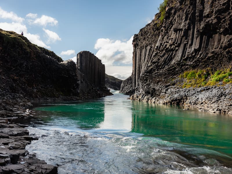
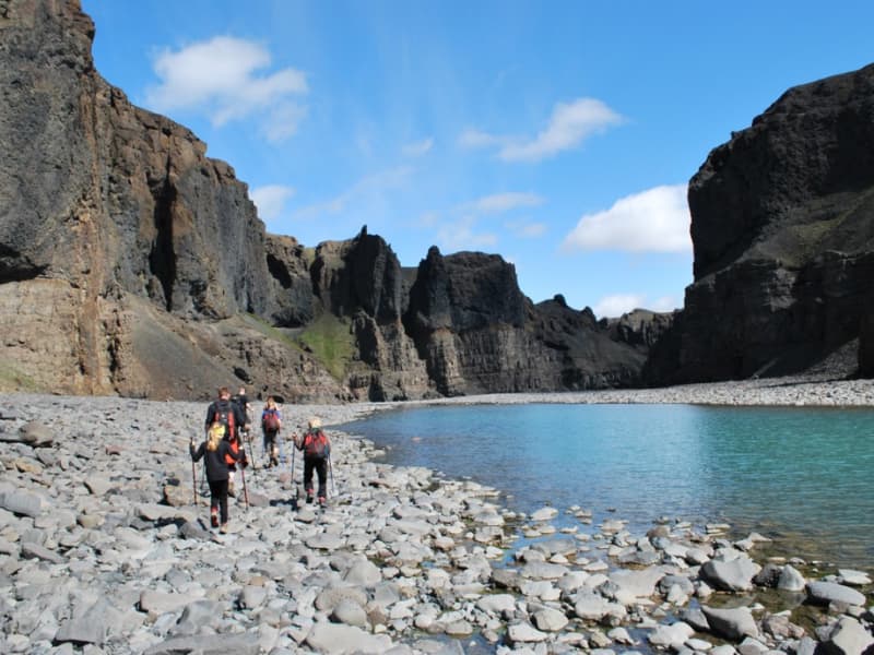
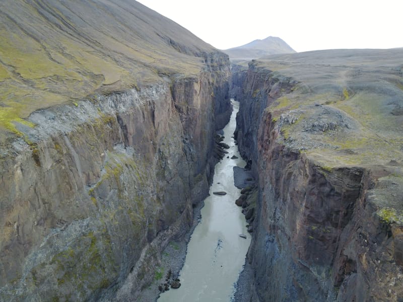
Stuðlagil is a unique basalt canyon located in Efri-Jökuldalur in Fljótsdalshérað, which in recent years has established itself as one of the most exciting destinations in East Iceland. For the longest time, Stuðlagil canyon was mostly hidden by a powerful glacial river called Jökulsá á Dal (referred to as Jökla by locals). It wasn’t properly discovered until after the Káranhjúkar hydro-dam was put in use and the Hálslón reservoir started to fill, making Jökla’s water levels drop and revealing the stunning basalt columns of Stuðlagil canyon. Jökla is one of the longest glacial rivers in Iceland, spanning a total of 150 kms from Vatnajökull glacier to Héraðssandar beach. Entering Jökla, or other glacial rivers, is extremely dangerous and forbidden as they are very powerful, and their currents are not always visible on the surface. Stuðlagil canyon boasts one of the country’s largest and most beautiful basalt formations and is exceptionally graphic, especially when Jökla’s glacial water is clear. The bluish-green colour of the water, which contrasts beautifully with the colourful basalt columns, really is a sight to behold. As is with glacial rivers, its colour and water flow change depending on the season. Come spring and snow start to thaw, and the Hálslón reservoir is overflowing, the river takes on a grey-brown colour. Overflow is most common from the beginning of August until October – but can occur at other times too. You can monitor the water level of the reservoir at any time. Stuðlagil canyon is a fantastic destination no matter the season, and no one should leave Austurland without visiting, even if only for a short time! Stuðlagil canyon is located roughly 52 kilometres (about an hour’s drive) from Egilsstaðir. If you’re visiting from the North, it will take around an hour and a half to drive from lake Mývatn. When leaving Route one (the Ringroad) towards Stuðlagil canyon, you’ll be driving on a gravel road (923). Although gravel, the road is accessible to all cars and is open all year round. Keep in mind if visiting during wintertime that, weather and road conditions can change in a matter of minutes. You can access Stuðlagil canyon via two routes: Stuðlagil observation platform Driving north on Highway 1 from Egilsstaðir, leading you through Jökuldalur, take the exit down route 923, just beyond Skjöldólfsstaðir. From there, it is about a 19 km drive on a gravel road to the farm Grund which stands on the northern side of Stuðlagil canyon. There you’ll find parking, toilets and safe access to an observation platform located at the top of the canyon – only a few minutes by foot from the parking lot. If you wish to enter the canyon, this is not the route for you Note that you cannot get down into the canyon from this side.  Stuðlagil hike Driving north on Highway 1 from Egilsstaðir, leading you through Jökuldalur, take the exit down route 923, just beyond Skjöldólfsstaðir. Turn towards the Klaustursel farm after driving roughly 15 kms. By Klaustursel, you’ll find two parking lots, one by the bridge over Jökla (around 10 km hike to Stuðlagil canyon back and forth) and the other by Stuðlafoss waterfall (about 5 km hike to and from Stuðlagil canyon). Stuðlafoss is a majestic waterfall surrounded by towering basalt columns. It truly is a sight, and you won’t find many like it in the world. Standing at the bottom of Stuðlagil canyon is another unique experience to check off your bucket list. Keep in mind when entering the canyon that the rocks might be wet and very slippery.  The nature surrounding Stuðlagil canyon is stunning but delicate. Visitors are encouraged to show respect for the area, wildlife and nature and leave it as they found it. From May 1st to June 10th, numerous pink-footed geese nest in the area and, therefore, crucial that guests stay within the marked trails so as not to upset the birds. The area surrounding Stuðlagil canyon is agricultural, so it’s common to see farmers bringing their sheep down from the highlands right before winter hits, which can be an enjoyable experience. In summertime, you can continue your drive through route 923 into the East Iceland Highlands (F-roads are generally only open from around mid-June for a few months, see more here). T here you can get on to The Highland Circle travel route, which will lead you to exciting places such as Kárahnjúkar dam, Laugarfell and down into Fljótsdalur. Note that parts of the way are only accessible for well-prepared 4x4 vehicles. For further information, visit the official Stuðlagil website. 
Rainbow Street in Seyðisfjörður
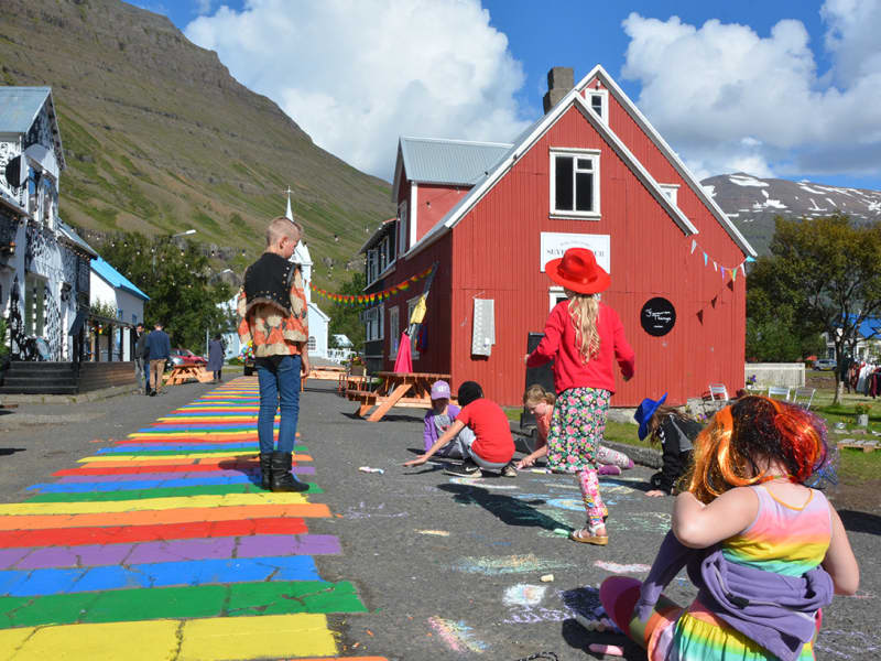
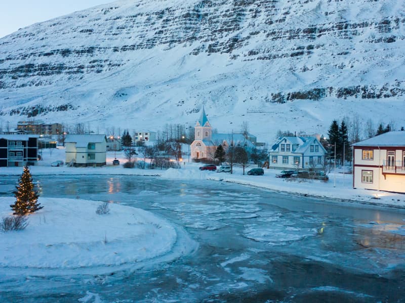
The small town of Seyðisfjörður is famous around Iceland for its colour and creativity. One of its best-known features is the Rainbow Street (referred to as Regnbogagatan in Icelandic) in the heart of town, which can best be described as a beautiful community project. On a sunny day in the summer of 2016 the town's residents got the idea to paint Norðurgata, a cute street in need of some love and restoration. That same night, people in town as well as the town’s employees got together and painted the colours of the rainbow onto the street – unknowingly creating one of the most popular visual landmarks in East Iceland. Year round, guests from all over the world come to visit the Rainbow Street in Seyðisfjörður to snap a "selfie" of themselves on this colourful street, surrounded with old historic houses which the town is also known for. At the end of the street stands the town’s picturesque church, usually referred to as “Bláa kirkjan” or the Blue Church. Ever since then the residents get together regularly each summer to repaint the street, and everyone is welcome to take part.  The Rainbow Street is located right in the town’s center and close by are some great restaurants, the local handcraft market and Blóðberg, a design boutique, all worth checking out. One of Iceland’s best sushi restaurants, Norð-Austur on the second floor of Hotel Aldan, serves sushi from the freshest ingredients available. Café Lára is the perfect stop for some soul food, juicy burgers, and local fish.  Every summer, the Blue Church Summer Concert series takes place and has become one of the major cultural events in East Iceland. It offers a varied program of music where some of the country’s most interesting musicians perform.  Seyðisfjörður is one of the highlights on our Fjord to Fjord travel route. If you are currently travelling around East Iceland or planning your next trip, we highly recommend taking checking out our travel routes for inspiration.
Hafnarhólmi
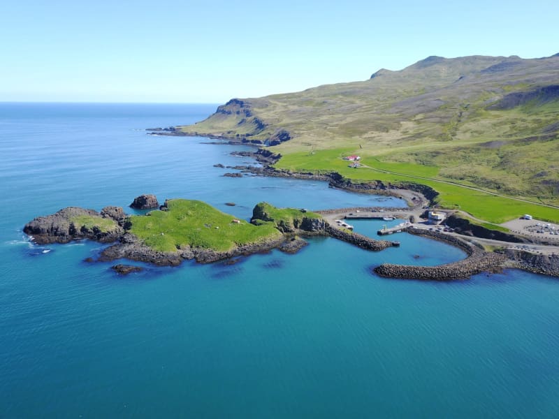
Hafnarhólmi islet at the harbour in Borgarfjörður Eystri is perfect for birdwatching. Hafnarhólmi is easily the most accessible Atlantic Puffin colony in Iceland where they nest every year from middle of April to beginning of August. Kittiwakes, Fulmar and Common Eider also nest in Hafnarhólmi along with many other bird species. Locals have taken care of Hafnarhólmi and its birds for decades and built it up to be easily accessible for visitors to enjoy the area in harmony with the wildlife there. At the newly built Hafnarhús - Harbour House you can enjoy art exhibitions and excellent view over the harbour and Hafnarhólmi while tasting some Icelandic delicacies. 
Stórurð
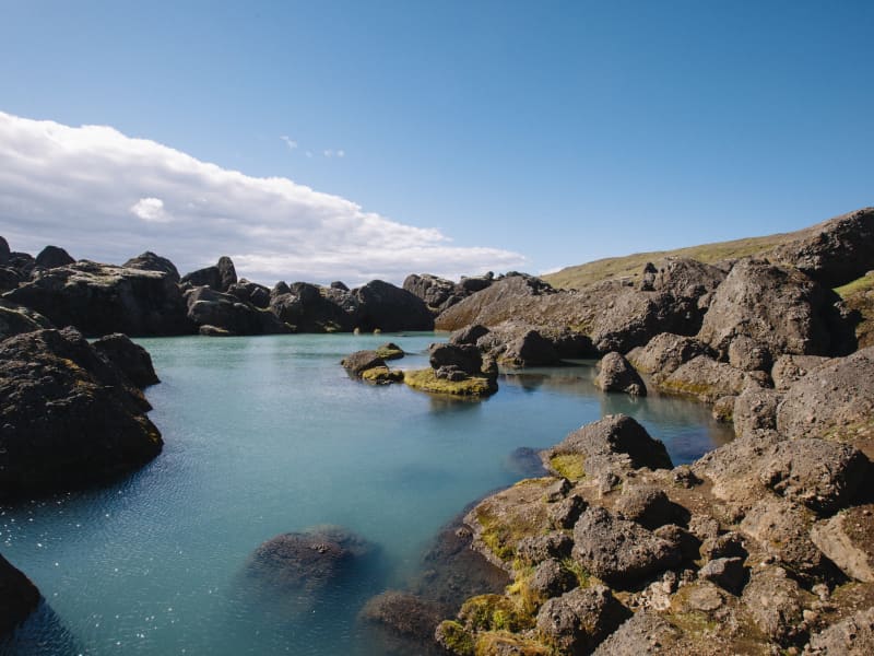
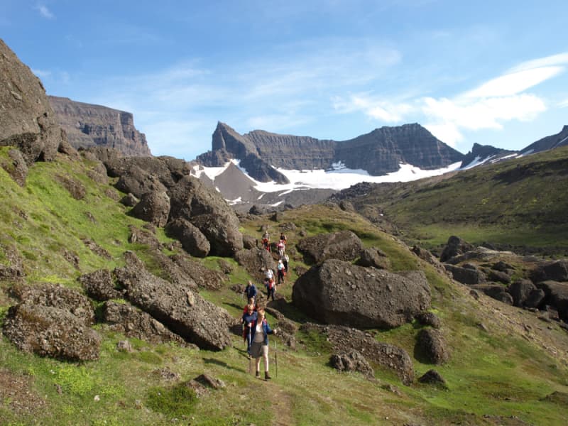
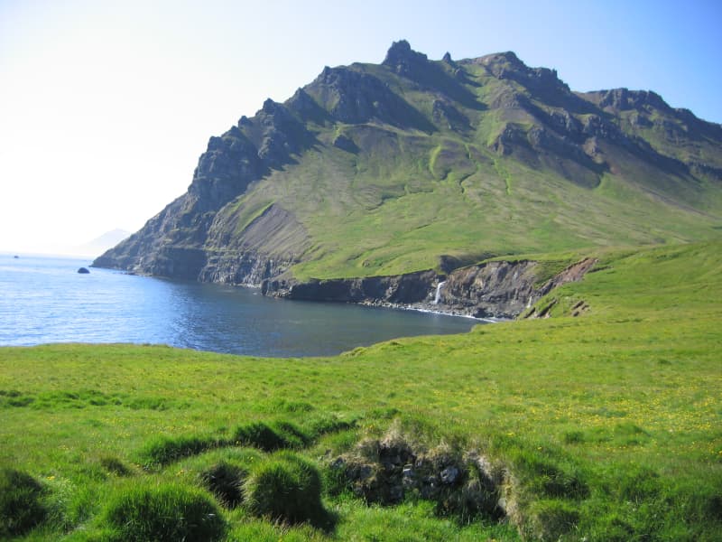
Stórurð boulders is one of Icelands most spectacular sights and has gained more popularity amongst hikers in recent years. The expansive surroundings offer plenty to see and experience; blue-green ponds contrast with flat, vegetated meadows surrounded by sheer-sloped and jagged tuff Dyrfjöll mountain peaks. As the name suggests, the area is strewn with many enormous boulders, likely abandoned by retreating glaciers. Five marked trails lead to and from Stórurð. Two from Vatnsskarð pass, one from Njarðvík and two from Borgarfjörður Eystri. Since Stórurð is located over 400 m above sea level, snow often lingers far into summer so best time for exploring this magnificent area is from mid-July to first appreciable snows of autumn. The hike back and forth takes about 4-5 hours so consider this a day tour.  
Hafrahvammagljufur
Hafrahvammagljúfur in Austurland is one of the largest and most magnificent gorges in Iceland. The gorge is about 200 meters from the bottom to the edge (where it is highest), and the canyon is about 8 kilometers long. There is a marked hiking trail along the gorge and down to Magnahellir. You need a four-wheel-drive car to drive to the trail's starting point, but you can see part of the gorge from Kárahjúkar dam, and you can get there by an average car. 
Stapavík by Héraðsflói
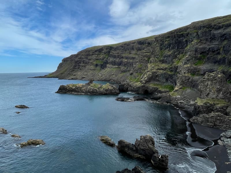
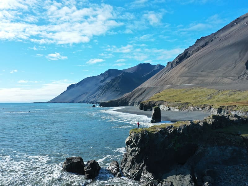
Stapavík is an inlet that lies in a magnificent setting of steep cliffs and the open sea. From 1930-1945 Stapavík was a used as an unloading port for ships and is closely related to the commercial history of Borgarfjörður Eystri and Hérað. Remains of the facilities are very picturesque and the view from the inlet is beautiful on a sunny day.  A marked trail leads from the farmstead Unaós, following Selfljót river downstream to the rivermouth. Héraðssandur black sand beach opens to the North of the river with a view over Hellisheiði Eystri rhyolite mountain ridge. This is a about a two hour long (back and forth) family friendly hike. Travellers could also challenge themselves to a longer hike by crossing Gönguskarð mountain pass over to Njarðvík which adds a about two hours to the hike. Powered by Wikiloc
Stapi in Stapavík
In Stapavík, south of Djúpivogur an close to Höfn, there is a majestic cliff rising about 20 meters out of the sea. It is landlocked and is a little way from the mainland cliff. Popular with locals and tourists alike, the cliff the beach south of Álftafjörður are considered unique natural gems and therefore essential stops when visiting the area.
Teigarhorn
Teigarhorn, close to Djúpivogur, is known for remarkable geological formations and interesting history of industry and culture. Teigarhorn is a nature reserve, and part of it is a natural monument. There is year-round ranger at Teigarhorn, and development work in the area is being done in harmony with nature. Teigarhorn is one of the most significant mining sites of zeolites in the world. Among the types of zeolite stones found at Teigarhorn are schoolite, stilbite, epistilbite, mordenite, laumontite and heulandite. There are also other minerals, such as seladonite, opal, chalcedony, rock crystal, calcite and Iceland spar. Zeolites from Teigarhorn have been used in various geological studies for more than 200 years. These include descriptions of crystal forms, chemical composition, internal structure of crystals and optics, some of which are among the first descriptions of the rocks in question. Samples from Teigarhorn were sold to museums around the world in the second half of the 18th century, but since 1976 the main mining places have been protected as natural monuments. Weywadthús, at Teigarhorn, was built by Níels P.E. Weywadt in the years 1880-1882. He was a store manager in the Örum and Wulff store in Djúpivogur. Weywadthús has been part of the National Museum of Iceland since 1992. Níels' daughter, Nicoline Weywadt, was the first Icelandic woman to study photography and operated a photography studio in Teigarhorn. Nicoline is also believed to have owned the first sewing machine in East Iceland.
Tvísöngur Sound Sculpure
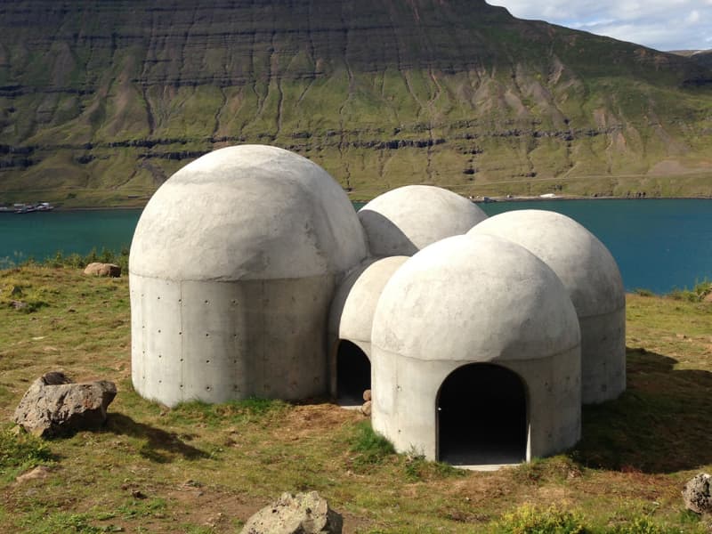
Tvísöngur sculpture, by artist Lukas Kühne, mixes concrete, nature, and sound to create an interactive tribute to Iceland’s unique tradition of five-tone harmony.  The installation piece looks like a grouping of interconnected cement bubbles from afar. Up close the five segments are quite large, ranging from roughly 6 to 12 feet tall and can be entered via rounded arches built into the walls. Once inside the stark industrial domes, visitors will find that they have each been designed to resonate at different harmonies as the wind blowing in off the cliff rushes through the openings. The collective effect is almost as though the wind itself is playing a giant instrument. The five chambers of the piece are meant to recall the Icelandic musical tradition of quintal harmony, with each dome reflecting a tone in the tradition. Juxtaposed with the serene and stark surroundings, it seems as though Iceland itself is creating the music. Tvísöngur is a permanent work and is meant to keep the country’s musical traditions alive, which is not an easy thing to do simply with concrete.
Eggin í Gleðivík - The Eggs in Merry bay
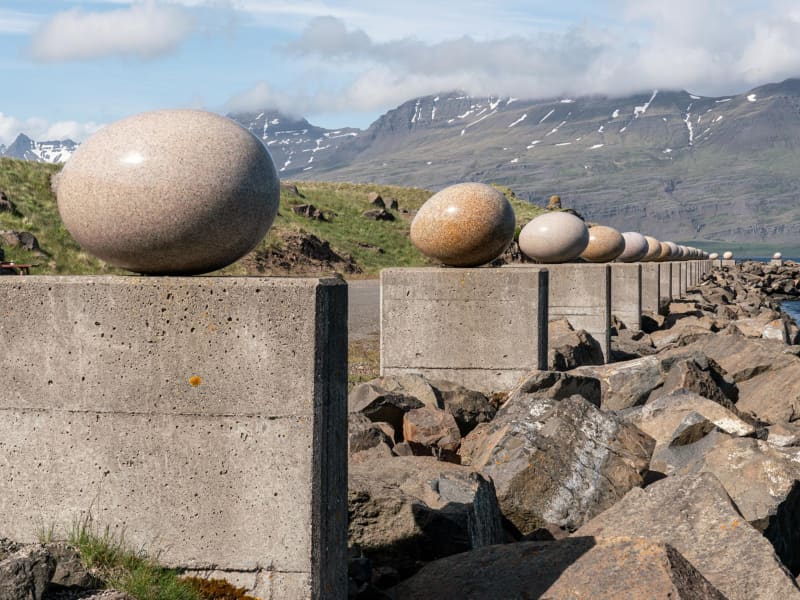
Eggin í Gleðivík (the eggs in Merry Bay) is an outdoor artwork by artist Sigurður Guðmundsson (b. 1942). The artwork has 34 replicas of eggs of nesting birds that nest in the vicinity of Djúpivogur and reflects the strong connection that Djúpivogur has with nature. The work is especially for the site. The eggs stand on concrete pillars that previously supported a landing pipe between the pier and the smelter. Eggin í Gleðivík are a popular tourist attraction and has become one of Djúpivogur´s landmarks.
Álftafjörður
Álftafjörður is a lagoon that Starmýrarfjörður, which is no wider than a large surf crosses them, separates the lagoon from the sea. The fjord is quite large, but relatively shallow and large areas of it dry up when the tides are low. There are several islands in Álftafjörður, Brimilsnes being the largest. To the south of the fjord rises Krossanesfjall, just over 700 m high straight up from the sea, but to the north are Mælifell and Sellönd. When this is released, we receive four valleys that rise from Álftafjörður, to the west. Their southernmost is Starmýrardalur. The mouth of the valley is narrow, but when it enters it opens slightly but high mountains, Flötufjöll and Miðfell to the south and Selfjall to the north, rise rapidly. Selá lies around the valley and has its source at the top of Starmýrardalur. At the mouth of the valley, the river flows through Sjónarhraun and from there in a bend to the northwest over Stekkjartún where it joins Starmýrará, which originates in Hæðir. From there, Selá falls into Krossavík south of Álftafjörður. North of Selfjall lies Flugustaðadalur, about 14 km. long. Like Starmýrardalur, it is narrow and the lowlands are small. To the east of the valley, the Suðurá / Flugustaðaá river, which originates in Bláskriðir at the bottom of the valley, falls under Tungutindar and Flugustaðatindir. Under Tungutindur by Tungusporð, the river Hofsá merges, which comes down from Hofsvötn east of Hofsjökull and together they flow east through Hofshólmur to the west of Álftafjörður. The mouth of Flugustaðadalur is to the south of the rivers and the mouth of Hofsdalur to the north, the division remains so until Tungutindur takes over and separates the valleys, so that Flugustaðadalur stretches further west and Hofsdalur bends to the northwest. Both valleys are fairly well-vegetated and there is considerable birch scrub. When you reach the valley, you face Jökulsgilsgrindur, Grísatungur and Hofsjökull (1280 m). At the northern side of Hofsdalur, steep mountain slopes take over and Selfjall (950 m) is the highest peak and beyond the mountain range is Geithelladalur, about 18 km long. High mountains are bends due to the valley all the way west of Þrándarjökull (1248 m) on the south side, but when you reach the bottom of the valley, land rises rapidly and the plateau northeast of Vatnajökull, so-called Hraun, is exposed. The valley is grassy and there is a lot of forest there. The Geithellaá river flows through the valley, which is a considerable waterfall and has its main source in large water into lava. It falls through Geithelladalur in waterfalls and gorges until it reaches the lowlands. From there it flows through gravel ears and falls into branches to the west of Álftafjörður. It is recommended to take a good time travelling through Álftafjörður and Hamarsfjörður to enjoy the natural beauty the area has to offer.
Blábjörg in Berufjörður
By the sea, on the north side of Berufjordur there is an interesting natural phenomenon. A short distance east of the farm Fagrihvammur, a peculiar cliff hammer rises and it is unlike any other rock in the area, both in colour and texture. The rock hammer is called Blábjörg (Blue Cliffs), and it's got a blue tinge. This rock is made of ignimbrite, approximately 9 million years old. The rock hammer is a testament to a spectacular event in Iceland's geological history; iignimbrite is formed by a spike in heavy explosive eruptions. When the eruption becomes heavier than the atmosphere, it collapses, so there will be a spike in volcanic eruptions, as the fiery spike whips at an alarming rate down the slopes of volcanoes. Is the speed such that there is no man's chance to get away from such a thing.
Búlandstindur
Búlandstindur is a 1069-meter-high basalt mountain in Djúpivogur district and is believed to be about 8 million years old. Búlandstindur is generally considered to be one of the most beautiful mountains in Iceland. At a height of about 700 m east of Búlandstindur runs a mountain ridge, Goðaborg, and it is said that people went up there with their deities immediately after the conversion to Christianity in order to throw them out of the mountain cliff. Other sources say that Goðaborg is a cliff high up in Búlandstindur, said to be wide and flat. It is steep and hard to get up there. Some say that there is water nearby, that was used to wash the bowels of animals that were sacrificed to the gods. Many people make their way to the summit every year. It is best to follow a road that runs along Búlandsá to the south and all the way to a dam that is in the heart of the valley. From there you walk straight up the grassy green slopes and landslides inside Stóruskriðugil in the direction of a pass inside Búlandstindur. After that, the route runs itself until the top peak is reached. You can view an aerial photo of a marked path up to the summit on Teigarhorn's website. The peak is a narrow and steep cliff and there is a great view. It is very important to be careful not to walk too far to the east if something is visually or if it is slippery, because the eastern slope of the mountain is steep and rocky. There is a good mobile connection on the summit.
Djáknadys
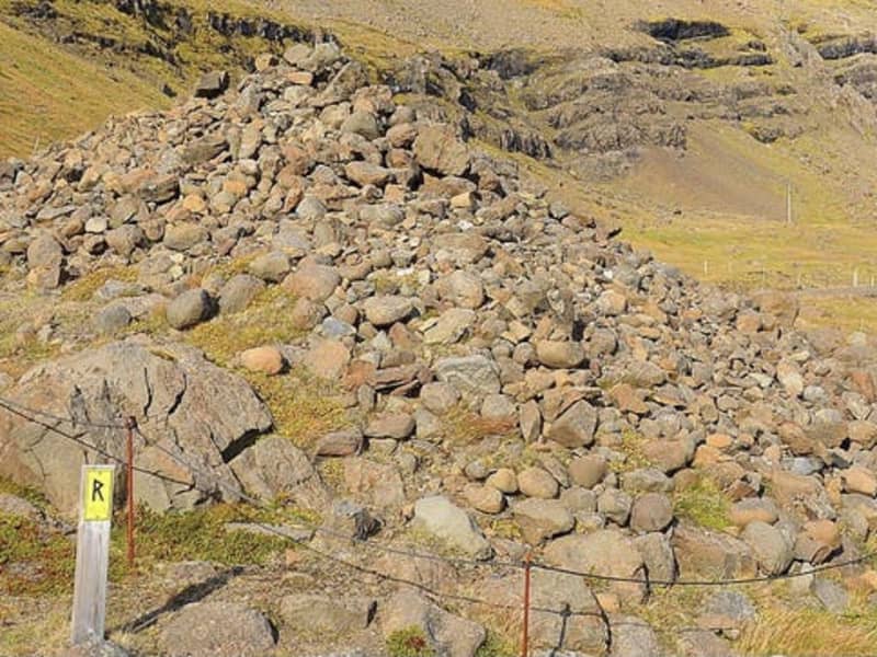
According to legend the mound marks the spot where the pastor of Háls and the deacon of Hamar fought to the death. Both were buried at the site, and that is the origin of the name Djáknadys (Deacon’s Burial Mound). Tradition requires every traveller, on first passing by Djáknadys, must throw a pebble or stone onto the mound: one for him/herself, and one for every horse or dog accompanying them. If they fail to do so they will lose their way. Another version of the tradition is that travellers must place three stones on the mound. An old verse on the subject says: To quickly dismount and fling a stone over the aged deacon brings good fortune along the road. Please treat this protected heritage site with respect and care. Do not remove stones from the mound and do not dispose of refuse under stones. 
Hamarsfjörður
Hamarsfjörður, a sea reservoir that lies between Berufjörður and Álftafjörður, is a particularly beautiful area with many reasons for outdoor activities. Melrakkanes separates Álftafjörður and Hamarfjörður and out of that is Melrakkanesós which is a narrow channel between Stapaey in Starmýrarfjörður and Þvottáreyjar which are in the mouth of Hamarsfjörður, but the fjords fall into the sea through the estuary. Another narrow channel, Holusund, is on the east side of Þvottáreyjar and lies next to Búlandsnes. On the north side of Hamarfjörður is Hálsfjall, but up from the fjord to the west is Hamarsdalur and its top draft is at the foot of Þrándarjökull. Grassy places can be found in the valley. Hamarsá falls through the valley, which has its main source up on Hraun and Hamarsdalsdrögur. Glacial water from Þrándarjökull mixes with it and it can often be very watery. The river flows from many cliffs on its way down the valley and forms beautiful waterfalls. When you reach the bottom of the valley, the river flows through your ears, until it flows into the sea at the bottom of Hamarsfjörður. Off Hamarsfjörður and Búlandsnes on Papagrunn is the largest island in the Eastfjords, Papey, about 2 square kilometers in size. In Búlandsnes, south of Berufjörður, is the town of Djúpivogur. It is recommended to take a good time travelling through Hamarsfjörður and Álftafjörður to enjoy the natural beauty the area has to offer.
Hálsaskógur
Hálsaskógur is in Búlandsnes, a short distance west of Djúpivogur. The forest area is very nice and there are signs providing information about the forest, such as the tree species, as well as tables and benches. There are footpaths going through the planted forest which makes it particularly suitable for those who prefer light walks.
Black Sand Beach in Djúpivogur
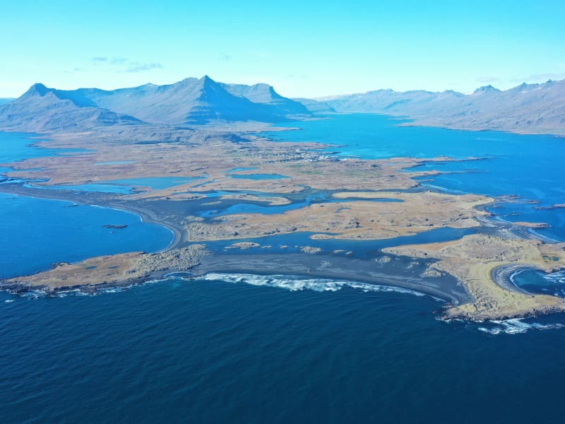
The area on Búlandsnes, just outside Djúpivogur, is ideal for hiking, experiencing beauty and adventure, playing, learning, and enjoying a break from the hustle and bustle of everyday life in the spirit of the slow movement, Cittaslow. It features exceptionally beautiful and diverse landscapes, with the colours of black sand, vegetated islets, and mirror-like ponds, rich birdlife, and abundant history. There is also a very scenic view of the mountains and the sea.    You can start the hike by walking east from Djúpivogur, stopping at Bóndavarða (Farmers’ Cairn). From there, you have a fantastic view in all directions, with a viewing disc showing the main place names. Inland, there are many prominent peaks and mountains, with Búlandstindur being one of the most beautiful and famous—a tall and steep pyramid on thesouthern side of Berufjörður. Towards the sea, you see islands and skerries like pearls on a string, with Papey being the largest and most well-known. The surroundings of Djúpivogur are marked by distinctive ridges or high, thin rock formations, standing parallel and giving an enchanting look to the area. These are dikes, ancient solidified lava that filled cracks during volcanic eruptions millions of years ago. Because the rock in these dikes is hard, the Ice Age glacier couldn't level these ridges to the ground.   From Bóndavarða, you can continue northeast along Langatangi cape or head directly east down to the shore and then south to Grunnasund and across it to the sand. Grunnasund may need to be waded or you can take a detour along its end. You can also walk straight out to the sand southward on the road that leads to the airstrip, a route also suitable for driving. The environment on Búlandsnes has changed significantly from earlier times when the islets on the sand were real islands with boat-accessible channels between them.     South of Grunnasund, the route continues into Úlfsey. In the past, when there was a channel between it and the mainland, boats rowed through it. Gradually, the channel shallowed, and sources say it was full of sand over 100 years ago, sometime after 1880. On Úlfsey, there is said to be an ancient burial mound, probably named after a person named Úlfur. "No man shall set foot on land there without singing a verse by the mound, making a prayer, or placing a stone on the mound," according to the folk tales of Jón Árnason. The mound believed to be Úlfshaugur is a half-grown pile of stones in the northeast of Úlfsey.   From Úlfsey, you can walk southeast to Hvaley where you can see, in the southernmost cliffs, a cave, considered a natural formation but filled with sand. It was partially excavated a few years ago but has since filled with sand again. It is believed that people who used the island for egg collecting or as a sheepfold, stayed in the cave.   Continue the hike with a stop at Kálki, where there are ruins of houses, and then out to Sandey. It is possible to scramble down to the shore in Sandey if the tide is low and explore a cave there. To close the loop, you can walk along the airfield to the ponds Fýluvogur and Breiðavogur, but first, you might take a detour west across the sand to Hrísey and Kiðhólmi. According to sources, there were settlements in Hrísey in earlier times, and ruins are visible there. According to records, there was a trading harbor in Fýluvogur, then a navigable cove in the 1500s. German merchants from Bremen traded at Fýluvogur, while Hamburg merchants traded at Djúpivogur. With the establishment of the Danish trade monopoly in 1602, German trade ceased.    At Fýluvogur, there are now birdwatching houses to make it easier for people to observe the diverse and bustling birdlife there. Wetlands, ponds, and shores are ideal for birdwatching, especially in spring when migratory birds arrive and during the breeding season, but there is also a passage of migratory birds through the area in autumn. There are many waders and very diverse duck breeding, such as the gadwall and shoveler. The great crested grebe has also nested by the ponds. Besides the many breeding birds, many waders and ducks pass through the area in spring and autumn, including interesting vagrant birds. In addition to the wetland birds, which are prominent on Búlandsnes, you can see seabirds along the coast, moorland birds on the hills and heaths, and if you go up into Hálsaskógur, a forested area near Djúpivogur, you might encounter the goldcrest, the smallest bird in Europe, and other woodland birds. Hálsar is also an ideal area for hiking and nature observation, featuring diverse and unusual landscapes with distinctive dikes.   
Þvottaá
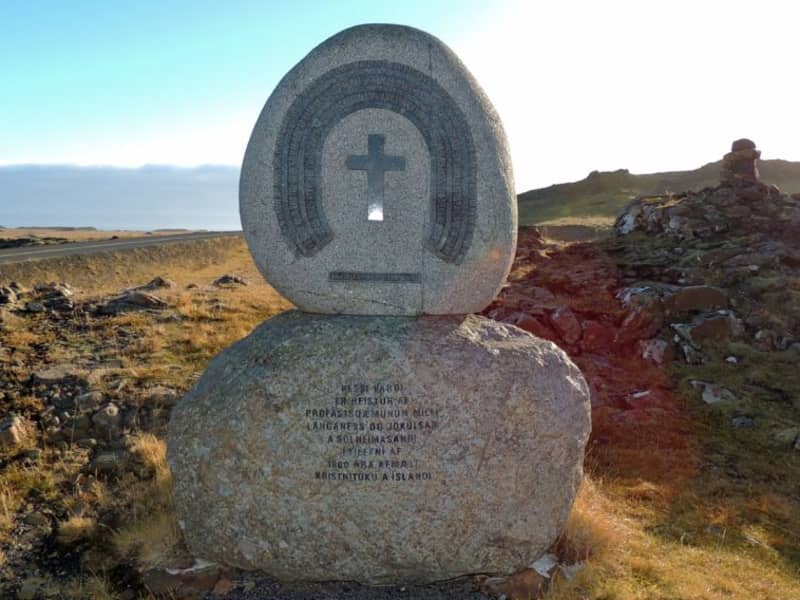
The farm Þvottá is the southernmost farm in Álftafjörður. Around the year 1000 the renowned Saga personality Hallur Þorsteinsson, or Síðu-Hallur, lived there. He received the priest and missionary Þangbrandur, who spent the winter with him. Síðu-Hallur and his whole household were baptized in the river by the farm and since then it was named River Þvottá (The Wash River). The farm gets its freshwater supplies from the so-called Þangbrandur Well, where the missionary probably held services at St. Michael’s Mass with the people of Þvottá attending the day before they were baptized. A ruin by the well was declared inviolate. Þvottá was a church site until 1754 and a parsonage for a long time. The old cemetery is still visible. Mt Mælifell (487m) is closer to the sea and north of it are Sellönd (Summer Pastures). The whole area is rather colourful because of the rhyolite intrusions and quite a few basaltic dykes decorate the landscape. These formations were created by the ancient and extinct central volcano, which has now mostly disappeared under the Álftafjörður Bay. Traces of several minerals were discovered in the area, gold, platinum etc. By Þvottaá, there is a monument to the adoption of Christianity and the area is vell suited for outdoor activities. 
Æðarsteinsviti Lighthouse
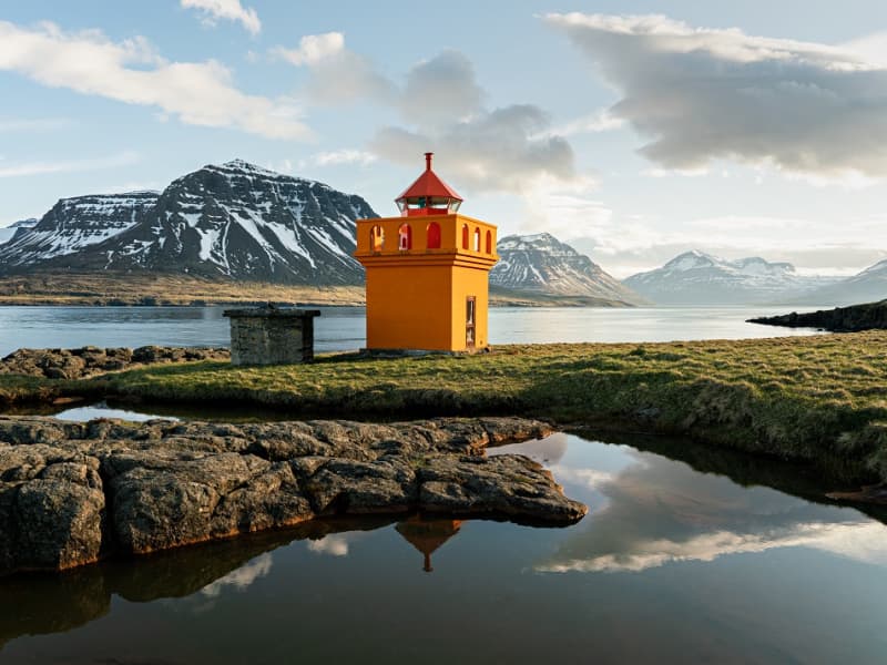
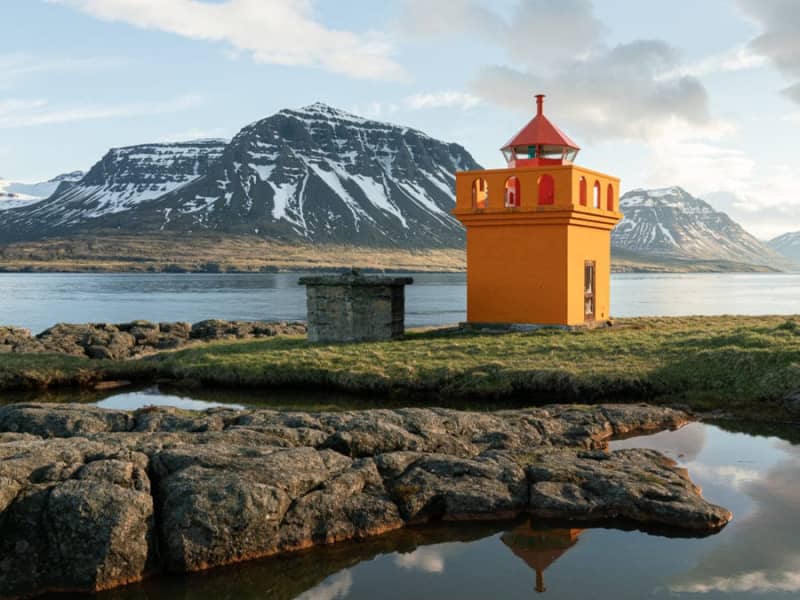
Æðarsteinn lighthouse - a pretty structure, a little way inland from the Gleðivík Eggs. Walking distance from the Tankur. It´s a nice place worth visiting during the walk.
Bóndavarðan - The farmers cairn
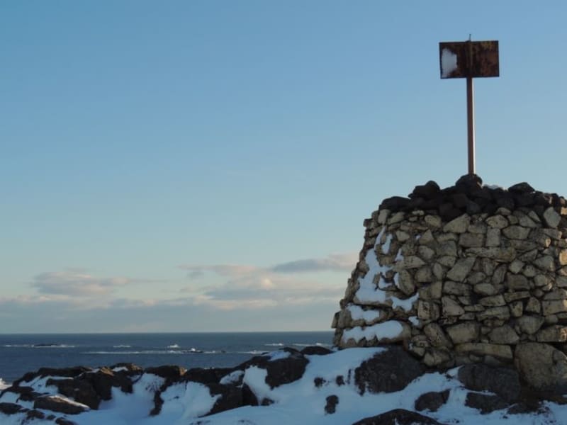
Bóndavarðan - The farmers ´cairn stands high on the ridge just seawards of the village. The view from Bóndavarðan cairn is great! it may have been first erected by farmers keeping watch towards the sea after a severe raid by North African pirates in 1627. There is a view indicator up the cairn.
Tankurinn
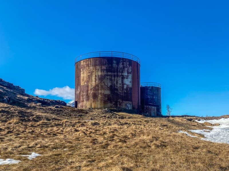
Tankurinn is an old fish oil tank reformed into an exhibition space for art and music. It is always open, and whether there is an installation there when you visit, you should at least go inside and enjoy the marvelous reverb. 
Sveinsstekksfoss
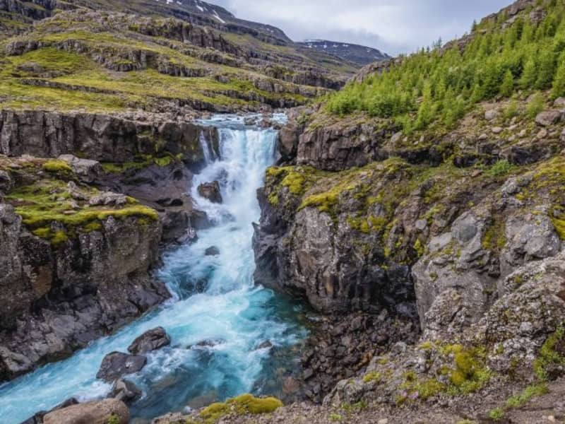
Sveinsstekksfoss, Fossárfoss eða Nykurhylsfoss Sveinsstekksfoss waterfall, also known as Fossárfoss waterfall, is a 50-foot waterfall on the Fossá River, the last fall before it empties into the Atlantic Ocean. It is located on Route 1, Northwest of Djúpivogur. You can climb above the waterfall to see more of the Fossá River cascades. Nykurhylsfoss waterfall is the lowermost waterfall in the Fossá River. The river plunges 15 m into a narrow gully, churning, and racing in pools and rapids until it reaches the 9 m deep Nykurhylur pool. The river Fossá has numerous waterfalls in its course. There used to be a magical water horse living in the lowest pool, just under the bottommost waterfall. All attempts to drive the water horse away remained unsuccessful, but it finally disappeared when baptismal water was poured into the river after the baptism of a child up the valley.
Bjólfur and the Snow Avalanche Barriers.
A trail leading to the uppermost mountain slopes (>600 m.) offers a breathtaking view of Seyðisfjörður and the Snow Avalanche Barriers. This 5 km. trail is an F-road and presents a rare opportunity for high-altitude sights for those generally averse to mountain climbing. Furthermore, the spot is ideal for paragliders. The ascent takes about 15-20 minutes from the Fjarðarheiði heath road up to the Snow Avalanche barriers. The trail is open from June - September.
Brimnes
Brimnes is an abandoned farm located on the northern side of Seyðisfjörður. It stands beneath Brimnesfjall, which acts as a protective barrier against the north wind. The highest point above the Brimnes farm is Ytra Rjúpnafell, which reaches 771 meters. The upper part of the mountain is characterized by steep and high cliffs, while the lower slopes are green, covered with shrubs and heather. Further out on the peninsula, the land is steep with difficult scree valleys.The coastal vegetation gives the land a distinct appearance. A hike to Brimnes in good weather is unforgettable. The nature is magnificent, and the view to the sea and over the fjord is beautiful. It is also an ideal place to reflect on the history of settlement in this remote location. The best starting point for the hike is Selstaðir, accessible by road No. 951 from Seyðisfjörður. A road was cleared to Brimnes before it was abandoned, but it is no longer driven. The sea route was the main supply route for the residents for most of the time.   Brimnes was a large farm in earlier times. The land was considered excellent for farming, and fishing was practiced. Several small farms were also in the vicinity of Brimnes, including Brimberg near the current lighthouse and Borgarhóll about one kilometer inland from Brimnes. The farm was inhabited until 1961 when the residential house burned down. Significant fishing was conducted in the late 19th century and early 20th century, forming a small community (Brimnessettlement). The Brimnes farm itself was located above Brimnestangi, and just outside it, above Útvogur, an icehouse was built in 1894, one of the first two icehouses in the country. The Brimnes lighthouse was built in 1906 and stands a short distance from the Brimnes farm. The residents of Brimnes engaged in fishing, and numerous visiting boats also fished there in the summer, providing the farmers with income from services. Several buildings related to fishing were constructed during these years, but most were only used in the summer. At the end of the 19th century, up to 40 rowboats operated from the Brimnes settlement in the summer, many from the Faroe Islands. This fishing activity ceased when motorboats became common, as proximity to fishing grounds was no longer as crucial. Remnants of old buildings can still be seen in the area. Near the farm is the place name Klausturskemmutangi, indicating that Brimneswas once owned by Skriðuklaustur monastery in Fljótsdalur.   Brimnes is not only beautiful, peaceful, and prosperous but also a place where nature and the struggle for survival could be harsh. In 1732, an avalanche struck Brimnes farm, killing nine people, while another nine survived. Some sources mention that nine days later, a four-year-old girl was found alive in the ruins. This winter was likely heavy with snow and was subsequently called Brimnes winter. In 1740, a boat carrying, among others, a county governor, was wrecked on a skerry later named Sýslumannsnaggur, located about one km outside Brimnes lighthouse at Sléttanesvogur. Then, on the morning of May 1, 1922, in calm and foggy conditions, the coastal ship Sterling ran aground on the same skerry. All on board, about 50 passengers and 30 crew members, were rescued. They reached land in lifeboats, and the ship's steward served refreshments on a place called Ostabalar nearby. The passengers were allowed to retrieve their belongings from the ship before the Danish coast guard transported them to the harbour at Seyðisfjörður. Goods and various ship items were salvaged from the ship, which was destroyed at the stranding site. There are well-documented records of this stranding, including a list of passengers and crew and an inventory of items salvaged from the ship and sold at auction. This event drew considerable attention since maritime transport was vital for the settlements at that time, with coastal ships transporting people, mail, and goods around the country. Sterling was among the first ships owned by the Icelandic state and was the only coastal ship at that time.   
Brimnesviti
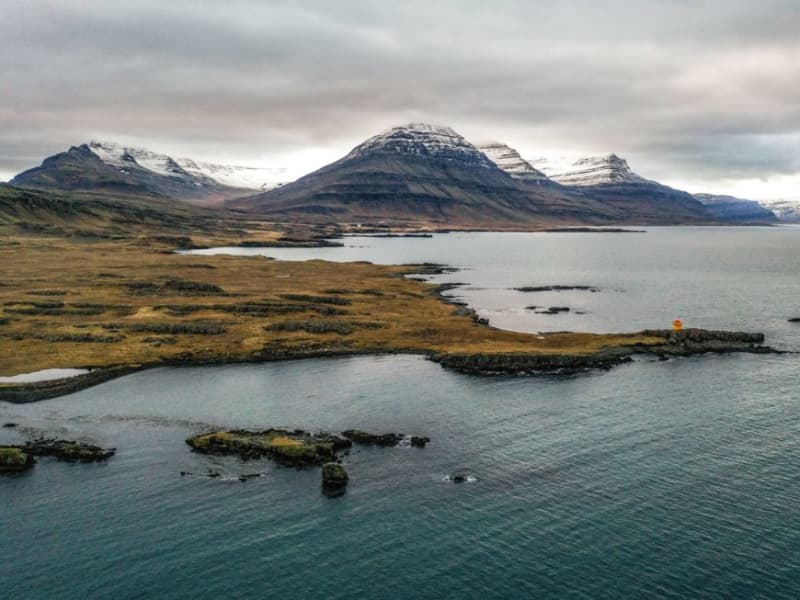
Brimnesviti lighthouse is loated on Brimnes peninsula, which is situated on the north side of Seyðisfjörður´s coastline. A 10 km. drive from the town centre brings guests to Selsstaðir farm. A hiking trail leads from the farm to Brimnes. For centuries, this was one of the bigges fishing centres in Iceland. Traces of old buildings are still visible. 
Dvergasteinn
Dvergasteinn (Dwarfs´rock) is situated on the northern shore of Seyðisfjörður, abour 3 km. outside the town. The stone is easily accessible and it is a prominent figure on the shore. According to legend, the rock originated on the other side of the fjord but moved across the sea on its own accord as the local church was movoed from one side of the fjord to the other.  . The legend states that the rock is a site of prayers for the local dwarfs and the idea of staying behind when the Christian church was moved to the other side was simply unacceptable to them.
Fjarðarsel Power Plant Museum
A turning point in the history of Icelandic electrification. Fjarðaselsvirkjun in Seyðisfjörður is Iceland´s oldest operational power plant, started on October 18th, 1913. The plant marked a turning point in the history of Icelandic electrification. It was the first power plant that generated alternating current It was the power station of the first municipal electric utility The first high voltage cable in Iceland was laid from this station On the occasion of t he 90th anniversary of the power plant the Iceland State Electricity (RARIK) devided to open the plant to Icelandic and foreign visitors. For this purpose, a historical exhibition was staged in the station house. The first water turbine is still there with its accompanying equipment. For a visit please contact Fjarðasel Museum or the Information Centre. Contact info: Tel: +354 472 1122 / +354 472 1551  Email: info@sfk.is www.fjardasel.is
Gufufoss
Gufufoss waterfall is a beautiful waterfall in Seyðisfjörður. The name is due to the steam emitted by the waterfall and envelops it in a certain mystery. The road over Fjarðaheiði lies next to the waterfall, and the access to it is very good.
Seyðisfjarðarkirkja
The Church in Seyðisfjörður is one of the most recognisable landmarks in Iceland. With its distinct colour and buildingstyle it has become a popular spot for tourists, especially since the street leading up to it was painted in the colours of the rainbow. The church used to stand at Dvergasteinn farm and in 1882 it was moved to Vestdalseyri. At first the church stood on a hill overlooking Vestdalseyri but in 1894 it was blown over and damaged by a huge storm. The church was rebuilt, this time down on the peninsula and stood there until 1920 when the decision was made to move to its present location in the heart of Seyðisfjörður. In 1989 the the Blue Church was damaged by fire when renovation work was being carried out on the building and a pipe organ that was installed in 1987 was ruined by the flames. Today the Blue Church has a pipe organ of the same type as the one that was lost to the fire. The Church is open for visitors in the summer.
Skálanes
Skálanes nature and heritage centre is situated in a beautifully restored Icelandic farmhouse set in its own nature reserve at the mouth of Seyðisfjörður East- Iceland. Dramatic snow-capped mountains, vast sea cliffs, secluded shoreline and coves, and a vibrant bird colony make Skálanes a place for relaxation, research, contemplation, and a different pace of life.     
Vestdalur
A walk to Vestdalur Nature Reserve, Vestdalur lake and the Mountain Lady cave. The route was used to transport mail and trade in the old days between Seyðisfjörður and other towns in East Iceland. In 1880 – 1910 this was one of East Iceland’s most frequently used trails and still presents several pretty, piled-rock constructions, including cairns. After several tiers of glorious waterfalls, you will arrive at a small lake, Vestdalsvatn, which remains frozen most of the year. There you will see Mt Bjólfur to your left. To the right you’ll find the tiny cave where the remains of the Mountain Lady were found in 2004. Around the Mountain Lady cave a group of workers found bones of a 30 year old lady, more than 400 pearls and brooches from the Viking era which have been identified as remains from the year 940.
Álfaborg
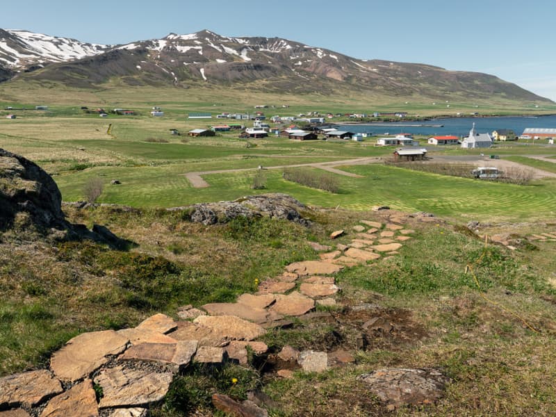
On arrival to Borgarfjörður Eystri, you will se a distinctive landmark in the middle of the village; Álfaborg, or The city of Elves, where the Queen of Elves lives, legend tells. Numerous tales tell of relations between elves and locals, such as young women marrying elvish men and living in Álfaborg. Álfaborg was declared a nature reserve in 1976, which makes the area protected for recreational and public use. On top of Álfaborg is an observation platform with excellent view over the fjord and surrounding mountains. The trail up Álfaborg is an easy walk and suitable for all. Below Álfaborg is the local camping ground and a fresbee golf course.
Bakkagerðiskirkja
Placed on the outskirts of the village of Borgarfjörður Eystri, close to the famed Álfaborg - The City of Elves, stands the church Bakkagerðiskirkja, consecrated in 1901. The church boasts of a beautiful altarpiece, painted in 1914 by the famous local artist Jóhannes S. Kjarval who was brought up in Borgarfjörður Eystri. The altarpiece depicts Christ giving the Sermon on the Mount, standing on top of Álfaborg, with the Dyrfjöll Mountains as a backdrop. This piece is one of Kjarval´s most famous works, attracting tourists visiting Borgarfjörður Eystri.
Breiðavík
Brúnavík
Brúnavík is a deserted inlet just south of Borgarfjörður Eystri, renowned for its serene surroundings. A hike back and forth from the parking lot at Hafnarhólmi marina across Brúnavíkurskarð pass (360 m) down to the ruins of the farm is approx. 12 km. Crossing at the mouth of the river is an absolute must to appreciate the colorful beach. The way back crosses the Brotagil ravine across the bridge to pass Hofstrandarskarð (320 m). The hike takes about 5-6 hours on a marked trail.
Dyrfjöll
The magnificent 1136 high mountain range Dyrfjöll near Borgarfjörður Eystri draws its name from the iconic "door" in the middle of the range. Its shape is very different from many other mountains in Iceland with steep vertical valls and the big door-like gap (856 m high) in the middle. Dyrfjöll is an old volcano formed during or before the last Ice age.  The hiking trail up the ridge is very diverse with untouched mossy areas, clear pools and glacier landscapes but only suitable for experienced hikers under guidance. The view from the top is breathtaking.  
Húsavík
Lindarbakki
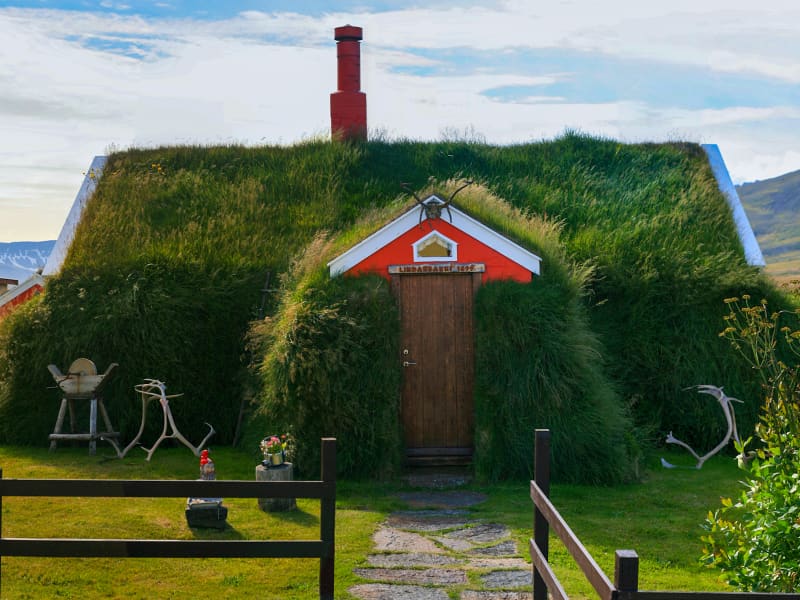
Borgarfjörður Eystri is known for its unique beauty and rich history. Lindarbakki, a small, beautiful turf house, has captivated many visitors with its picturesque look. A must see when visiting the village. The house is typical of its time, originally built in 1899 but parts have been rebuilt since. 
Loðmundarfjörður
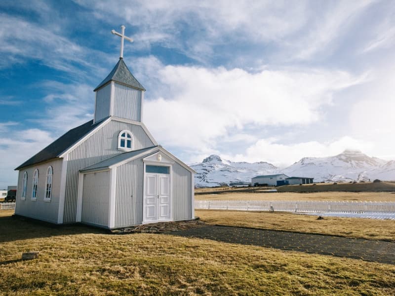
Loðmundarfjörður is a beautiful deserted fjord north of Seyðisfjörður. It was probably inhabited since settlement started in Iceland. It is known that 143 people lived there in 1860, but their number decreased after that. Loðmundarfjörður was deserted in 1973. You can still see quite a few traces of settlements in the area, and there is still a tiny church by Klyppstaður. Today, Loðmundarfjörður is a popular destination for hikers, as the fjord is part of the hiking trail system Víknaslóðir. It is possible to drive to Loðmundarfjörður in the second half of the summer, but it is necessary to have a four-wheel-drive car.
Njarðvíkurskriður and Naddi
Until the year 1949, when passable road came about, all traffic through the Njarðvíkurskriður screes between Njarðvík and Borgarfjörður Eystri was either on foot or on horseback. Njarðvíkurskriður were considered extremely dangerous, especially in winter, because of avalanches and, when raining heavily, mudslides. In such conditions, travellers in the area were putting their lives on the line. The screes hold sheer cliff drops down to the sea and above them steep slopes of mudslides, riddled with gullies. The road to Egilsstaðir from Borgarfjörður over the pass at Vantsskarð was opened in 1954, significantly higher up in the screes that the old horse track. Most recent road construction was in the year 2019 when the road was paved. More than one version exists of the folk tale of Naddi. Legend has it that in the time of the family of Björn Skafinn, the road along Njarðvíkurskriður became almost impassable because of a monster which had the lower body of a man and upper body of a beast and lived in a gully since named Naddagil. This monster ambushed travellers, especially after dark, attacked them and killed many. Finally, a valiant farmer from Borgarfjörður Eystri managed to overcome the ominous monster and force him into the sea. A cross was erected to mark the spot and still stands there. Mystery surrounds the cross in Njarðvíkurskriður, bearing a Latin inscription and the date 1306. Many have written about this cross and speculated about its age an why it was erected in the first place and then constantly renewed. The folk tale of the monster Naddi is connected to Njarðvíkurskriður and the cross, which is sometimes called Naddakross as shown in this old four-line stanza: The cross of Naddi is fallen tower. Our lives are lacking protection but God´s sacred pover will ensure its resurrection.
Víknaslóðir
Víknaslóðir trails, sometimes also referred to as Trails of the Inlets is a vast net of well-marked and versatile hiking routes reaching from the village in Borgarfjörður Eystri to Loðmundarfjörður. Locals have through the years marked out and maintained numerous trails, making the area a rightfully called hiker's Paradise. They also publish a high-quality hiking map and operate comfortable hiking lodges with facilities in Breiðavík, Húsavík and Loðmundarfjörður, deserted inlets and fjord, south of Borgarfjörður Eystri. The mountains come in all shapes and sizes and the variety of colors is stunning; everything from the black sand beaches to the pinkish orange hues of the mountain ridges. The trails wind themselves between isolated coves and fjords over colorful hills and through green valleys all the way down to the coast. Abandoned houses and ruins of ancient farms leave their mark on the surroundings. Travellers can easily spend a few days in the area exploring and taking in the breathtaking views. Tourism companies in Borgarfjörður Eystri offer hikers all kinds of services related to their journey, whether it be tour planning, guidance or transport.
Eiðar
Eiðar (approx. 15 km drive from Egilsstaðir) is a church site with longstanding and important cultural and educational background. One of the first agricultural schools in Iceland was founded in Eiðar in 1883 which later converted into a general educational center for Austurland. Its function as a school was discontinued in 1995 and since then many ideas have been launched as to its future role. Tourism and services to travellers has grown in recent years with a guesthouse, camping site and recreational area. A great location for travellers who want to stay in a peaceful and picturesque area on the banks of beautiful Lake Lagarfljót in the center of Austurland. 
Eyvindará river
Among the precious gems of the township, Egilsstaðir is the river Eyvindará. A farm on the river banks,k with the same name, traces its roots prior to  A.D. 1000. The burial mound of saga legend Helgi Droplaugarson, and ruins - commonly believed to be the ruins of his historic abode- are still to be seen on the Eyvindará grounds.  The area is highly popular among the local youths for all kinds of outdoor activities.
Gálgaás
Gálgaás is an old execution place in Egilsstaðir. The cliff Gálgaás, just east of Egilsstaðir Church, may seem unimposing, yet it has been the location of many a lugubrious destiny in centuries past. The most renowned person to lose his life at Gálgaás was a farmer named Valtýr, living at Eyjólfsstaðir some 10 km southwards. He was hanged in the wake of being tried for theft and murder, accusations which he steadfastly denied. Fourteen years later, the real murderer was unmasked by mere chance - also named Valtýr und suffered the same fate as his innocent namesake. Both skeletons were left lying below the cliff, which now bears a bronze plate commemorating these events.
Geirsstaðakirkja
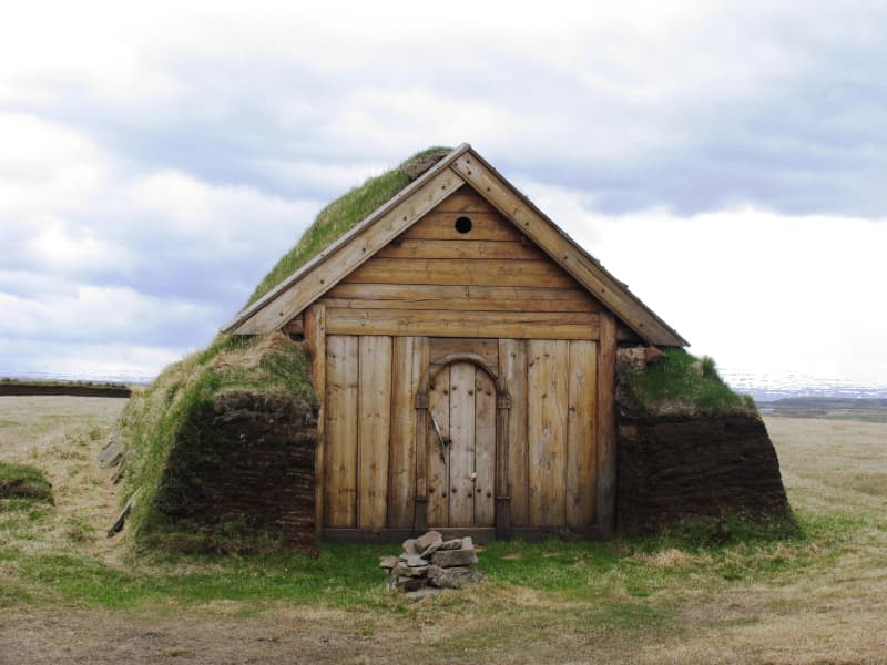
The pretty little turf church Geirsstaðakirkja is a reconstruction of a church from the Age of Vikings. An excavation at the estate of Litli-Bakki back in 1997 revealed ancient ruins of the small turf church, farmstead, longhouse and two smaller buildings. The reconstruction took place in 1999-2001 and the church is now open to the public.
Hallormsstaður National Forest
The birchwood remnants at Hallormsstaður farm were protected in 1905, making it Iceland’s first national forest. Today, birch forest and woodland cover about 350 hectares within the original fenced area, and a variety of tree species have been planted on another 200 hectares. Large areas to the north and south have been annexed to the forest more recently and either planted with trees or allowed to naturally regenerate with birch. A total of 85 tree species from over 600 locations worldwide can be found in the forest, covering around 740 hectares.Lands managed by the Land and Forest Service are designated as National Forests. These areas are open to everyone year-round and are located throughout Iceland. Many, like Hallormsstaður Forest, are easily accessible and offer a variety of facilities for outdoor recreation. Others require a 4WD vehicle or hiking up steep hillsides to enjoy.Hallormsstaður Forest is ideal for hiking, strolling, or biking. There are well-marked trails, in different colors, throughout much of the surrounding woodland. These trails are shown on a clear map published by the Forestry Service, which you can find in boxes at the entrance of many trails and nearby services. The maps can also be downloaded here.There are two camping sites in the forest: one in Atlavík and the other in Höfðavík. Both sites have small and large flat areas among the trees and are close to Lake Lagarfljót. Foresters will collect the payment for camping. More information can be found on our Facebook page.Rest places and picnic areas are scattered throughout the forest. For example, in Stekkjarvík, there is a barbecue area and a playground. The arboretum in Hallormsstaður is unique in the Arctic region. 
Héraðssandur
Héraðssandur
Húsey
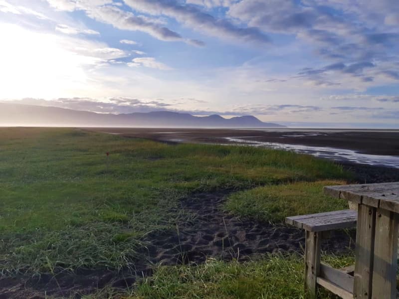
Húsey farm is renowned for its picturesque nature, abundant wildlife and hiking opportunities. A marked hiking route will take you towards river Jökulsá where seals and seal pups hang out in the river mouth and out to Héraðssandur black sand beach. Húsey is a bird watchers' paradise and with nesting grounds of red-throated divers, parasitic jaegers and great skuas, to name a few.  GPS : N65°38.775-W14°14.670   Powered by Wikiloc
Kárahnjúkar
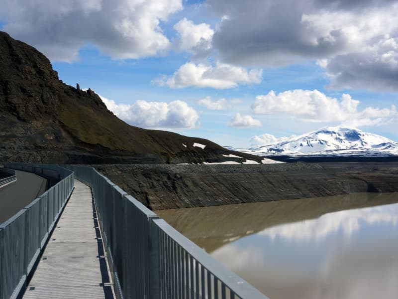
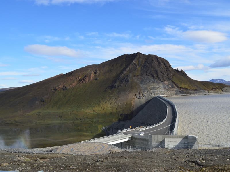
The Power Plant at Kárahnjúkar is the largest construction project in Icelandic history and the most significant electricity production in the country. The Kárahnjúkar Power Plant was built to produce energy for the aluminum plant at Reyðarfjörður. A trip to Kárahnjúkar is an ideal road trip for the family. A paved road runs from Fljótsdalur to the Kárahnjúkar dam.  The Kárahnjúkar area is ideal for outdoor activities. It is fun to see the Kárahnjúkar Dam itself and the Hálslón Reservoir. When Hálslón fills up and overflows, the Hverfandi waterfall appears at the western end of the dam, where the water plunges about 100 meters into Hafrahvammahljúfur. The waterfall is mighty and can become more powerful than Dettifoss. There are also fun hiking trails in the area; for example, there is a great hiking trail along Hafrahvammagljúfur and to Magnahellir, but to get to the starting point of the marked hiking trail, you need a four-wheel-drive car. 
Kárahnjúkavirkjun
A large power plant has been built at Kárahnjúkar, to supply the aluminum plant in Reyðarfjörður with energy. The Kárahnjúkar power plant is the largest construction project in Icelandic history and, at the same time, the most significant electricity production in the country. A trip to Kárahnjúkar is an ideal road trip for the family. A paved road runs from Fljótsdalur to the Kárahnjúkar dam. The Kárahnjúkar area is ideal for outdoor activities. It is fun to see the Kárahnjúkar Dam itself and the Hálslón Reservoir. When Hálslón fills up and overflows, the Hverfandi waterfall appears at the western end of the dam, where the water plunges about 100 meters into Hafrahvammagljúfur. The waterfall is mighty and can become more powerful than Dettifoss waterfall. There are also fun hiking trails in the area; for example, there is a great hiking trail along Hafrahvammagljúfur and to Magnahellir, but to get to the starting point of the marked hiking trail, you need a four-wheel-drive car. 
Kjarvalshvammur
A peaceful little haven, located at road 94 beside the Selfljót river south of Ketilsstaðir farm on the way out Héraðsflói. Here still stands a small cabin and a boathouse both of which belonged to Iceland´s master painter Jóhannes S. Kjarval (1889 -1972). When this master painter had spent two summers here a tent, just before 1950, the farmer at Ketilsstaðir presented him the piece of land in question and built the cabin which still stands.  This was the only real estate Kjarval ever owned. He often stayed here for extended periods, producing some of his most famous paintings.  The boathouse still shelters Kjarval´s little dinghy on which he descended the river out to sea, sailing as far as the village of Borgarfjörður Eystri 1957.
Lagarfljót and Lögurinn
Lagarfljót is one of Iceland´s deepest lakes, covering about 140 km from its source in Eyjabakkafjökull glacier to Héraðsflói Bay. The innermost section forms the lake Lögurinn, with a surface of 53 square kilometers and an average depth of 51 m, reaching 112 m where it is deepest. Its deep, mysterious glacial waters are home to Iceland´s ancient and much older equivalent of the Loch Ness Monster: The terrifying sea-worm-like Wyrm or Lagarfljótsormur. The oldest recorded sighting dates back to 1345. It was considered a bad omen if the curved forms of the monster were spotted above the water´s edge. In recent years the Wyrm has mostly kept to itself but pay close attention as you never know when it may reveal itself again!
Lagarfljót Wyrm monster
The Lagarfljót is one of Iceland´s deepest lakes and lies in a narrow trough carved by glaciers. It reaches a depth of 112 m, 90 m below sea level and shows no obvious flow. Its deep mysterious glacial waters are the home of Iceland´s ancient and much older equivalent of the Loch Ness monster, the terrifying sea-worm-like Wyrm or "Lagarfljótsormur". The oldest recorded sighting dates back to 1345. At that time the wyrm was said sometimes to resemble large islands, but at other times to rise out of the water in arches, spanning hundreds of fathoms. People were unsure what sort of monster this was, because neither its head nor tail were visible. In 1589, the wyrm was reported to have lifted its back so high above the water that a fast ship under full sail - crosstree, tackling and all - could have passed underneath. When its gigantic body slammed back into the water, the resulting crash rumbled throughout the vicinity. Sightings of the wyrm´s activities were frequent during the next centuries. It appeared variously as humps or islets, and yet again lifted its huge form into the sky. Such appearances were generally considered to bode misfortune. During the 20th century, various shapes of the Lagarfljót Wyrm were viewed from all around the lake. It shot its humps up regularly in addition to appearing as a clump or overturned boat gliding upriver against the current and aginast the wind, tossing towards both sides. A depth sounder once noted it snuggling under an overhanging bank, far below the surface. In February 2012 the farmer at Hrafnkelsstaðir in Fljótsdalur valley cought on camera a large swimming creature in one of the rivers that run into the lake Lagarfljót. The video got over 5 millions hits on Youtube and was in the news around the world. Informatijon boards about the wyrm are located at certain lakeside rest stops. We recommend these stops to check for signs of wyrm activities.
Laugavalladalur
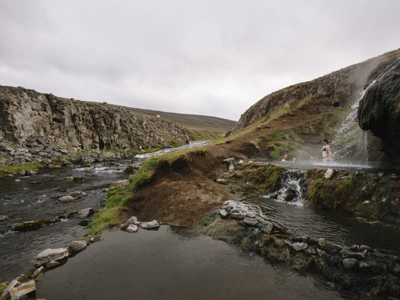
Laugavalladalur is a green oasis west of river Jökulsá á Dal, some 20 km. north of dam Káraghnjúkar. Close to the site of an abandoned farm, there is a geothermal stream, ideal for taking a bath and a shower in the warm waterfall where the stream runs into the valley's main river. Please be wary of the temperature as it sometimes rises well above suitable limits!
Magnahellir
Drive north of Kárahnjúkastífla reservoir along a road (fit for SUV) on Lambafell to crossroads by Laugavellir. Drive down to a parking area by Dimmugljúfur canyons. There you will find a sign containing information and the trail running through Hafrahvammar canyon and Magnahellir cave where you will find the cylinder with the visitors’ log and stamp. The farmers in Eiríksstaðir used to keep their sheep in the slopes by Jökulsá river close to the cave called Magna cave which derives its name from the farmer named Magni who was the first one to keep his sheep there in winter. Part of Hiking Treasures in Egilsstaðir Region GPS : N64°99.252-W15°71.683   Powered by Wikiloc
Möðrudalur
Möðrudalur is the highest settled farm in Iceland, 469 meters ( 1.539 feet) above sea-level. It has been inhabited since early settlement in Iceland and Möðrudalur has served as a presbytery for centuries. The builder of the church in Möðrudalur was Jón A. Stefánsson (1880 – 1971). He was a great farmer and a multitask-artist and the altarpiece is made by himself. His son was Stefan ,,Stórval“ Jónsson ( 1908 – 1994), one of a kind character and a painter. The panorama view from the farm is interesting in many ways – judge for yourself.  Several hiking trails are available in the area, and you can get maps at the information center. There you can also see a film that shows the eruption in Holuhraun 2014. Möðrudalur is close to many incomparable natural gems such as Herðubreiðarlindir, Askja, Kverkfjöll, Hvannalindir, Jökuldalsheiði Stuðlagil and Stórurður.  Campsites open from June until mid-September.
Rjúkandi
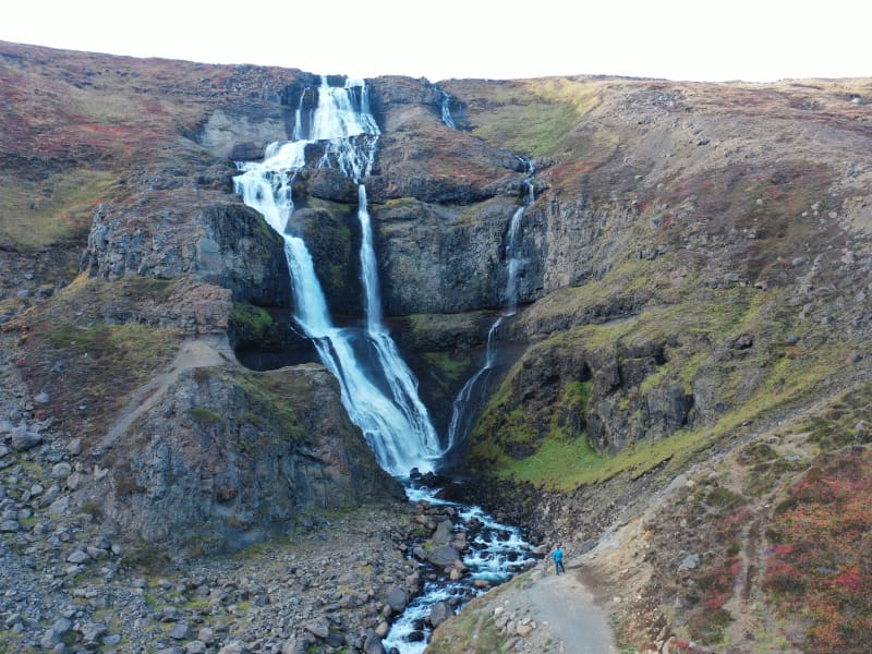
Rjúkandi waterfall is a beautiful waterfall that gracefully descends a few cliffs, from the mountains and almost down to highway 1. Access to the waterfall is very good; it is only a short walk from the car park by the main road.
Skessugarður
Skessugarður - the Rampart of the Giantess is a natural phenomenon in East Iceland, which has been called one of the most amazing natural formations in the country. It was formed by an ice-age glacier, Brúarjökull. It is a large arch-shaped moraine and consists of massive boulders (porphyritic basalt) making up to a ca 300 meters long and ca 7 meters high natural wall. It lies from west to east. It marks the stagnation level of Brúarjökull at the end of the last glacial period. After the stagnation of the glacier, a flood followed which washed this area clean of smaller rock leaving behind the big ones which makes this moraine unique as it lacks all smaller, finer sand particles and stones, or the glacial flour. Skessugarður is located by the lake Grjótgarðsvatn was of Sænautasel turf house, on the other side of Mt. Snæfell. Turn left onto the old ring road (number 907, a gravel road) after you leave Sænautasel and drive for a couple of km. Then turn left onto a dirt road, which turns into a track until you reach Skessugarður after 2 km.
Sandfell Skriddalur
Sandfell is an impressive looking rhyolite mountain in the shape of a ridge and reminds one of a tent because of its even slopes which are mostly free of cliffs and by it’s two darker peaks. The path starts by the main road (no 1). A little distance from the Gilsá river you will find the sign where you start. Walk the trail towards a fence then turn and walk up along it, then upwards by the trail on the northern ridge straight to the top which reaches 1157 m. Part of Hiking Treasures in Egilsstaðir Region GPS : N65°05.637-W14°30.298 Powered by Wikiloc
Selskógur
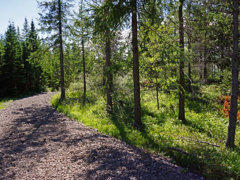
Selskógur the small forest on the eastern outskirts of Egilsstaðir, mainly consists of birch but also numerous rowans. Inviting woodchip trails of various lengths lure the wanderer to stroll through the peaceful surroundings.  A football field and a playground are among other recreational options in the area.
Sænautasel highland farm
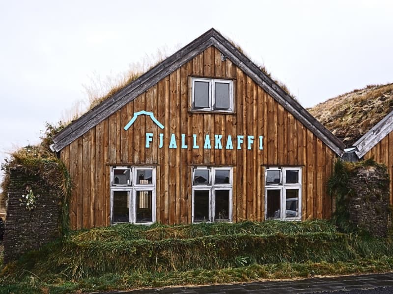
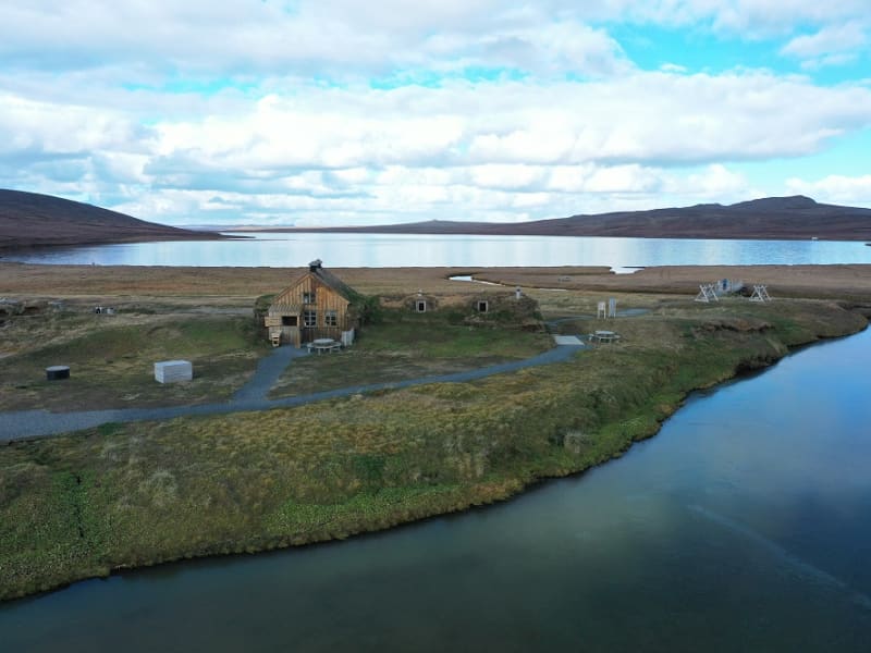
Sænautasel on Jökuldalsheiði is a unique location by the tranquil mountain lake, Sænautavatn. Sænautasel is an old highland farmstead that was rebuilt in 1992 and has been welcoming visitors during the summer since then. At Sænautasel, you can learn about the conditions and struggles of those who lived in the highlands. Guided tours are offered around the farm, sharing stories about the people and farming practices at the highland farmsteads that were inhabited well into the 20th century. Light refreshments are available in a traditional style. It is open every day in June-August.   To reach Sænautasel, you can drive from Highway 1 north of Skjöldólfsstaðir onto Möðrudalsvegur (Road 901) and then, after a short drive, turn onto Brúarvegur (Road 907). Alternatively, you can drive from Brú on Jökuldalur via Brúarvegur (Road 907) north to Sænautasel. From Sænautasel, it is a short distance to the magnificent natural rock formations Skessugarður slightly west on Jökuldalsheiði, and also close to Stuðlagil on Jökuldalur.   Settlement in Jökuldalsheiði began in the mid-19th century. The settlements in the highlands were partly built on the ruins of ancient farms and sheepfolds. The highlands are exceptionally beautiful in summer, making it hard to imagine how it was to live there year-round, including the harsh winters. The first farmstead built in the highlands during this period was Háreksstaðir in 1841. Over the next two decades, a total of 16 farmsteads were established in Jökuldalsheiði, the last one in 1862. The quality of the highland farms varied, and their periods of occupancy ranged from a single year at some to nearly a whole century at Sænautasel. The reasons for establishing these highland farms included overcrowding in the lowlands where all farms were occupied, and the development of urban areas and employment opportunities by the sea was still minimal. Therefore, people had few alternatives other than being laborers or tenants.   The farming conditions in the highlands were not entirely bad, although most places had heavy snow, as most farms were over 500 meters above sea level. Resources such as trout fishing in lakes, hunting for ptarmigan, geese, ducks, and swans, and grass harvesting were significant supplements. Some areas had excellent hayfields, at least in good years. Reindeer roamed the area, though their population was at a historical low around the turn of the 20th century. About 120 people lived in the highlands simultaneously at its peak. The eruption of Askja in 1875 greatly affected the highland settlements, causing a temporary abandonment of all farms except the northernmost ones. Many who left eventually emigrated to America. A few years later, some farms were reoccupied, and the settlement continued into the early decades of the 20th century. The last farm was abandoned in 1946.   Sænautasel was first established in 1843 and was inhabited until 1943, except for five years after the Askja eruption. It was the longest-inhabited farm in the highlands, occupied for a total of 95 years. Farming in the highlands under difficult conditions and great isolation has inspired Icelandic writers. Many fans of Halldór Kiljan Laxness know the story of Bjartur of Summerhouses in the novel *Independent People*. It describes the struggle of an independent crofter in a remote highland area. Many believe the story's inspiration came from Sænautasel, as Halldór stayed there in the 1920s. Highland farming was also a subject for writers Gunnar Gunnarsson and Jón Trausti.     Old legends said that sea cattle had been seen in Sænautavatn and even suggested that there were underwater tunnels from the lake to the sea that the sea cattle used.  
Unaos
Unaós ("The Estuary of Uni" is a beautiful inlet on the east coast of Héraðflói bay. It is named after the settler Uni Garðarsson but according to the Book of Settlements (12th.century), he docked in the estuary. Uni was the son of one of the three discoverers of Iceland, Gardar Svavarsson.  He was sent to Iceland by King Haraldur Fairhair of Norway in order  to convince the Icelanders to become his subjects.  His mission was however unfruitful. Uni docked his ship at a cliff in Selfljót river called Knörr.  In the estuary of the river, there´s a promontory called Krosshöfði by which was the principal harbor of the region, Óshöfn, until a passable road to the village Borgarfjörður eystri came about in the late 1940ties. The harbor was a primitive one since total calm and favorable currents were needed in order to bring the merchandise ashore. The area presents several points of interest and several walking trails are to be found there.
Vallanes
Vallanes is a farm and a vicarage, known for the habitation of many leading scholars and literates of centuries past. Today the farmers of Vallanes are renowned for organic farming and pioneer products, i.a. vegetables and barley. They also produce food and cosmetics under the brand name of  "Móðir Jörð" - "Mother Earth".  In the last century, the locals of the surrounding district erected their community centre, Iðavellir, on the outskirts of Vallanes, and there the East Iceland Equestrian Association has its main hub on the grounds for races and shows.  
Þerribjarg and Múlahöfn
Drive the main road up Hellisheiði mountain and when you’ve reached where you are about the highest part, take an off-road trail to the right from there until you’ve reached Kattárdalsdrög. The trail leads to Kattárdal valley. There is a sign where you can park your car and start walking. The trail is staked to the edge of the cliffs above Múlahöfn harbor. From there (65°45.144 - W14°21.964) lies a trail below the edge, down a rocky slope down to Múlahöfn, one of the natures’ masterpieces surrounded by cliffs and huge pillars of rock on two sides. This harbor was declared an official trading harbor in 1890 but was only used once as such because of the complications when bringing the shipment further on land. From the harbor, walk north to the outer point. From there one can see Þerribjarg cliffs and Langisandur shore. The cylinder with the visitors’ log and a stamp is by the trail leading down to the beach. Hikers are encouraged to go down and walk along the sand under Þerribjarg before turning back. Part of Hiking Treasures in Egilsstaðir Region Powered by Wikiloc