Skip to content

Or try searching by Category and/or Location

Historic and Cultural sites in Egilsstaðir

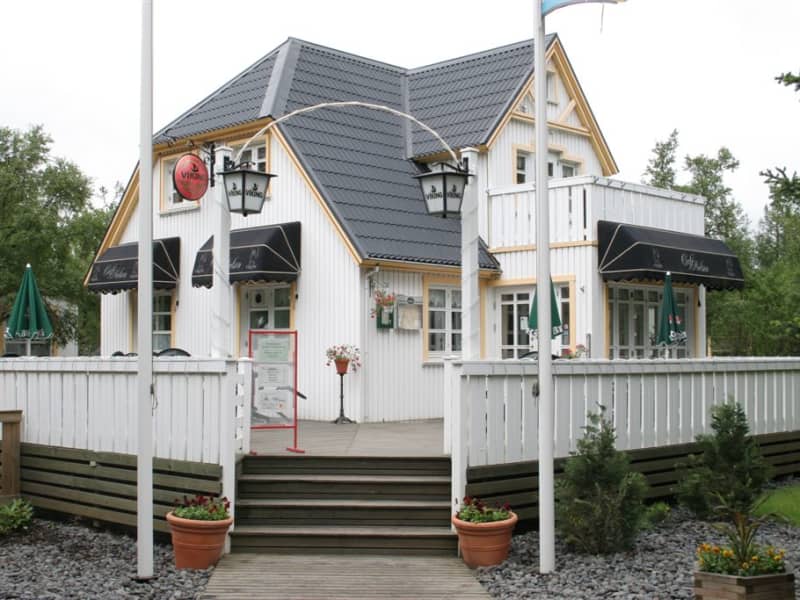
Nielsenshus
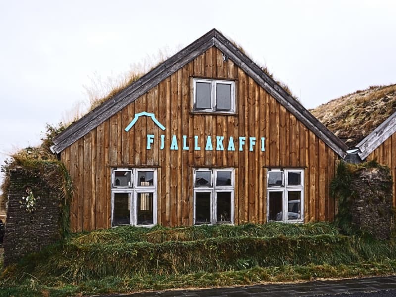
The Nielsen House was the first private house built in the village of Egilsstaðir , built in the year 1944 by the danish Oswald Nielsen. Today it houses a nice a restaurant, Café Nielsen. 
Geirsstaðakirkja
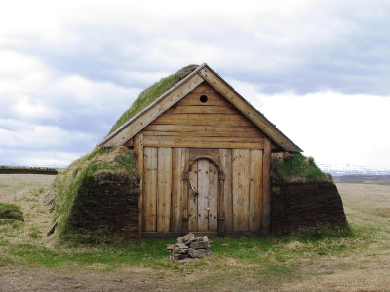
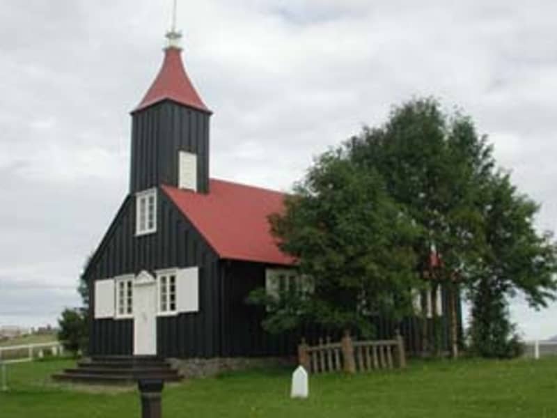
The pretty little turf church Geirsstaðakirkja is a reconstruction of a church from the Age of Vikings. An excavation at the estate of Litli-Bakki back in 1997 revealed ancient ruins of the small turf church, farmstead, longhouse and two smaller buildings. The reconstruction took place in 1999-2001 and the church is now open to the public.
Kjarvalshvammur
A peaceful little haven, located at road 94 beside the Selfljót river south of Ketilsstaðir farm on the way out Héraðsflói. Here still stands a small cabin and a boathouse both of which belonged to Iceland´s master painter Jóhannes S. Kjarval (1889 -1972). When this master painter had spent two summers here a tent, just before 1950, the farmer at Ketilsstaðir presented him the piece of land in question and built the cabin which still stands.  This was the only real estate Kjarval ever owned. He often stayed here for extended periods, producing some of his most famous paintings.  The boathouse still shelters Kjarval´s little dinghy on which he descended the river out to sea, sailing as far as the village of Borgarfjörður Eystri 1957.
Sænautasel highland farm
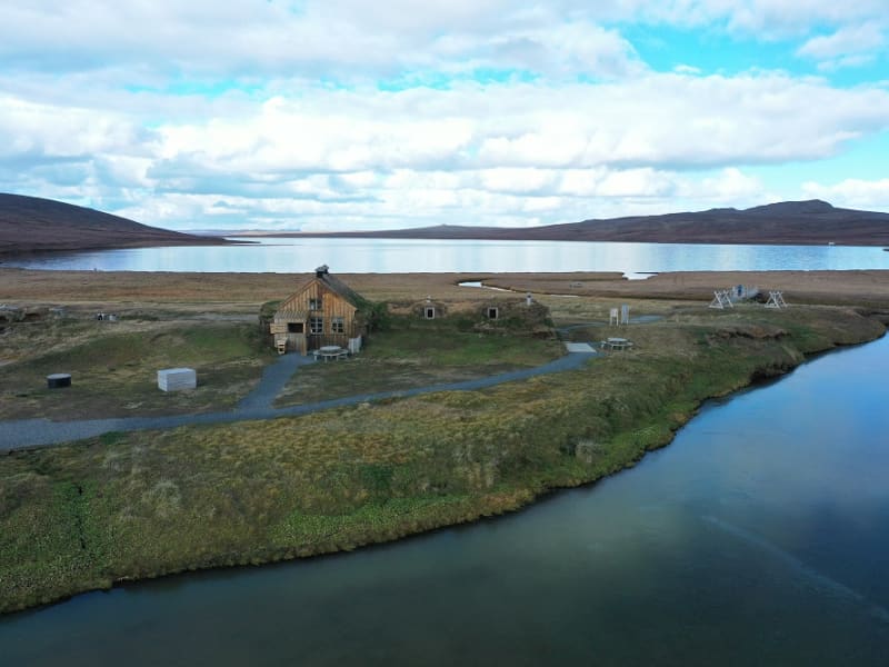
Sænautasel on Jökuldalsheiði is a unique location by the tranquil mountain lake, Sænautavatn. Sænautasel is an old highland farmstead that was rebuilt in 1992 and has been welcoming visitors during the summer since then. At Sænautasel, you can learn about the conditions and struggles of those who lived in the highlands. Guided tours are offered around the farm, sharing stories about the people and farming practices at the highland farmsteads that were inhabited well into the 20th century. Light refreshments are available in a traditional style. It is open every day in June-August.   To reach Sænautasel, you can drive from Highway 1 north of Skjöldólfsstaðir onto Möðrudalsvegur (Road 901) and then, after a short drive, turn onto Brúarvegur (Road 907). Alternatively, you can drive from Brú on Jökuldalur via Brúarvegur (Road 907) north to Sænautasel. From Sænautasel, it is a short distance to the magnificent natural rock formations Skessugarður slightly west on Jökuldalsheiði, and also close to Stuðlagil on Jökuldalur.   Settlement in Jökuldalsheiði began in the mid-19th century. The settlements in the highlands were partly built on the ruins of ancient farms and sheepfolds. The highlands are exceptionally beautiful in summer, making it hard to imagine how it was to live there year-round, including the harsh winters. The first farmstead built in the highlands during this period was Háreksstaðir in 1841. Over the next two decades, a total of 16 farmsteads were established in Jökuldalsheiði, the last one in 1862. The quality of the highland farms varied, and their periods of occupancy ranged from a single year at some to nearly a whole century at Sænautasel. The reasons for establishing these highland farms included overcrowding in the lowlands where all farms were occupied, and the development of urban areas and employment opportunities by the sea was still minimal. Therefore, people had few alternatives other than being laborers or tenants.   The farming conditions in the highlands were not entirely bad, although most places had heavy snow, as most farms were over 500 meters above sea level. Resources such as trout fishing in lakes, hunting for ptarmigan, geese, ducks, and swans, and grass harvesting were significant supplements. Some areas had excellent hayfields, at least in good years. Reindeer roamed the area, though their population was at a historical low around the turn of the 20th century. About 120 people lived in the highlands simultaneously at its peak. The eruption of Askja in 1875 greatly affected the highland settlements, causing a temporary abandonment of all farms except the northernmost ones. Many who left eventually emigrated to America. A few years later, some farms were reoccupied, and the settlement continued into the early decades of the 20th century. The last farm was abandoned in 1946.   Sænautasel was first established in 1843 and was inhabited until 1943, except for five years after the Askja eruption. It was the longest-inhabited farm in the highlands, occupied for a total of 95 years. Farming in the highlands under difficult conditions and great isolation has inspired Icelandic writers. Many fans of Halldór Kiljan Laxness know the story of Bjartur of Summerhouses in the novel *Independent People*. It describes the struggle of an independent crofter in a remote highland area. Many believe the story's inspiration came from Sænautasel, as Halldór stayed there in the 1920s. Highland farming was also a subject for writers Gunnar Gunnarsson and Jón Trausti.     Old legends said that sea cattle had been seen in Sænautavatn and even suggested that there were underwater tunnels from the lake to the sea that the sea cattle used.  
Stapavík by Héraðsflói
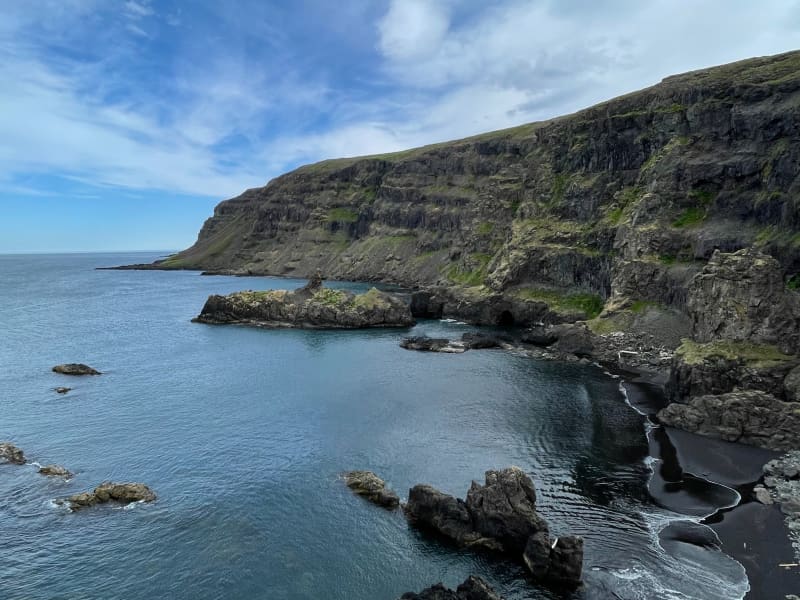
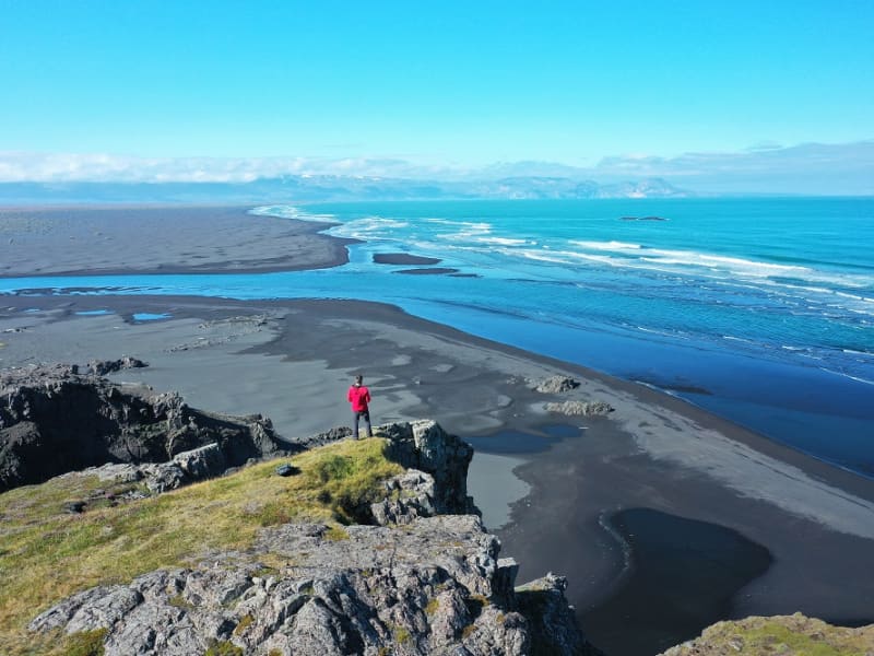
Stapavík is an inlet that lies in a magnificent setting of steep cliffs and the open sea. From 1930-1945 Stapavík was a used as an unloading port for ships and is closely related to the commercial history of Borgarfjörður Eystri and Hérað. Remains of the facilities are very picturesque and the view from the inlet is beautiful on a sunny day.  A marked trail leads from the farmstead Unaós, following Selfljót river downstream to the rivermouth. Héraðssandur black sand beach opens to the North of the river with a view over Hellisheiði Eystri rhyolite mountain ridge. This is a about a two hour long (back and forth) family friendly hike. Travellers could also challenge themselves to a longer hike by crossing Gönguskarð mountain pass over to Njarðvík which adds a about two hours to the hike. Powered by Wikiloc
Lagarfljót Wyrm monster
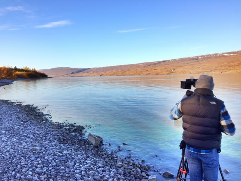
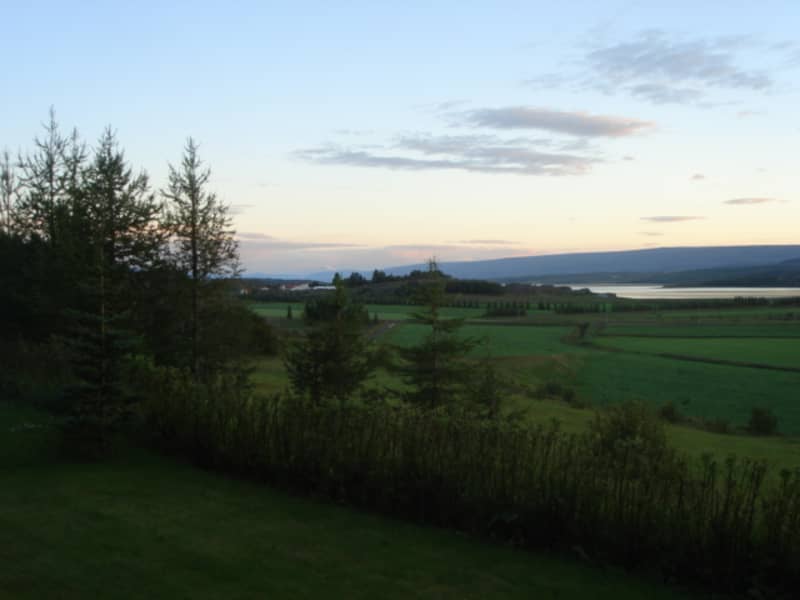
The Lagarfljót is one of Iceland´s deepest lakes and lies in a narrow trough carved by glaciers. It reaches a depth of 112 m, 90 m below sea level and shows no obvious flow. Its deep mysterious glacial waters are the home of Iceland´s ancient and much older equivalent of the Loch Ness monster, the terrifying sea-worm-like Wyrm or "Lagarfljótsormur". The oldest recorded sighting dates back to 1345. At that time the wyrm was said sometimes to resemble large islands, but at other times to rise out of the water in arches, spanning hundreds of fathoms. People were unsure what sort of monster this was, because neither its head nor tail were visible. In 1589, the wyrm was reported to have lifted its back so high above the water that a fast ship under full sail - crosstree, tackling and all - could have passed underneath. When its gigantic body slammed back into the water, the resulting crash rumbled throughout the vicinity. Sightings of the wyrm´s activities were frequent during the next centuries. It appeared variously as humps or islets, and yet again lifted its huge form into the sky. Such appearances were generally considered to bode misfortune. During the 20th century, various shapes of the Lagarfljót Wyrm were viewed from all around the lake. It shot its humps up regularly in addition to appearing as a clump or overturned boat gliding upriver against the current and aginast the wind, tossing towards both sides. A depth sounder once noted it snuggling under an overhanging bank, far below the surface. In February 2012 the farmer at Hrafnkelsstaðir in Fljótsdalur valley cought on camera a large swimming creature in one of the rivers that run into the lake Lagarfljót. The video got over 5 millions hits on Youtube and was in the news around the world. Informatijon boards about the wyrm are located at certain lakeside rest stops. We recommend these stops to check for signs of wyrm activities.
Sláturhúsið
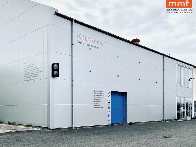
The Center for Art and Culture in Fljotsdalsherad (MMF) is located in Slaturhusid, Egilsstadir. As a Center for Performing Arts we are inspired every day to create, share, teach, excite and perform for our community. Although performing arts are our main focus we also host art exhibitions. Director of MMF is Ragnhildur Asvaldsdottir
East Iceland Heritage Museum
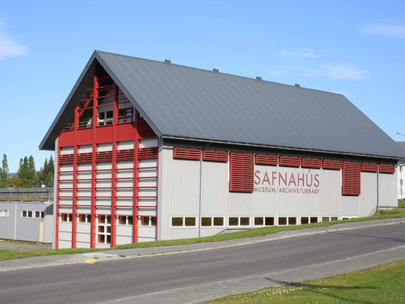
The East Iceland Heritage Museum was founded in 1943 and since then its aims has been to preserve the history of East Iceland by collecting and preserving things that reflect the society, culture and everyday life of people in the area, from past to present day.  The museum has two permanent exhibitions, one about the reindeers in East Iceland and one about the old rural household in the region. The museum also has diverse temporary exhibitions through the year.  Reindeer in East IcelandThe East is the only part of Iceland where you will find wild reindeer. They contribute to the unique nature and are strongly connected to the region’s history and culture. The focus of the exhibition is on their nature, characteristics, and survival, as well as reindeer hunting and how reindeer products have contributed to a creative development of fashion design and handcraft.  The old rural household as a self-sufficient entityOn display are items from the historical, rural community in East-Iceland up until the mid-20th century. Some items relate to a practical role in everyday life, while others bear witness to the fact that life was not only about basic survival but also about creating beautiful things for decoration and pleasure. Among things on display is a living room (baðstofa) of an Icelandic turf house.  For more information, please visit www.minjasafn.is
Gálgaás
Gálgaás is an old execution place in Egilsstaðir. The cliff Gálgaás, just east of Egilsstaðir Church, may seem unimposing, yet it has been the location of many a lugubrious destiny in centuries past. The most renowned person to lose his life at Gálgaás was a farmer named Valtýr, living at Eyjólfsstaðir some 10 km southwards. He was hanged in the wake of being tried for theft and murder, accusations which he steadfastly denied. Fourteen years later, the real murderer was unmasked by mere chance - also named Valtýr und suffered the same fate as his innocent namesake. Both skeletons were left lying below the cliff, which now bears a bronze plate commemorating these events.
Kirkjubær
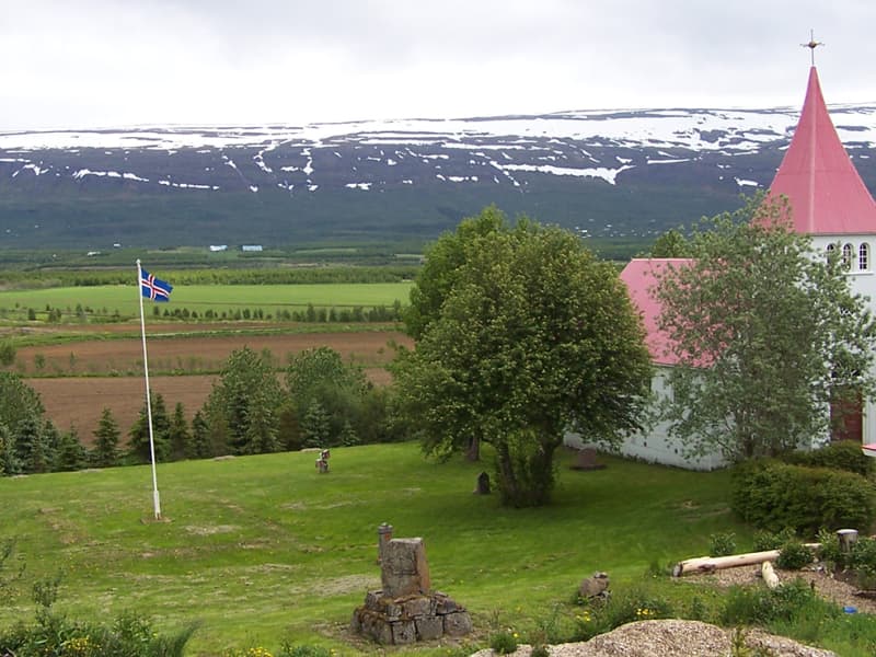
Kirkjubær in Hróarstunga was a presbitery until 1956, a site of distinction and local intellectuals. The church dates from 1851 and is well preserved. It has a pulprit dating from the 16. th. century and the baptismal font is beautifully carved by master carver and sculptor Ríkharður Jónsson (ref. Langabúð, Djúpivogur). The altarpiece dates from the year 1894.
Kóreksstaðavígi
Kóreksstaðavígi is a beautiful rock of basalt columns. There the Viking Kórekur is said to have fought his enemies to the death and been buried at the site. One drives past Hjaltalundur and takes the road towards the farm Kóreksstaðir. Park your car in an area close to the sign by the gate leading to the farm. Walk on towards the Kóreksstaðavígi where you will find a cylinder with the visitors’ log and stamp. Standing on its top is an enjoyable experience. Part of Hiking Treasures in Egilsstaðir Region GPS : N65°32.782-W14°10.591 Powered by Wikiloc
Midhús
Miðhús was among the first guesthouses in the Hérað region. Travelers passed Miðhús on their way to Seyðisfjörður and Eskifjörður. Today Miðhús houses an art gallery and a workshop (operative since 1975) where Icelandic material is used in many different ways.
Möðrudalskirkja
In Möðrudalur there is a small and beautiful church that was built in 1949. Farmer Jón A. Stefánsson (1880-1971) created the church in memory of his wife, Þórunn Vilhjálmsdóttir, who died in 1944. The church is built on the foundation of the older Möðrudalskirkja church. Jón both constructed and decorated the church; he even painted the altarpiece, which shows the Sermon on the Mount. Previously, there was a parsonage in Möðrudalur, which was closed down in 1716, but then the place was deserted for several years.
Möðrudalur
Möðrudalur is the highest settled farm in Iceland, 469 meters ( 1.539 feet) above sea-level. It has been inhabited since early settlement in Iceland and Möðrudalur has served as a presbytery for centuries. The builder of the church in Möðrudalur was Jón A. Stefánsson (1880 – 1971). He was a great farmer and a multitask-artist and the altarpiece is made by himself. His son was Stefan ,,Stórval“ Jónsson ( 1908 – 1994), one of a kind character and a painter. The panorama view from the farm is interesting in many ways – judge for yourself.  Several hiking trails are available in the area, and you can get maps at the information center. There you can also see a film that shows the eruption in Holuhraun 2014. Möðrudalur is close to many incomparable natural gems such as Herðubreiðarlindir, Askja, Kverkfjöll, Hvannalindir, Jökuldalsheiði Stuðlagil and Stórurður.  Campsites open from June until mid-September.
Raudshaugur
Rauðshaugur is a rock or a hill protruding from the farm Höfði and can be seen widely from Hérað. According to legend it is the burial heap of farmer Rauður or Ásrauður in the sagas and from there two similar heaps can be located, the burial heap Bessahaugur in Fljótsdalur and the heap Ormarshaugur in Fell. Legend Rauður was buried with all his riches. People are said to have tried digging into the pile of rocks but always had to give up because of a burning vision of the homestead in Ketilsstadir. Walk from the sign by Fagridalur road (N65°14.590 -W14°21.156) along the trail on Egilsstaðaháls towards Rauðshaugur. Part of Hiking Treasures in Egilsstaðir Region GPS : N65°12.77-W14°23.01 Powered by Wikiloc
Skessugarður
Skessugarður - the Rampart of the Giantess is a natural phenomenon in East Iceland, which has been called one of the most amazing natural formations in the country. It was formed by an ice-age glacier, Brúarjökull. It is a large arch-shaped moraine and consists of massive boulders (porphyritic basalt) making up to a ca 300 meters long and ca 7 meters high natural wall. It lies from west to east. It marks the stagnation level of Brúarjökull at the end of the last glacial period. After the stagnation of the glacier, a flood followed which washed this area clean of smaller rock leaving behind the big ones which makes this moraine unique as it lacks all smaller, finer sand particles and stones, or the glacial flour. Skessugarður is located by the lake Grjótgarðsvatn was of Sænautasel turf house, on the other side of Mt. Snæfell. Turn left onto the old ring road (number 907, a gravel road) after you leave Sænautasel and drive for a couple of km. Then turn left onto a dirt road, which turns into a track until you reach Skessugarður after 2 km.
Turf Houses by Hjarðarhagi
The old sheep houses by Hjarðarhagi are the remains of a six-house cluster, but the other houses were removed around 1970 due to proximity to the ring road. Today, these remaining houses have been renovated in their original form. The houses were in use until 1980 and are called Efstahús and Miðhús.
Galtastaðir Fram Turf house
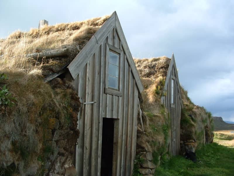
The old farm of Galtastaðir Fram is a well-preserved turf house from the 19th century. Inhabited until 1967 the building exemplifies the sort of housing common in Iceland in previous centuries, heated to some extent by keeping cows under the communal living room or "baðstofa", which was also used for sleeping and handcraft.  Both the interior and exterior of this small but remarkable showcase of former living conditions can be visited by the consent of the proprietor. Galtastaðir Fram has ranked on the preservation list of the National Museum since 1976. 
Unaos
Unaós ("The Estuary of Uni" is a beautiful inlet on the east coast of Héraðflói bay. It is named after the settler Uni Garðarsson but according to the Book of Settlements (12th.century), he docked in the estuary. Uni was the son of one of the three discoverers of Iceland, Gardar Svavarsson.  He was sent to Iceland by King Haraldur Fairhair of Norway in order  to convince the Icelanders to become his subjects.  His mission was however unfruitful. Uni docked his ship at a cliff in Selfljót river called Knörr.  In the estuary of the river, there´s a promontory called Krosshöfði by which was the principal harbor of the region, Óshöfn, until a passable road to the village Borgarfjörður eystri came about in the late 1940ties. The harbor was a primitive one since total calm and favorable currents were needed in order to bring the merchandise ashore. The area presents several points of interest and several walking trails are to be found there.
Vallanes
Vallanes is a farm and a vicarage, known for the habitation of many leading scholars and literates of centuries past. Today the farmers of Vallanes are renowned for organic farming and pioneer products, i.a. vegetables and barley. They also produce food and cosmetics under the brand name of  "Móðir Jörð" - "Mother Earth".  In the last century, the locals of the surrounding district erected their community centre, Iðavellir, on the outskirts of Vallanes, and there the East Iceland Equestrian Association has its main hub on the grounds for races and shows.