Skip to content

Or try searching by Category and/or Location

Historic and Cultural sites in Múlaþing

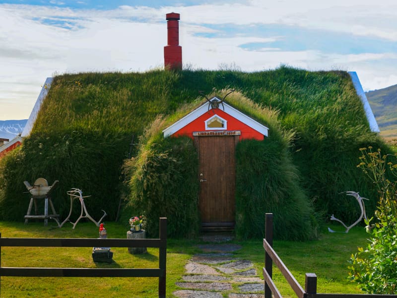
Lindarbakki
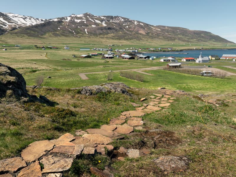
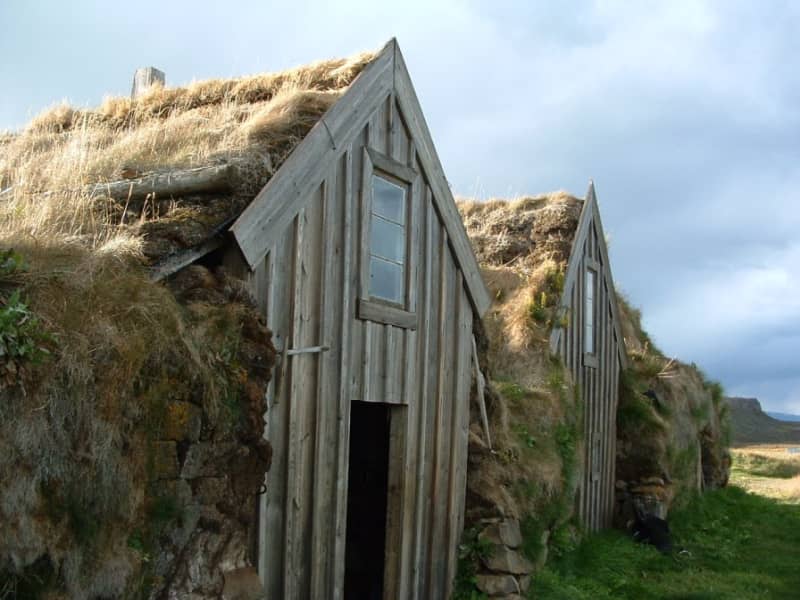
Borgarfjörður Eystri is known for its unique beauty and rich history. Lindarbakki, a small, beautiful turf house, has captivated many visitors with its picturesque look. A must see when visiting the village. The house is typical of its time, originally built in 1899 but parts have been rebuilt since. 
Teigarhorn
Teigarhorn, close to Djúpivogur, is known for remarkable geological formations and interesting history of industry and culture. Teigarhorn is a nature reserve, and part of it is a natural monument. There is year-round ranger at Teigarhorn, and development work in the area is being done in harmony with nature. Teigarhorn is one of the most significant mining sites of zeolites in the world. Among the types of zeolite stones found at Teigarhorn are schoolite, stilbite, epistilbite, mordenite, laumontite and heulandite. There are also other minerals, such as seladonite, opal, chalcedony, rock crystal, calcite and Iceland spar. Zeolites from Teigarhorn have been used in various geological studies for more than 200 years. These include descriptions of crystal forms, chemical composition, internal structure of crystals and optics, some of which are among the first descriptions of the rocks in question. Samples from Teigarhorn were sold to museums around the world in the second half of the 18th century, but since 1976 the main mining places have been protected as natural monuments. Weywadthús, at Teigarhorn, was built by Níels P.E. Weywadt in the years 1880-1882. He was a store manager in the Örum and Wulff store in Djúpivogur. Weywadthús has been part of the National Museum of Iceland since 1992. Níels' daughter, Nicoline Weywadt, was the first Icelandic woman to study photography and operated a photography studio in Teigarhorn. Nicoline is also believed to have owned the first sewing machine in East Iceland.
Kjarvalshvammur
A peaceful little haven, located at road 94 beside the Selfljót river south of Ketilsstaðir farm on the way out Héraðsflói. Here still stands a small cabin and a boathouse both of which belonged to Iceland´s master painter Jóhannes S. Kjarval (1889 -1972). When this master painter had spent two summers here a tent, just before 1950, the farmer at Ketilsstaðir presented him the piece of land in question and built the cabin which still stands.  This was the only real estate Kjarval ever owned. He often stayed here for extended periods, producing some of his most famous paintings.  The boathouse still shelters Kjarval´s little dinghy on which he descended the river out to sea, sailing as far as the village of Borgarfjörður Eystri 1957.
Njarðvíkurskriður and Naddi
Until the year 1949, when passable road came about, all traffic through the Njarðvíkurskriður screes between Njarðvík and Borgarfjörður Eystri was either on foot or on horseback. Njarðvíkurskriður were considered extremely dangerous, especially in winter, because of avalanches and, when raining heavily, mudslides. In such conditions, travellers in the area were putting their lives on the line. The screes hold sheer cliff drops down to the sea and above them steep slopes of mudslides, riddled with gullies. The road to Egilsstaðir from Borgarfjörður over the pass at Vantsskarð was opened in 1954, significantly higher up in the screes that the old horse track. Most recent road construction was in the year 2019 when the road was paved. More than one version exists of the folk tale of Naddi. Legend has it that in the time of the family of Björn Skafinn, the road along Njarðvíkurskriður became almost impassable because of a monster which had the lower body of a man and upper body of a beast and lived in a gully since named Naddagil. This monster ambushed travellers, especially after dark, attacked them and killed many. Finally, a valiant farmer from Borgarfjörður Eystri managed to overcome the ominous monster and force him into the sea. A cross was erected to mark the spot and still stands there. Mystery surrounds the cross in Njarðvíkurskriður, bearing a Latin inscription and the date 1306. Many have written about this cross and speculated about its age an why it was erected in the first place and then constantly renewed. The folk tale of the monster Naddi is connected to Njarðvíkurskriður and the cross, which is sometimes called Naddakross as shown in this old four-line stanza: The cross of Naddi is fallen tower. Our lives are lacking protection but God´s sacred pover will ensure its resurrection.
Tvísöngur Sound Sculpure
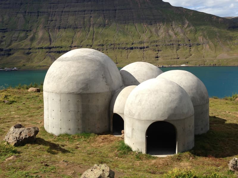
Tvísöngur sculpture, by artist Lukas Kühne, mixes concrete, nature, and sound to create an interactive tribute to Iceland’s unique tradition of five-tone harmony.  The installation piece looks like a grouping of interconnected cement bubbles from afar. Up close the five segments are quite large, ranging from roughly 6 to 12 feet tall and can be entered via rounded arches built into the walls. Once inside the stark industrial domes, visitors will find that they have each been designed to resonate at different harmonies as the wind blowing in off the cliff rushes through the openings. The collective effect is almost as though the wind itself is playing a giant instrument. The five chambers of the piece are meant to recall the Icelandic musical tradition of quintal harmony, with each dome reflecting a tone in the tradition. Juxtaposed with the serene and stark surroundings, it seems as though Iceland itself is creating the music. Tvísöngur is a permanent work and is meant to keep the country’s musical traditions alive, which is not an easy thing to do simply with concrete.
Sænautasel highland farm
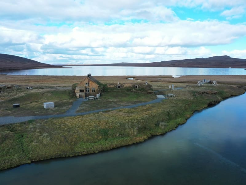
Sænautasel on Jökuldalsheiði is a unique location by the tranquil mountain lake, Sænautavatn. Sænautasel is an old highland farmstead that was rebuilt in 1992 and has been welcoming visitors during the summer since then. At Sænautasel, you can learn about the conditions and struggles of those who lived in the highlands. Guided tours are offered around the farm, sharing stories about the people and farming practices at the highland farmsteads that were inhabited well into the 20th century. Light refreshments are available in a traditional style. It is open every day in June-August.   To reach Sænautasel, you can drive from Highway 1 north of Skjöldólfsstaðir onto Möðrudalsvegur (Road 901) and then, after a short drive, turn onto Brúarvegur (Road 907). Alternatively, you can drive from Brú on Jökuldalur via Brúarvegur (Road 907) north to Sænautasel. From Sænautasel, it is a short distance to the magnificent natural rock formations Skessugarður slightly west on Jökuldalsheiði, and also close to Stuðlagil on Jökuldalur.   Settlement in Jökuldalsheiði began in the mid-19th century. The settlements in the highlands were partly built on the ruins of ancient farms and sheepfolds. The highlands are exceptionally beautiful in summer, making it hard to imagine how it was to live there year-round, including the harsh winters. The first farmstead built in the highlands during this period was Háreksstaðir in 1841. Over the next two decades, a total of 16 farmsteads were established in Jökuldalsheiði, the last one in 1862. The quality of the highland farms varied, and their periods of occupancy ranged from a single year at some to nearly a whole century at Sænautasel. The reasons for establishing these highland farms included overcrowding in the lowlands where all farms were occupied, and the development of urban areas and employment opportunities by the sea was still minimal. Therefore, people had few alternatives other than being laborers or tenants.   The farming conditions in the highlands were not entirely bad, although most places had heavy snow, as most farms were over 500 meters above sea level. Resources such as trout fishing in lakes, hunting for ptarmigan, geese, ducks, and swans, and grass harvesting were significant supplements. Some areas had excellent hayfields, at least in good years. Reindeer roamed the area, though their population was at a historical low around the turn of the 20th century. About 120 people lived in the highlands simultaneously at its peak. The eruption of Askja in 1875 greatly affected the highland settlements, causing a temporary abandonment of all farms except the northernmost ones. Many who left eventually emigrated to America. A few years later, some farms were reoccupied, and the settlement continued into the early decades of the 20th century. The last farm was abandoned in 1946.   Sænautasel was first established in 1843 and was inhabited until 1943, except for five years after the Askja eruption. It was the longest-inhabited farm in the highlands, occupied for a total of 95 years. Farming in the highlands under difficult conditions and great isolation has inspired Icelandic writers. Many fans of Halldór Kiljan Laxness know the story of Bjartur of Summerhouses in the novel *Independent People*. It describes the struggle of an independent crofter in a remote highland area. Many believe the story's inspiration came from Sænautasel, as Halldór stayed there in the 1920s. Highland farming was also a subject for writers Gunnar Gunnarsson and Jón Trausti.     Old legends said that sea cattle had been seen in Sænautavatn and even suggested that there were underwater tunnels from the lake to the sea that the sea cattle used.  
Skessugarður
Skessugarður - the Rampart of the Giantess is a natural phenomenon in East Iceland, which has been called one of the most amazing natural formations in the country. It was formed by an ice-age glacier, Brúarjökull. It is a large arch-shaped moraine and consists of massive boulders (porphyritic basalt) making up to a ca 300 meters long and ca 7 meters high natural wall. It lies from west to east. It marks the stagnation level of Brúarjökull at the end of the last glacial period. After the stagnation of the glacier, a flood followed which washed this area clean of smaller rock leaving behind the big ones which makes this moraine unique as it lacks all smaller, finer sand particles and stones, or the glacial flour. Skessugarður is located by the lake Grjótgarðsvatn was of Sænautasel turf house, on the other side of Mt. Snæfell. Turn left onto the old ring road (number 907, a gravel road) after you leave Sænautasel and drive for a couple of km. Then turn left onto a dirt road, which turns into a track until you reach Skessugarður after 2 km.
Bóndavarðan - The farmers cairn
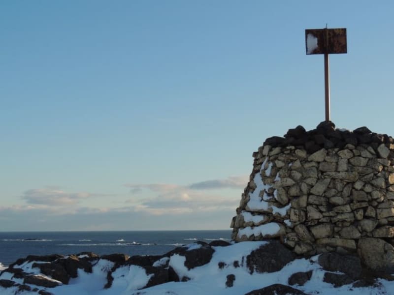
Bóndavarðan - The farmers ´cairn stands high on the ridge just seawards of the village. The view from Bóndavarðan cairn is great! it may have been first erected by farmers keeping watch towards the sea after a severe raid by North African pirates in 1627. There is a view indicator up the cairn.
Rainbow Street in Seyðisfjörður
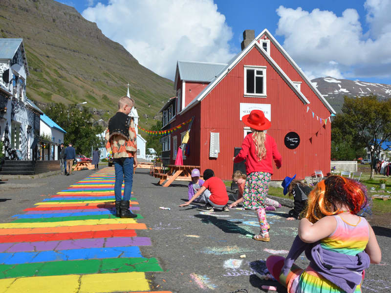
The small town of Seyðisfjörður is famous around Iceland for its colour and creativity. One of its best-known features is the Rainbow Street (referred to as Regnbogagatan in Icelandic) in the heart of town, which can best be described as a beautiful community project. On a sunny day in the summer of 2016 the town's residents got the idea to paint Norðurgata, a cute street in need of some love and restoration. That same night, people in town as well as the town’s employees got together and painted the colours of the rainbow onto the street – unknowingly creating one of the most popular visual landmarks in East Iceland. Year round, guests from all over the world come to visit the Rainbow Street in Seyðisfjörður to snap a "selfie" of themselves on this colourful street, surrounded with old historic houses which the town is also known for. At the end of the street stands the town’s picturesque church, usually referred to as “Bláa kirkjan” or the Blue Church. Ever since then the residents get together regularly each summer to repaint the street, and everyone is welcome to take part.  The Rainbow Street is located right in the town’s center and close by are some great restaurants, the local handcraft market and Blóðberg, a design boutique, all worth checking out. One of Iceland’s best sushi restaurants, Norð-Austur on the second floor of Hotel Aldan, serves sushi from the freshest ingredients available. Café Lára is the perfect stop for some soul food, juicy burgers, and local fish.  Every summer, the Blue Church Summer Concert series takes place and has become one of the major cultural events in East Iceland. It offers a varied program of music where some of the country’s most interesting musicians perform.  Seyðisfjörður is one of the highlights on our Fjord to Fjord travel route. If you are currently travelling around East Iceland or planning your next trip, we highly recommend taking checking out our travel routes for inspiration.
Gálgaás
Gálgaás is an old execution place in Egilsstaðir. The cliff Gálgaás, just east of Egilsstaðir Church, may seem unimposing, yet it has been the location of many a lugubrious destiny in centuries past. The most renowned person to lose his life at Gálgaás was a farmer named Valtýr, living at Eyjólfsstaðir some 10 km southwards. He was hanged in the wake of being tried for theft and murder, accusations which he steadfastly denied. Fourteen years later, the real murderer was unmasked by mere chance - also named Valtýr und suffered the same fate as his innocent namesake. Both skeletons were left lying below the cliff, which now bears a bronze plate commemorating these events.
Eggin í Gleðivík - The Eggs in Merry bay
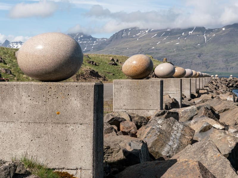
Eggin í Gleðivík (the eggs in Merry Bay) is an outdoor artwork by artist Sigurður Guðmundsson (b. 1942). The artwork has 34 replicas of eggs of nesting birds that nest in the vicinity of Djúpivogur and reflects the strong connection that Djúpivogur has with nature. The work is especially for the site. The eggs stand on concrete pillars that previously supported a landing pipe between the pier and the smelter. Eggin í Gleðivík are a popular tourist attraction and has become one of Djúpivogur´s landmarks.
Álfaborg
On arrival to Borgarfjörður Eystri, you will se a distinctive landmark in the middle of the village; Álfaborg, or The city of Elves, where the Queen of Elves lives, legend tells. Numerous tales tell of relations between elves and locals, such as young women marrying elvish men and living in Álfaborg. Álfaborg was declared a nature reserve in 1976, which makes the area protected for recreational and public use. On top of Álfaborg is an observation platform with excellent view over the fjord and surrounding mountains. The trail up Álfaborg is an easy walk and suitable for all. Below Álfaborg is the local camping ground and a fresbee golf course.
Lagarfljót Wyrm monster
The Lagarfljót is one of Iceland´s deepest lakes and lies in a narrow trough carved by glaciers. It reaches a depth of 112 m, 90 m below sea level and shows no obvious flow. Its deep mysterious glacial waters are the home of Iceland´s ancient and much older equivalent of the Loch Ness monster, the terrifying sea-worm-like Wyrm or "Lagarfljótsormur". The oldest recorded sighting dates back to 1345. At that time the wyrm was said sometimes to resemble large islands, but at other times to rise out of the water in arches, spanning hundreds of fathoms. People were unsure what sort of monster this was, because neither its head nor tail were visible. In 1589, the wyrm was reported to have lifted its back so high above the water that a fast ship under full sail - crosstree, tackling and all - could have passed underneath. When its gigantic body slammed back into the water, the resulting crash rumbled throughout the vicinity. Sightings of the wyrm´s activities were frequent during the next centuries. It appeared variously as humps or islets, and yet again lifted its huge form into the sky. Such appearances were generally considered to bode misfortune. During the 20th century, various shapes of the Lagarfljót Wyrm were viewed from all around the lake. It shot its humps up regularly in addition to appearing as a clump or overturned boat gliding upriver against the current and aginast the wind, tossing towards both sides. A depth sounder once noted it snuggling under an overhanging bank, far below the surface. In February 2012 the farmer at Hrafnkelsstaðir in Fljótsdalur valley cought on camera a large swimming creature in one of the rivers that run into the lake Lagarfljót. The video got over 5 millions hits on Youtube and was in the news around the world. Informatijon boards about the wyrm are located at certain lakeside rest stops. We recommend these stops to check for signs of wyrm activities.
Þvottaá
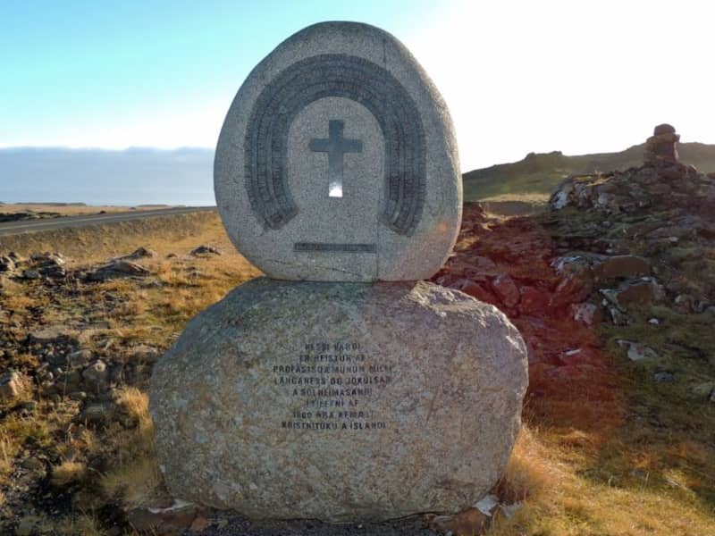
The farm Þvottá is the southernmost farm in Álftafjörður. Around the year 1000 the renowned Saga personality Hallur Þorsteinsson, or Síðu-Hallur, lived there. He received the priest and missionary Þangbrandur, who spent the winter with him. Síðu-Hallur and his whole household were baptized in the river by the farm and since then it was named River Þvottá (The Wash River). The farm gets its freshwater supplies from the so-called Þangbrandur Well, where the missionary probably held services at St. Michael’s Mass with the people of Þvottá attending the day before they were baptized. A ruin by the well was declared inviolate. Þvottá was a church site until 1754 and a parsonage for a long time. The old cemetery is still visible. Mt Mælifell (487m) is closer to the sea and north of it are Sellönd (Summer Pastures). The whole area is rather colourful because of the rhyolite intrusions and quite a few basaltic dykes decorate the landscape. These formations were created by the ancient and extinct central volcano, which has now mostly disappeared under the Álftafjörður Bay. Traces of several minerals were discovered in the area, gold, platinum etc. By Þvottaá, there is a monument to the adoption of Christianity and the area is vell suited for outdoor activities. 
Tankurinn
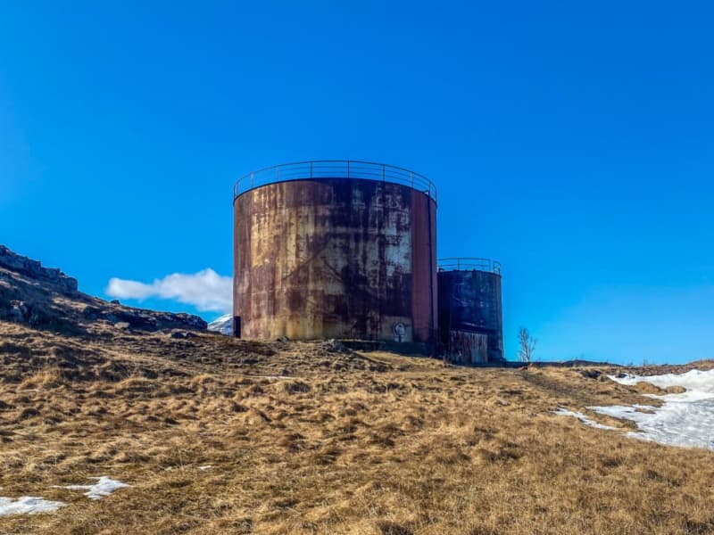
Tankurinn is an old fish oil tank reformed into an exhibition space for art and music. It is always open, and whether there is an installation there when you visit, you should at least go inside and enjoy the marvelous reverb. 
LIBERTY and Hans Jonathan
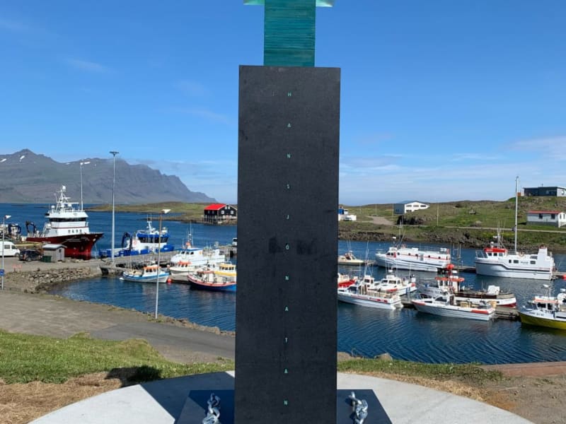
Hans Jonathan (1784-1827) was born into slavery on St. Croix in the Danish Virgin Islands in the Caribbean. His mother, Emilia Regina, was a house slave from West Africa; his father was white, probably a Dane. At age seven, Hans Jonathan was sent to Copenhagen to join the household of his owners, the Schimmelmann family. He played a heroic role in the Battle of Copenhagen in 1801, imagining he would become a free man. Widow Schimmelmann, however, took him to court and had his enslavement confirmed. Hans Jonathan then decided to take his freedom and escape to Iceland soon after the legal verdict. He settled at Djúpivogur where he worked as a trader at the Löngubúð store, later becoming a peasant. Icelanders embraced the newcomer, and nothing indicates that he would be shunned because of the color of his skin or his origin in slavery. He married a respected local girl, Katrín Antoníusdóttir. Their two children now have one thousand descendants. As far as we know, Hans Jonathan was the first black person to settle in Iceland. His biography, The Man Who Stole Himself: The Slave Odyssey of Hans Jonathan (authored by Gísli Pálsson), appeared in 2016 (also published in Icelandic, Danish, and French). A memorial sculpture, "Freedom," has been raised at Djúpivogur in his honor, echoing international protests against the use of skin color in refuting human rights. The memorial is the work of renowned Icelandic artist Sigurður Guðmundsson. The Government of Iceland, the inhabitants of Djúpivogur, Fiskeldi Austurlands, and numerous individuals generously financed its construction. Prime Minister Katrín Jakobsdóttir revealed the memorial at a ceremony in Djúpivogur on July 10th, 2021
Seyðisfjarðarkirkja
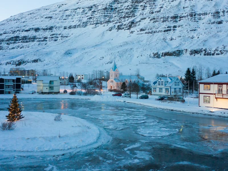
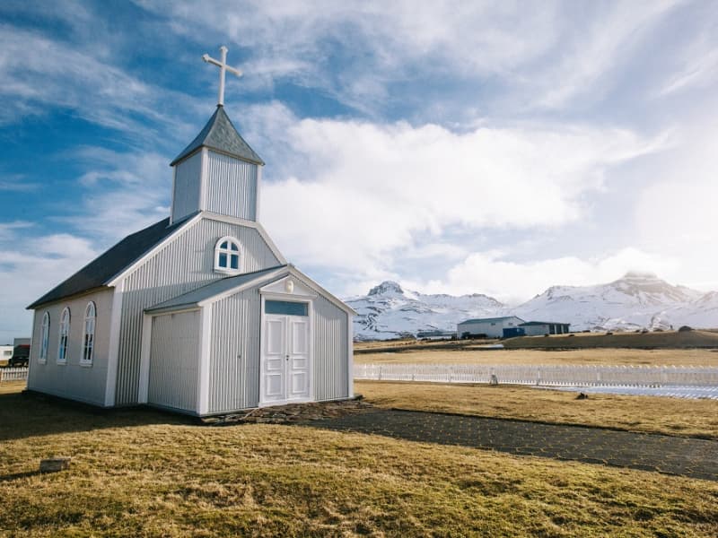
The Church in Seyðisfjörður is one of the most recognisable landmarks in Iceland. With its distinct colour and buildingstyle it has become a popular spot for tourists, especially since the street leading up to it was painted in the colours of the rainbow. The church used to stand at Dvergasteinn farm and in 1882 it was moved to Vestdalseyri. At first the church stood on a hill overlooking Vestdalseyri but in 1894 it was blown over and damaged by a huge storm. The church was rebuilt, this time down on the peninsula and stood there until 1920 when the decision was made to move to its present location in the heart of Seyðisfjörður. In 1989 the the Blue Church was damaged by fire when renovation work was being carried out on the building and a pipe organ that was installed in 1987 was ruined by the flames. Today the Blue Church has a pipe organ of the same type as the one that was lost to the fire. The Church is open for visitors in the summer.
Fjallkonustígur hiking trail
A walk to the Vestdalur Nature Reserve in Seyðisfjörður, up to the Vestdalur lake and the cave of "The Mountain Maid". The route once served as the principal communication link between Seyðisfjörður and other regions in East Iceland. Relics of this 19th - 20th c. pillar of transport can still be detected through meticulous road constructions, stone walls, and Cairns. Having passed several tiers of glorious waterfalls, the wanderer reaches a small lake, Vestdalsvatn, which remains frozen most of the year. With majestic Mt. Bjólfur to the left., a tiny cave awaits to the right, the site of one the most important archaeologic discoveries of later times. In 2004 a group of workers unearthed some human bones, later defined as those of lady, around thirtyish - along with more than 400 pearls and some pins dating back to the era of settlement.  The remains are believed to date from the era around 940. These are now conserved at the National Museum. Vestdalseyri / Vestdalur valleyDuration: 3,5 hours / 6 km Period: June - September 
Fjarðarsel Power Plant Museum
A turning point in the history of Icelandic electrification. Fjarðaselsvirkjun in Seyðisfjörður is Iceland´s oldest operational power plant, started on October 18th, 1913. The plant marked a turning point in the history of Icelandic electrification. It was the first power plant that generated alternating current It was the power station of the first municipal electric utility The first high voltage cable in Iceland was laid from this station On the occasion of t he 90th anniversary of the power plant the Iceland State Electricity (RARIK) devided to open the plant to Icelandic and foreign visitors. For this purpose, a historical exhibition was staged in the station house. The first water turbine is still there with its accompanying equipment. For a visit please contact Fjarðasel Museum or the Information Centre. Contact info: Tel: +354 472 1122 / +354 472 1551  Email: info@sfk.is www.fjardasel.is
Djáknadys
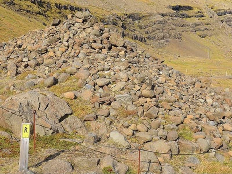
According to legend the mound marks the spot where the pastor of Háls and the deacon of Hamar fought to the death. Both were buried at the site, and that is the origin of the name Djáknadys (Deacon’s Burial Mound). Tradition requires every traveller, on first passing by Djáknadys, must throw a pebble or stone onto the mound: one for him/herself, and one for every horse or dog accompanying them. If they fail to do so they will lose their way. Another version of the tradition is that travellers must place three stones on the mound. An old verse on the subject says: To quickly dismount and fling a stone over the aged deacon brings good fortune along the road. Please treat this protected heritage site with respect and care. Do not remove stones from the mound and do not dispose of refuse under stones. 
Bakkagerðiskirkja
Placed on the outskirts of the village of Borgarfjörður Eystri, close to the famed Álfaborg - The City of Elves, stands the church Bakkagerðiskirkja, consecrated in 1901. The church boasts of a beautiful altarpiece, painted in 1914 by the famous local artist Jóhannes S. Kjarval who was brought up in Borgarfjörður Eystri. The altarpiece depicts Christ giving the Sermon on the Mount, standing on top of Álfaborg, with the Dyrfjöll Mountains as a backdrop. This piece is one of Kjarval´s most famous works, attracting tourists visiting Borgarfjörður Eystri.
Hafnarhús
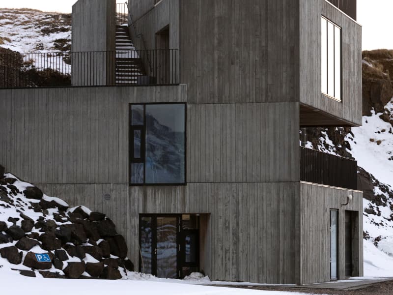
At Hafnarhólmi in Borgarfjörður eystri a new, magnificent building was unveiled in 2020. Not only had there been a lack of facilities for fishermen and other dock workers of Borgarfjörður harbor - but also for the enormous number of tourists who make their way to the puffin nesting ground in Hafnarhólmi each year. The municipality, therefore, decided to host a design competition in collaboration with the Association of Icelandic Architects for the construction of a new facility in the area. The winning submission came from Anderson & Sigurdsson architects. The house is plain and fits well in with the surroundings, but still is an attraction in itself and catches the eye of everyone who visits the area.
Geirsstaðakirkja
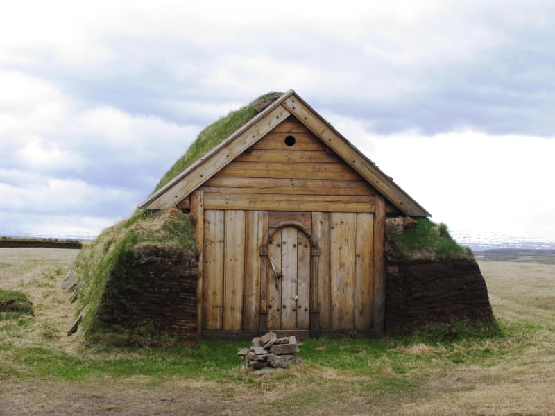
The pretty little turf church Geirsstaðakirkja is a reconstruction of a church from the Age of Vikings. An excavation at the estate of Litli-Bakki back in 1997 revealed ancient ruins of the small turf church, farmstead, longhouse and two smaller buildings. The reconstruction took place in 1999-2001 and the church is now open to the public.
Kirkjubær
Kirkjubær in Hróarstunga was a presbitery until 1956, a site of distinction and local intellectuals. The church dates from 1851 and is well preserved. It has a pulprit dating from the 16. th. century and the baptismal font is beautifully carved by master carver and sculptor Ríkharður Jónsson (ref. Langabúð, Djúpivogur). The altarpiece dates from the year 1894.
Kóreksstaðavígi
Kóreksstaðavígi is a beautiful rock of basalt columns. There the Viking Kórekur is said to have fought his enemies to the death and been buried at the site. One drives past Hjaltalundur and takes the road towards the farm Kóreksstaðir. Park your car in an area close to the sign by the gate leading to the farm. Walk on towards the Kóreksstaðavígi where you will find a cylinder with the visitors’ log and stamp. Standing on its top is an enjoyable experience. Part of Hiking Treasures in Egilsstaðir Region GPS : N65°32.782-W14°10.591 Powered by Wikiloc
Midhús
Miðhús was among the first guesthouses in the Hérað region. Travelers passed Miðhús on their way to Seyðisfjörður and Eskifjörður. Today Miðhús houses an art gallery and a workshop (operative since 1975) where Icelandic material is used in many different ways.
Möðrudalskirkja
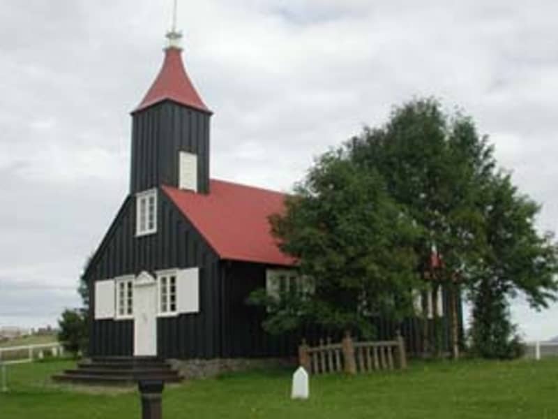
In Möðrudalur there is a small and beautiful church that was built in 1949. Farmer Jón A. Stefánsson (1880-1971) created the church in memory of his wife, Þórunn Vilhjálmsdóttir, who died in 1944. The church is built on the foundation of the older Möðrudalskirkja church. Jón both constructed and decorated the church; he even painted the altarpiece, which shows the Sermon on the Mount. Previously, there was a parsonage in Möðrudalur, which was closed down in 1716, but then the place was deserted for several years.
Möðrudalur
Möðrudalur is the highest settled farm in Iceland, 469 meters ( 1.539 feet) above sea-level. It has been inhabited since early settlement in Iceland and Möðrudalur has served as a presbytery for centuries. The builder of the church in Möðrudalur was Jón A. Stefánsson (1880 – 1971). He was a great farmer and a multitask-artist and the altarpiece is made by himself. His son was Stefan ,,Stórval“ Jónsson ( 1908 – 1994), one of a kind character and a painter. The panorama view from the farm is interesting in many ways – judge for yourself.  Several hiking trails are available in the area, and you can get maps at the information center. There you can also see a film that shows the eruption in Holuhraun 2014. Möðrudalur is close to many incomparable natural gems such as Herðubreiðarlindir, Askja, Kverkfjöll, Hvannalindir, Jökuldalsheiði Stuðlagil and Stórurður.  Campsites open from June until mid-September.
Nielsenshus
The Nielsen House was the first private house built in the village of Egilsstaðir , built in the year 1944 by the danish Oswald Nielsen. Today it houses a nice a restaurant, Café Nielsen. 
Turf Houses by Hjarðarhagi
The old sheep houses by Hjarðarhagi are the remains of a six-house cluster, but the other houses were removed around 1970 due to proximity to the ring road. Today, these remaining houses have been renovated in their original form. The houses were in use until 1980 and are called Efstahús and Miðhús.
Raudshaugur
Rauðshaugur is a rock or a hill protruding from the farm Höfði and can be seen widely from Hérað. According to legend it is the burial heap of farmer Rauður or Ásrauður in the sagas and from there two similar heaps can be located, the burial heap Bessahaugur in Fljótsdalur and the heap Ormarshaugur in Fell. Legend Rauður was buried with all his riches. People are said to have tried digging into the pile of rocks but always had to give up because of a burning vision of the homestead in Ketilsstadir. Walk from the sign by Fagridalur road (N65°14.590 -W14°21.156) along the trail on Egilsstaðaháls towards Rauðshaugur. Part of Hiking Treasures in Egilsstaðir Region GPS : N65°12.77-W14°23.01 Powered by Wikiloc
Stapavík by Héraðsflói
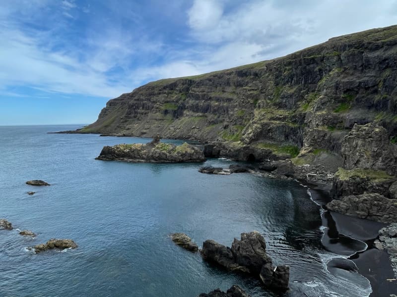
Stapavík is an inlet that lies in a magnificent setting of steep cliffs and the open sea. From 1930-1945 Stapavík was a used as an unloading port for ships and is closely related to the commercial history of Borgarfjörður Eystri and Hérað. Remains of the facilities are very picturesque and the view from the inlet is beautiful on a sunny day.  A marked trail leads from the farmstead Unaós, following Selfljót river downstream to the rivermouth. Héraðssandur black sand beach opens to the North of the river with a view over Hellisheiði Eystri rhyolite mountain ridge. This is a about a two hour long (back and forth) family friendly hike. Travellers could also challenge themselves to a longer hike by crossing Gönguskarð mountain pass over to Njarðvík which adds a about two hours to the hike. Powered by Wikiloc
Galtastaðir Fram Turf house
The old farm of Galtastaðir Fram is a well-preserved turf house from the 19th century. Inhabited until 1967 the building exemplifies the sort of housing common in Iceland in previous centuries, heated to some extent by keeping cows under the communal living room or "baðstofa", which was also used for sleeping and handcraft.  Both the interior and exterior of this small but remarkable showcase of former living conditions can be visited by the consent of the proprietor. Galtastaðir Fram has ranked on the preservation list of the National Museum since 1976. 
Unaos
Unaós ("The Estuary of Uni" is a beautiful inlet on the east coast of Héraðflói bay. It is named after the settler Uni Garðarsson but according to the Book of Settlements (12th.century), he docked in the estuary. Uni was the son of one of the three discoverers of Iceland, Gardar Svavarsson.  He was sent to Iceland by King Haraldur Fairhair of Norway in order  to convince the Icelanders to become his subjects.  His mission was however unfruitful. Uni docked his ship at a cliff in Selfljót river called Knörr.  In the estuary of the river, there´s a promontory called Krosshöfði by which was the principal harbor of the region, Óshöfn, until a passable road to the village Borgarfjörður eystri came about in the late 1940ties. The harbor was a primitive one since total calm and favorable currents were needed in order to bring the merchandise ashore. The area presents several points of interest and several walking trails are to be found there.

Other (2)

Sagatrails of East Iceland Sunnufelli 4 700 Egilsstaðir
Skálanes Suðurgata 2 710 Seyðisfjörður info@skala