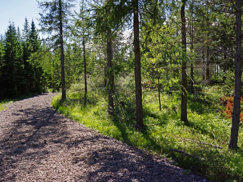
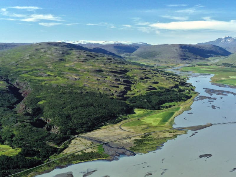
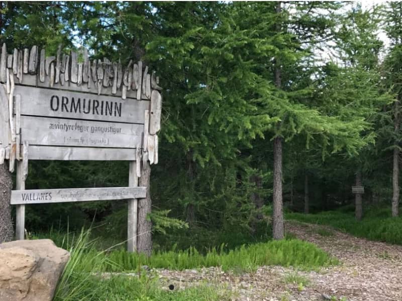
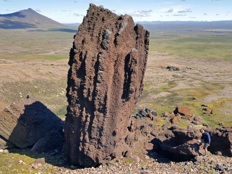
Skip to content

Or try searching by Category and/or Location

Hallormsstaður National Forest
The birchwood remnants at Hallormsstaður farm were protected in 1905, making it Iceland’s first national forest. Today, birch forest and woodland cover about 350 hectares within the original fenced area, and a variety of tree species have been planted on another 200 hectares. Large areas to the north and south have been annexed to the forest more recently and either planted with trees or allowed to naturally regenerate with birch. A total of 85 tree species from over 600 locations worldwide can be found in the forest, covering around 740 hectares.Lands managed by the Land and Forest Service are designated as National Forests. These areas are open to everyone year-round and are located throughout Iceland. Many, like Hallormsstaður Forest, are easily accessible and offer a variety of facilities for outdoor recreation. Others require a 4WD vehicle or hiking up steep hillsides to enjoy.Hallormsstaður Forest is ideal for hiking, strolling, or biking. There are well-marked trails, in different colors, throughout much of the surrounding woodland. These trails are shown on a clear map published by the Forestry Service, which you can find in boxes at the entrance of many trails and nearby services. The maps can also be downloaded here.There are two camping sites in the forest: one in Atlavík and the other in Höfðavík. Both sites have small and large flat areas among the trees and are close to Lake Lagarfljót. Foresters will collect the payment for camping. More information can be found on our Facebook page.Rest places and picnic areas are scattered throughout the forest. For example, in Stekkjarvík, there is a barbecue area and a playground. The arboretum in Hallormsstaður is unique in the Arctic region. 
Hallormsstaður hiking circle
A fun trail for the whole family. The route is unmarked but leads to three marked hiking trails. We walk from Hallormsstaðskóli (Húsó), down to Kliftjörn, from there through Höfðavík campsite and then down to Trjásafn. From the Trjásafn you walk up into the forest and come down at Hotel Hallormsstaðar and the circle closes at Hallormsstaðskóli. You can walk the path in both directions. Distance: 5.4 km Family-friendly forest walk
Remba - Hiking trail
The way up Remba is a very pleasant trail. On it you can see Lambafoss, 21 m high, and the gorge which Staðará flows through. If you walk all the way up, you come to an old dam for a 27 kW power plant that supplied Hallormsstaður with electricity in the years 1936 - 1955. Below the stile you can still see the remains of the log that led the water down to the power plant building. Distance: 2.8 km
Arboretum in Hallormsstaðar Forest
The Hallormsstaður Arboretum is unique in Iceland, comprising a collection of around 80 tree species originating from various parts of the world. In addition to trees, there are also various species of shrubs. Begin your walk through the arboretum from the car park by the main road and follow the paths. Allow yourself plenty of time, about 2-3 hours, to explore the arboretum, enjoy the surroundings, and breathe in the fresh air. Walk down to Lake Lagarfljót, enjoy a picnic, and listen to the birds singing.Forestry in Hallormsstaður began in 1903 by fencing off 12 hectares for a tree nursery called Mörk. Half a hectare was prepared as nursery beds, marking the beginning of the nursery. In 1905, 50 Engelmann spruces were planted on the upper half of Mörk. Now, only five of these trees remain, and they are the oldest spruces in the forest, standing close to the parking lot.Over the years, single trees and groups of various species have been planted in Mörk. This arboretum is already the most impressive in the country, offering visitors a good opportunity to see both common and rare species. 
Bjargselsbotnar - hike
Hiking trail starts by a sign near Hallormsstaðarskóli schoolhouse in Hallormsstaður woodland following a light green marked trail that passes through an area where half the mountain slid forward some 10.000 years ago. You’ll ascend up to Bjargselsbotnar, onwards to Bjarg and Þverbjarg to Illaskriða landslide. From there you follow the trail to the Leirtjarnarhryggur ridge.  Part of Hiking Treasures in Egilsstaðir Region GPS : N65°05.465-W14°43.031  
Strútsfoss
Start from the sign near Sturluflöt which is the innermost farm in Suðurdalur, east of Kelduá river. Walk along the banks of Fellsá river on the east side of Villingadalur valley. The waterfall can’t be seen until one is quite far into the valley once there one can walk along Strútsgil creek. The cylinder with visitors’ log and a stamp is to be found up by Strútsgil creek. You can not get to the waterfall except by going into the creek and crossing the river a few times which can be treacherous. Strútsfoss waterfall is on the list of nature reserves. Part of Hiking Treasures in Egilsstaðir Region GPS : N64°54.194-W15°02.314
Hengifossárgil Gorge
Hengifossárgil Gorge features distinct rock layers and formations. Along the trail, you'll encounter two stunning waterfalls: Stuðlabergsfoss (also known as Litlanesfoss), framed by captivating rock formations, and Hengifoss, one ofIceland's tallest waterfalls standing at 128.5 meters. While the hike up the gorge is steep, expect a two-hour round trip with an elevation gain of approximately 300 meters. You can ascend to Hengifoss and descend on the opposite side. You have to be very careful when crossing the river because there an be high tides.   You can get information from Snæfellsstofa about hiking trails within Vatnajökull National Park. The Wilderness center offers a variety of outdoor activities and recreation.  
Ranaskógur woods
Often considered one of the country´s most beautiful birch woods, Ranaskógur has numerous birches with white bark and tall, straight trunks. Moreover, the forest floor is unusually smooth, in comparison to most Icelandic wooded areas. In the Icelandic name, skógur means "woods" and rana refers to the lower end of the long ridge west of the Gilsá river gorge. Ranaskógur extends along the west side of the gorge, which is the traditional border between two counties in East Iceland. The Icelandic birch species is Betula pubescens. Besides the abundant wood crane´s bill, Geranium sylvaticum, and stone bramble berry plants, Rubus saxatilis, in the undergrowth, Ranaskógur has an unusual number of tall rowan trees, Sorbus aucuparia; in fact, no other Icelandic site presents such a concentration of large rowans.  
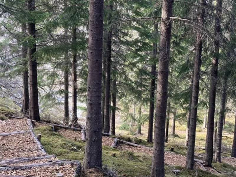
At the Kiðuhóll rise in the middle of Ranaskógur, Metúsalem J. Kjerúlf, farmer at the nearby Hrafnkelsstaðir, started a plot of coniferous trees between 1955 and 1961, in remembrance of his brother Páll. Not only did Metúsalem plant 23 different species, but 21 are still represented, with the talles trees nearing a height of 20 m. The Ranaskógur woods have existed ever since Iceland´s settlement and are mentioned in documents from the 15th century. hey are part of the woods which figured in the well-known Saga of Hrafnkell, which states that the saga´s hero cut down stands of trees here when he moved to this valley and built up the farm that has since been named after him, Hrafnkelsstaðir. 
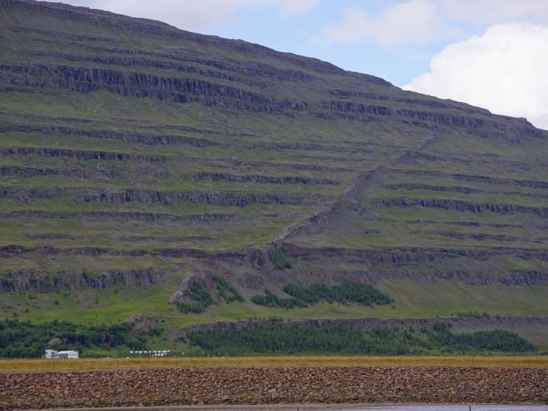
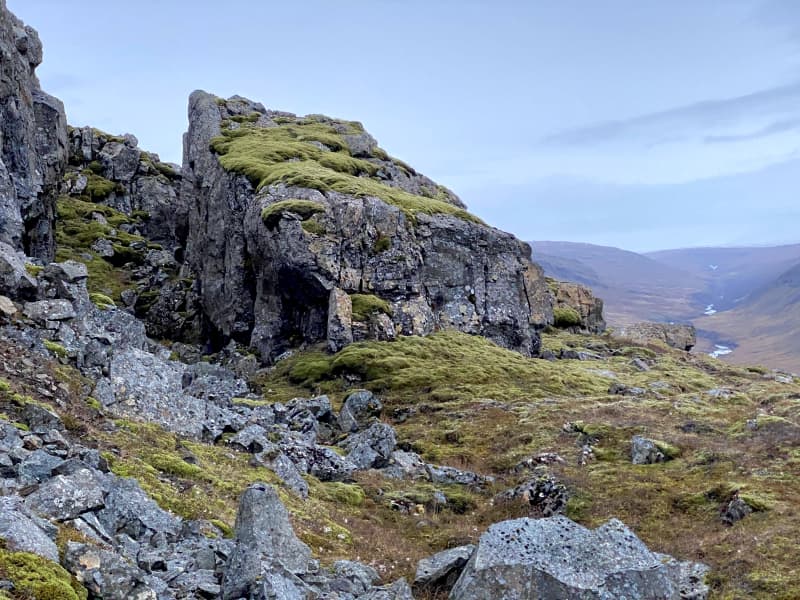
Nineteenth-century quarrels between the Hrafnkelsstaðir and Víðivellir farmers over the use of forest resources resulted in most of the lower part of the woods being cut down. While the woods had previously extended south below Kirkjuhamar cliff, now only a very few of those trees remain, at a place called Skógarbali.  The traditional use of Ranaskógur for firewood continued until nearly the middle of the 20th century, and in 1951 Eirkíkur M. Kjerúlf bought the woods to make them part of a new farm, Vallholt.
Tröllkonustígur hiking trail
Tröllkonustígur is the name of a hiking trail between Skriðuklaustur and Végarður in Fljótsdalur, which runs, among otherthings, after a rock passage in Valþjófsstaðafjall. Folklore says that the street in the mountain was created due to the travels of a troll in the olden days. The trail is marked and goes through the forest above Snæfellsstofa and out to the Bessastaðarárgljúfur. Distance: 5 km.  
Waterfall Circle
The Waterfall Circle is an 8 kilometers long hiking circle that starts and ends in Laugarfell. On the hike, you can see five waterfalls and one canyon. Some of these waterfalls are among the most powerful in East Iceland. Most famous of the waterfalls are Kirkjufoss and Faxi. This beautiful hike is getting more and more popular among hikers. After the hike then it is a good idea to take a bath in the hot springs in Laugarfell.
The waterfall trail
The glacial river of the Fljótsdalur valley has many waterfalls of different sizes and shapes, stretching from farms by the edge of the highlands up to the Ramsar protected wetlands of Eyjabakkar. It takes you about 6 hours to walk this 20 km route by the river which in many places runs through a deep canyon. The Wilderness Center is a good starting point and on the way is a natural birch forest, an ideal resting place. You can expect to see reindeer or maybe an arctic fox. When you reach the plateau it is ideal to drop by the highland hostel at Laugarfell and relax in the natural hot springs. You can also start at Laugarfell and work your way downhill towards the Wilderness Center. The choice is yours. Both Laugarfell and Wilderness Center offer you a drive from one place to the other, before or after the hike.
Snæfell
Mt Snæfell towering to 1,833 m, is the highest mountain in Iceland, outside the glacier regions. Even so, and despite the omnipresent snow, (Snæfell = "The Snow Mountain), it is fairly accessible from Snæfellsskáli hut. While Snæfell boasts a splendor of its own, it offers a fabulous view, partly overlooking the oasis of Eyjabakkar. Eyjabakkar is the choice habitat for geese.  Reindeer can frequently be spotted west of Snæfell, towards Hálsalón reservoir, in addition to other territories in the East Iceland highlands.
Vatnsdalur
A beautiful hiking trail northeast of Snæfell that runs through the valley between Nálhúshnjúkar, Sandfell and Vatnskollur, which contains a small lake from which Hölkná falls to the north. A marked path runs between the parking lot at Hölkná to the north and at Snæfellsnes to the east. It is important to follow the footpath because the moss in Vatnsdal is extremely sensitive. Distance: 5.2 km.
The Worm in Vallanes
An adventurous trail that meanders like the Lagarfljót worm through the oldest forest in Vallanes from 1989. There are many short and exciting side paths (escape routes) on the trail. In the middle of the forest is the "eye of the snake", an area with benches and good picnic facilities. Distance: 1.5 km Family friendly
Sótavistir - Hiking trail
A marked hiking trail at the foot of Snæfell where Sótajökull is disappearing from a glacier basin in the mountain called Sótavistir. At the bottom stands a large crag of dark slag rock that the sliding glacier has raised on its end so that it resembles a boulder. It is called Sótaleiði, named after the giant Sóti.
Gjárhjalli
The trail to Gjárhjalli runs from Glúmsstaðasel in Norðurdalur, Fljótsdalur and up the western slope of Múlan. Gjárhjallin is a special natural phenomenon with cracks and chasms, up to 20 m deep. The cracks are believed to have been formed by gradual rock creep over millennia. Distance: 2 km Steep and beware of ground cracks.
Bessastaðaárgil Gorge
Bessastaðarárgil is withing Bessastaðir and Eyrarland. You can walk from Melarétt along the main road and over the bridge. From there, you go up the ravine to the outside. The largest waterfall in the gorge is called Jónsfoss at a height of about 30 m near the middle of the gorge, but further down are Tófufoss and Litlifoss. Beneath it is Sunnevuhylur, and you can see it from the road. There are colorful sedimentary layers in the gorge from the Teritary period and evidence of a sour fire with ancient vegetation remains, such as in the Hengifoss river gorge. The gorge can also be viewed from the highlandroad that leads to Snæfell, but at one point, the road goes all the way to the edge of the gorge. If you go up the river on the inside, you will come to a small waterfall below Tófufoss.  
Hrakstrandarkofi
Hrakstrandarkofi is a newly renovated pedestrian hut on the hiking trail between Norður and Suðurdalur. You can walk intoNorðurdalur past Glúmstaðarsel and into Hrakströnd, and then the next day across to Þorgerðstaðardalur and on to Suðurdalur. Bookins for the hut are made at The Wilderness Centre .