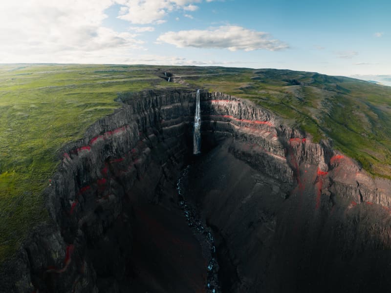
Skip to content

Or try searching by Category and/or Location

Top Destinations in Hallormsstaður

Hallormsstaður National Forest
The birchwood remnants at Hallormsstaður farm were protected in 1905, making it Iceland’s first national forest. Today, birch forest and woodland cover about 350 hectares within the original fenced area, and a variety of tree species have been planted on another 200 hectares. Large areas to the north and south have been annexed to the forest more recently and either planted with trees or allowed to naturally regenerate with birch. A total of 85 tree species from over 600 locations worldwide can be found in the forest, covering around 740 hectares.Lands managed by the Land and Forest Service are designated as National Forests. These areas are open to everyone year-round and are located throughout Iceland. Many, like Hallormsstaður Forest, are easily accessible and offer a variety of facilities for outdoor recreation. Others require a 4WD vehicle or hiking up steep hillsides to enjoy.Hallormsstaður Forest is ideal for hiking, strolling, or biking. There are well-marked trails, in different colors, throughout much of the surrounding woodland. These trails are shown on a clear map published by the Forestry Service, which you can find in boxes at the entrance of many trails and nearby services. The maps can also be downloaded here.There are two camping sites in the forest: one in Atlavík and the other in Höfðavík. Both sites have small and large flat areas among the trees and are close to Lake Lagarfljót. Foresters will collect the payment for camping. More information can be found on our Facebook page.Rest places and picnic areas are scattered throughout the forest. For example, in Stekkjarvík, there is a barbecue area and a playground. The arboretum in Hallormsstaður is unique in the Arctic region. 
Hallormsstaður
Hallormsstaður is a village situated in the middle of Iceland's oldest national forest. The forest is a popular recreational area featuring camping sites, marked hiking and biking trails, an arboretum, and a frisbee golf course.Hallormsstaður also hosts a large hotel with two restaurants and a spa. In the summer, an ice-cream shop with groceries operates by the gas station. Great accommodations, restaurants, and activities can be found in the surrounding area. You will find all the information you need on this website, along with links to social media.From Egilsstaðir, the major town of East Iceland located by Route 1, there are two routes to Hallormsstaður. The shortest route, on the east side of Lake Lagarfljót, is 27 km long. For this route, take Road 95 from Egilsstaðir and continue on Road 931 by the Grímsá river. If you choose the west side of the lake, which is 40 km long, you will find the junction with Route 1 on the hill north of the timber bridge near the Egilsstaðir airport. This route is marked as Road 931 with signs pointing to Fljótsdalur and Skriðuklaustur. When you reach the end of the lake, turn left just before reaching Hengifoss waterfall, towards a long bridge, and continue to the forest. 
Atlavík
The inlet of Atlavík camp site in Hallormsstaðaskógur woodland is beautifully situated on the shores of Lake Lagarfljót. In the eighties Icelanders would flock to the legendary Atlavík Festival where no other than Ringo Starr performed in 1984! Like other areas in Hallormsstaðaskógur, the inlet provides the shelter of trees, as well as a comparatively continental climate at the south end of the lake, far away from oceanic conditions. The forest is considered to be Iceland’s largest one. It covers an area of 740 hectares, most of which is native birch. The birchwood remnants at Hallormsstaður were declared protected in 1905. Hallormsstaðaskógur is a popular outdoor recreational area for both locals and travellers, with its diverse landscapes and over 40 kms of versatile hiking routes and marked trails, open spaces and playgrounds. The Hallormsstaður Arboretum is unique in Iceland, comprising a collection of around 80 tree species from all over the world.   
Arboretum in Hallormsstaðar Forest
The Hallormsstaður Arboretum is unique in Iceland, comprising a collection of around 80 tree species originating from various parts of the world. In addition to trees, there are also various species of shrubs. Begin your walk through the arboretum from the car park by the main road and follow the paths. Allow yourself plenty of time, about 2-3 hours, to explore the arboretum, enjoy the surroundings, and breathe in the fresh air. Walk down to Lake Lagarfljót, enjoy a picnic, and listen to the birds singing.Forestry in Hallormsstaður began in 1903 by fencing off 12 hectares for a tree nursery called Mörk. Half a hectare was prepared as nursery beds, marking the beginning of the nursery. In 1905, 50 Engelmann spruces were planted on the upper half of Mörk. Now, only five of these trees remain, and they are the oldest spruces in the forest, standing close to the parking lot.Over the years, single trees and groups of various species have been planted in Mörk. This arboretum is already the most impressive in the country, offering visitors a good opportunity to see both common and rare species. 
Lagarfljót and Lögurinn
Lagarfljót is one of Iceland´s deepest lakes, covering about 140 km from its source in Eyjabakkafjökull glacier to Héraðsflói Bay. The innermost section forms the lake Lögurinn, with a surface of 53 square kilometers and an average depth of 51 m, reaching 112 m where it is deepest. Its deep, mysterious glacial waters are home to Iceland´s ancient and much older equivalent of the Loch Ness Monster: The terrifying sea-worm-like Wyrm or Lagarfljótsormur. The oldest recorded sighting dates back to 1345. It was considered a bad omen if the curved forms of the monster were spotted above the water´s edge. In recent years the Wyrm has mostly kept to itself but pay close attention as you never know when it may reveal itself again!
Lagarfljót Wyrm monster
The Lagarfljót is one of Iceland´s deepest lakes and lies in a narrow trough carved by glaciers. It reaches a depth of 112 m, 90 m below sea level and shows no obvious flow. Its deep mysterious glacial waters are the home of Iceland´s ancient and much older equivalent of the Loch Ness monster, the terrifying sea-worm-like Wyrm or "Lagarfljótsormur". The oldest recorded sighting dates back to 1345. At that time the wyrm was said sometimes to resemble large islands, but at other times to rise out of the water in arches, spanning hundreds of fathoms. People were unsure what sort of monster this was, because neither its head nor tail were visible. In 1589, the wyrm was reported to have lifted its back so high above the water that a fast ship under full sail - crosstree, tackling and all - could have passed underneath. When its gigantic body slammed back into the water, the resulting crash rumbled throughout the vicinity. Sightings of the wyrm´s activities were frequent during the next centuries. It appeared variously as humps or islets, and yet again lifted its huge form into the sky. Such appearances were generally considered to bode misfortune. During the 20th century, various shapes of the Lagarfljót Wyrm were viewed from all around the lake. It shot its humps up regularly in addition to appearing as a clump or overturned boat gliding upriver against the current and aginast the wind, tossing towards both sides. A depth sounder once noted it snuggling under an overhanging bank, far below the surface. In February 2012 the farmer at Hrafnkelsstaðir in Fljótsdalur valley cought on camera a large swimming creature in one of the rivers that run into the lake Lagarfljót. The video got over 5 millions hits on Youtube and was in the news around the world. Informatijon boards about the wyrm are located at certain lakeside rest stops. We recommend these stops to check for signs of wyrm activities.
Stekkjarvík
Stekkjarvík is an outdoor area for the family about 4 km away from the urban area of ​​Hallormsstaður, close to Hafursá. There are playground equipment made from local wood, charcoal grills and tables in beautiful clearings.
Hengifoss Waterfall
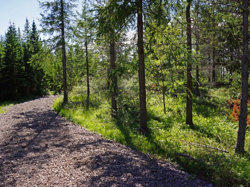
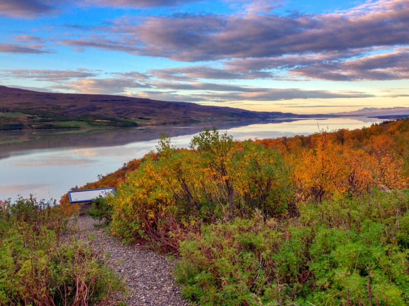
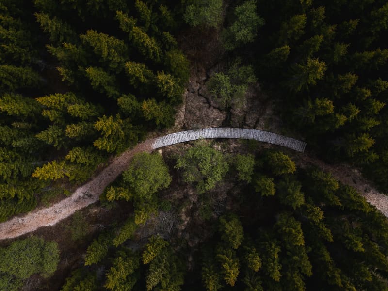
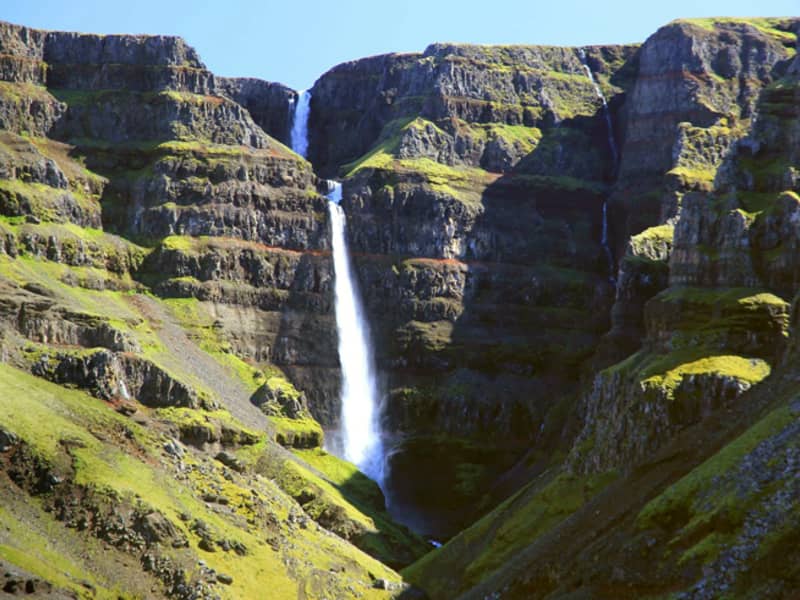
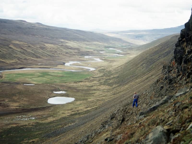
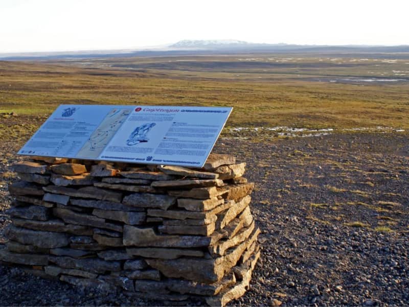
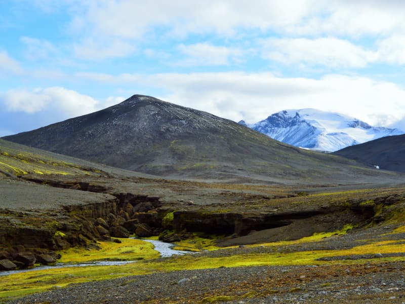
Hengifoss Waterfall is one of the most popular destinations in East Iceland, known for being one of the tallest waterfalls in Iceland at 128 meters high. It is particularly picturesque. A good hiking trail leads you to the waterfall from a service center by the parking lot. Excellent accommodations, restaurants, and activities can be found in the surrounding area.The Hengifoss waterfall plunges from the plateau into a magnificent gorge. The layers between the numerous Tertiary lava strata yield a reddish color, particularly striking in the cliffs around Hengifoss. On the way to Hengifoss, you can also see Litlanesfoss, which features impressive basalt columns on both sides of the gorge.How to Get ThereFrom Egilsstaðir, the major town of East Iceland located by Highway 1, there are two routes to Hengifoss. You can drive on either the west side or the east side of Lake Lagarfljót. The distance is the same, around 35 km.West Side: You will find the junction with Highway 1 on the hill by the timber bridge close to Egilsstaðir airport. It is marked as Route 931 with signs pointing to Fljótsdalur and Skriðuklaustur.East Side: Follow Route 95 first and then Route 931 towards Hallormsstaður, continuing until you reach the end of Lake Lagarfljót. There you should see the waterfall and the parking lot by the main road.From the parking lot, it takes 40-60 minutes to walk to the waterfall on either side of the river. Start by going through a gate by the service center and climbing up a flight of stairs. Then follow a good gravel trail for the next 2 km, which is moderately steep but not very difficult. About halfway up, around 1.2 km from the parking lot, you will see Litlanesfoss with its beautiful basalt columns. There are trails down into the canyon below the waterfall, but they are steep and covered in loose gravel, so be cautious if you decide to enter the canyon. Keep in mind that getting very close to the canyon edge is risky due to the danger of falling. This is especially important if you are accompanied by children.There are two bridges for hikers to connect the trails on each side of the river: one at the upper end just before you enter the great gorge, and the other by the parking lot.By the parking lot is a new service center where you can get information from rangers about the area and the surroundings. We recommend taking your time to visit Hengifoss as there is much more to explore in the area than just the waterfall. You can learn more on this website and use it to help plan your trip.Hiking in SummerDuring the high season (July), Hengifoss can be crowded, mainly with cars at the parking lot. If you can't find a parking space, continue further into the valley and check the visitor's center for Vatnajökull National Park at Skriðuklaustur (5 km away), then return to see if a space has opened up.The waterfall and the gorge face southeast, so for the best lighting, visit in the morning. In June and July, there is usually plenty of water in the river, making Hengifoss magnificent. However, in August, if the summer is really dry, the falls may not be as broad, but they are still enormously high.Late May and early June can be risky due to melting snow in the highlands, causing high water levels in creeks and rivers. Expect muddy trails and slippery paths on your way to the waterfall, and the need to wade through some small streams. By autumn, rain can make the trails muddy as well, but you usually won’t have to wade through any streams unless you want to enter the gorge and get close to the base of the great waterfall.Hiking in WinterMore people are visiting Hengifoss in winter, but caution is necessary. The trails and paths can become icy and very slippery, so stay away from the edge of the canyon and be aware of the dangers. It is not safe to enter the gorge by the big falls in winter due to the risk of falling ice from the cliffs. 
Strútsfoss
Start from the sign near Sturluflöt which is the innermost farm in Suðurdalur, east of Kelduá river. Walk along the banks of Fellsá river on the east side of Villingadalur valley. The waterfall can’t be seen until one is quite far into the valley once there one can walk along Strútsgil creek. The cylinder with visitors’ log and a stamp is to be found up by Strútsgil creek. You can not get to the waterfall except by going into the creek and crossing the river a few times which can be treacherous. Strútsfoss waterfall is on the list of nature reserves. Part of Hiking Treasures in Egilsstaðir Region GPS : N64°54.194-W15°02.314
Vallanes
Vallanes is a farm and a vicarage, known for the habitation of many leading scholars and literates of centuries past. Today the farmers of Vallanes are renowned for organic farming and pioneer products, i.a. vegetables and barley. They also produce food and cosmetics under the brand name of  "Móðir Jörð" - "Mother Earth".  In the last century, the locals of the surrounding district erected their community centre, Iðavellir, on the outskirts of Vallanes, and there the East Iceland Equestrian Association has its main hub on the grounds for races and shows.  
Valþjófsstaður
Valþjófsstaður is an estate deep in Fljótsdalur. It is an ancient manor, and there has been a church since the thirteenth century. Valþjófsstaður was one of the mainstays of Svínfellingar, but several members of that family were prominent in the conflicts of Sturlungaaldur. The church that now stands in Valþjófsstaður was sanctified in 1966. The door in the inner doorway of the church is a replica of the famous Valþjófsstaður door that Halldór Sigurðsson in Miðhús carved out in the 13th century. The old door was initially used in a manor but was later used as an interior door in an old church that stood in Valþjófsstaður for many centuries. The original door is now in the custody of the National Museum of Iceland.
Laugarfell
Laugarfell is located in the eastern part of the Icelandic Highlands, a bit north from Mount Snæfell. There are only two km from the road that leads to Kárahnjúkar to the hostel and it is the only part of the road that is not paved. In the summer there is good access to Laugarfell in all kinds of vehicles. Laugarfell offers accommodation for 28 people. Two natural pools are located in Laugarfell and according to old folk tales the water is known for its healing powers. There are many interesting tracking paths around Laugarfell and a number of beautiful waterfalls. Additionally, one can expect to see reindeers wandering around the area of Laugarfell. Laugarfell is open from the 1st of June to 30th of September.
Waterfall Circle
The Waterfall Circle is an 8 kilometers long hiking circle that starts and ends in Laugarfell. On the hike, you can see five waterfalls and one canyon. Some of these waterfalls are among the most powerful in East Iceland. Most famous of the waterfalls are Kirkjufoss and Faxi. This beautiful hike is getting more and more popular among hikers. After the hike then it is a good idea to take a bath in the hot springs in Laugarfell.
Snæfell
Mt Snæfell towering to 1,833 m, is the highest mountain in Iceland, outside the glacier regions. Even so, and despite the omnipresent snow, (Snæfell = "The Snow Mountain), it is fairly accessible from Snæfellsskáli hut. While Snæfell boasts a splendor of its own, it offers a fabulous view, partly overlooking the oasis of Eyjabakkar. Eyjabakkar is the choice habitat for geese.  Reindeer can frequently be spotted west of Snæfell, towards Hálsalón reservoir, in addition to other territories in the East Iceland highlands.
Vatnajökull National Park
Vatnajökull national park established 7. June 2008, covers an area of 14,141 km2 (13,7% of Iceland). The eastern covers 2.384km2. There are many places to visit, and experience, the contrasts in the unique nature are magnificent. The battle between ice and fire still rages within the National Park's boundaries. Few other places in the world exhibit the effects of such a wide range of natural phenomena.Among highlights of the east are Kverkfjöll, the home of Ice and fire, the oasis Hvannalindir, Snæfell the ancient volcano, where the reindeer roam and Eyjabakkar the celebrated home of the Pink-footed Goose.
Kárahnjúkar
The Power Plant at Kárahnjúkar is the largest construction project in Icelandic history and the most significant electricity production in the country. The Kárahnjúkar Power Plant was built to produce energy for the aluminum plant at Reyðarfjörður. A trip to Kárahnjúkar is an ideal road trip for the family. A paved road runs from Fljótsdalur to the Kárahnjúkar dam.  The Kárahnjúkar area is ideal for outdoor activities. It is fun to see the Kárahnjúkar Dam itself and the Hálslón Reservoir. When Hálslón fills up and overflows, the Hverfandi waterfall appears at the western end of the dam, where the water plunges about 100 meters into Hafrahvammahljúfur. The waterfall is mighty and can become more powerful than Dettifoss. There are also fun hiking trails in the area; for example, there is a great hiking trail along Hafrahvammagljúfur and to Magnahellir, but to get to the starting point of the marked hiking trail, you need a four-wheel-drive car. 
Þjófadalur (Thief valley)
Þjófadalur is a beautiful valley that lies south of Snæfell. To get there you have to walk, the best is to walk along the Þjófadalsá river through Þjófadalur between Snæfell and Þjófahnjúkar. The valley is beautiful and accessibility is only good as summer passes. If you walk east into the valley, there is a very good view of Eyjabakki and Þóriseyjar.
Hrafnkelsstadir
Hrafnkelsstaðir is a farm in Fljótsdalur valley, S-E of river Lagarfljót. It was formerly the abode of saga era hero Hrafnkell Freysgoði Hallfreðarson after he had been chasen off his original settlement at farm Aðalbóli in Hrafnkelsdalur valley. The Saga of Hrafnkell Freysgoði ranks among the classics of Icelandic ancient litterature. The farmsted land include the Ranaskógur forest, an idyllic woodland located in the extremities of the so called Víðivallaháls ridge. In days of yore the entire area was covered with green forest.   
Hrafnkels saga trail
Hrafnkell's Saga Freysgoði takes place in East Iceland and recounts the conflicts between chieftains in the 10th century. Hrafnkell's farm in Fljótsdal is named so because Hrafnkell lived there for a time. Not far from the town, there is a historical sign that is part of a historical trail that can be followed over Fljótsdalsheiði and down to Hrafnkelsdal.
Ranaskógur woods
Often considered one of the country´s most beautiful birch woods, Ranaskógur has numerous birches with white bark and tall, straight trunks. Moreover, the forest floor is unusually smooth, in comparison to most Icelandic wooded areas. In the Icelandic name, skógur means "woods" and rana refers to the lower end of the long ridge west of the Gilsá river gorge. Ranaskógur extends along the west side of the gorge, which is the traditional border between two counties in East Iceland. The Icelandic birch species is Betula pubescens. Besides the abundant wood crane´s bill, Geranium sylvaticum, and stone bramble berry plants, Rubus saxatilis, in the undergrowth, Ranaskógur has an unusual number of tall rowan trees, Sorbus aucuparia; in fact, no other Icelandic site presents such a concentration of large rowans.  At the Kiðuhóll rise in the middle of Ranaskógur, Metúsalem J. Kjerúlf, farmer at the nearby Hrafnkelsstaðir, started a plot of coniferous trees between 1955 and 1961, in remembrance of his brother Páll. Not only did Metúsalem plant 23 different species, but 21 are still represented, with the talles trees nearing a height of 20 m. The Ranaskógur woods have existed ever since Iceland´s settlement and are mentioned in documents from the 15th century. hey are part of the woods which figured in the well-known Saga of Hrafnkell, which states that the saga´s hero cut down stands of trees here when he moved to this valley and built up the farm that has since been named after him, Hrafnkelsstaðir. Nineteenth-century quarrels between the Hrafnkelsstaðir and Víðivellir farmers over the use of forest resources resulted in most of the lower part of the woods being cut down. While the woods had previously extended south below Kirkjuhamar cliff, now only a very few of those trees remain, at a place called Skógarbali.  The traditional use of Ranaskógur for firewood continued until nearly the middle of the 20th century, and in 1951 Eirkíkur M. Kjerúlf bought the woods to make them part of a new farm, Vallholt.
Sanddalur
Sanddalur is a beautiful valley that lies south of Snæfell. The valley is barren and breathtaking with green moss plains and peculiar rock formations that envelop the valley with a fairytale glow. To go to Sanddalur you need a four-wheel-drive car, but you can also walk there from road number 910 to Kárahnjúkar.
Aðalból
Aðalból, settled by the hero of Hrafnkell's Saga, is situated in a valley and is isolated from the farms farther down. Those who have read this exciting saga can visit a number of features relating to it, such as Hrafnkell's burial mound. Furthermore, ancient relics found in the vicinity have added to the atmosphere of the Saga era. All this puts one in touch with Nordic literary heritage and Icelandic history.
Hrakstrandarkofi
Hrakstrandarkofi is a newly renovated pedestrian hut on the hiking trail between Norður and Suðurdalur. You can walk intoNorðurdalur past Glúmstaðarsel and into Hrakströnd, and then the next day across to Þorgerðstaðardalur and on to Suðurdalur. Bookins for the hut are made at The Wilderness Centre .  
Mulakollur
Þingmúli divides Skriðdalur into Norðurdalur and Suðurdalur. The Round Road nr.1 lies through Suðurdalur to Breiðdalur. The homestead at Þingmúli was a place of gathering for the Thing in Eastern Iceland for centuries. The northernmost part of the mountain is called Múlakollur. Walk the ridge from the sign straight up to 400 m. When you reach Múlakollur’s top it is pleasant to walk onwards and along the top and descend on the east side a bit south of Múlastekkur. One can also ascend by walking up from Múlastekkur. Part of Hiking Treasures in Egilsstaðir Region GPS : N65°01.624-W14°38.049 Powered by Wikiloc